- Human geography nature and scope
- Introduction to human geography
- Overview
- As you know geography as a field of study is integrative, empirical, and practical
- Thus, the reach of geography is extensive and each and every event or phenomenon which varies over space and time can be studied geographically
- Core concerns and debates
- You are already aware of the fact that the core concern of geography as a discipline is to understand the earth as home of human beings and to study all those elements which have sustained them
- Thus, emphasis is on study of nature and human beings
- You will realise that geography got subjected to dualism and the wide-ranging debates started whether geography as a discipline should be a law making/theorising (nomothetic) or descriptive (idiographic)
- These have been issues for intellectual exercise but finally you will appreciate that the dichotomy between physical and human is not a very valid one because nature and human are inseparable elements and should be seen holistically
- Metaphorical descriptions
- It is interesting to note that both physical and human phenomena are described in metaphors using symbols from the human anatomy
- We often talk of the ‘face’ of the earth, ‘eye’ of the storm, ‘mouth’ of the river, ‘snout’ (nose) of the glacier, ‘neck’ of the isthmus and ‘profile’ of the soil
- Similarly regions, villages, towns have been described as ‘organisms’
- German geographers describe the ‘state/country’ as a ‘living organism’
- Networks of road, railways and water ways have often been described as “arteries of circulation”
- The basic questions now arises, can we separate nature and human when they are so intricately intertwined?
- Human geography defined
- “Human geography is the synthetic [made by chemical synthesis, especially to imitate a natural product] study of relationship between human societies and earth’s surface”. Ratzel
- Synthesis has been emphasized in the above definition
- “Human geography is the study of ‘the changing relationship between the un resting man and the unstable earth.’” Ellen C. Semple
- Dynamism in the relationship is the keyword in Semple’s definition
- “Conception resulting from a more synthetic knowledge of the physical laws governing our earth and of the relations between the living beings which inhabit it”. Paul Vidal de la Blache
- Human geography offers a new conception of the interrelationships between earth and human beings
- Nature of human geography
- Overview
- Human geography studies the inter-relationship between the physical environment and sociocultural environment created by human beings through mutual interaction with each other
- These elements are landforms, soils, climate, water, natural vegetation and diverse flora and fauna
- Houses, villages, cities, road-rail networks, industries, farms, ports, items of our daily use and all other elements of material culture have been created by human beings using the resources provided by the physical environment
- While physical environment has been greatly modified by human beings, it has also, in turn, impacted human lives
- Naturalization of humans and humanization of nature
- Role of technology
- Human beings interact with their physical environment with the help of technology
- It is not important what human beings produce and create but it is extremely important ‘with the help of what tools and techniques do they produce and create’
- Technology indicates the level of cultural development of society
- Human beings were able to develop technology after they developed better understanding of natural laws
- For example, the understanding of concepts of friction and heat helped us discover fire
- Similarly, understanding of the secrets of DNA and genetics enabled us to conquer many diseases
- We use the laws of aerodynamics to develop faster planes
- You can see that knowledge about Nature is extremely important to develop technology and technology loosens the shackles [a chain or manacle used to restrain a prisoner] [a pair of fetters connected together by a chain] of environment on human beings
- Environmental determinism
- In the early stages of their interaction with their natural environment humans were greatly influenced by it
- They adapted to the dictates of Nature
- This is so because the level of technology was very low and the stage of human social development was also primitive
- This type of interaction between primitive human society and strong forces of nature was termed as environmental determinism
- At that stage of very low technological development we can imagine the presence of a naturalized human, who listened to Nature, was afraid of its fury [wild or violent anger] and worshipped it
- The naturalization of humans
- Example: Benda’s story
- Benda lives in the wilds of the Abujh Maad area of central India
- His village consists of three huts deep in the wilds
- Not even birds or stray dogs that usually crowd villages can be seen in these areas
- Wearing a small loin cloth and armed with his axe he slowly surveys the penda (forest) where his tribe practices a primitive form of agriculture called shifting cultivation
- Benda and his friends burn small patches of forest to clear them for cultivation
- The ash is used for making the soil fertile
- Benda is happy that the Mahua trees around him are in bloom
- How lucky I am to be a part of this beautiful universe, he thinks as he looks up to see the Mahua, Palash and Sal trees that have sheltered him since childhood
- Crossing the penda in a gliding motion, Benda makes his way to a stream
- As he bends down to scoop up a palmful of water, he remembers to thank Loi-Lugi, the spirit of the forest for allowing him to quench his thirst
- Moving on with his friends, Benda chews on succulent leaves and roots
- The boys have been trying to collect Gajjhara and Kuchla, from the forest
- These are special plants that Benda and his people use
- He hopes the spirits of the forest will be kind and lead him to these herbs
- These are needed to barter in the madhai or tribal fair coming up the next full moon
- He closes his eyes and tries hard to recall what the elders had taught him about these herbs and the places they are found in
- He wishes he had listened more carefully
- Suddenly there is a rustling of leaves
- Benda and his friends know it is the outsiders who have come searching for them in the wilds
- In a single fluid motion Benda and his friends disappear behind the thick canopy of trees and become one with the spirit of the forest
- Interpretation
- The story in the box represents the direct relationship of a household belonging to an economically primitive society with nature
- Read about other primitive societies which live in complete harmony with their natural environment
- You will realise that in all such cases nature is a powerful force, worshipped, revered and conserved
- There is direct dependence of human beings on nature for resources which sustain them
- The physical environment for such societies becomes the “Mother Nature”
- Possibilism
- Possibilism, in the context of geography, is a philosophy that contrasts with environmental determinism
- It views the environment as providing possibilities for human development and action, rather than dictating human behavior.
- The people begin to understand their environment and the forces of nature with the passage of time
- With social and cultural development, humans develop better and more efficient technology
- They move from a state of necessity to a state of freedom
- They create possibilities with the resources obtained from the environment
- The human activities create cultural landscape
- The imprints of human activities are created everywhere; health resorts on highlands, huge urban sprawls, fields, orchards and pastures in plains and rolling hills, ports on the coasts, oceanic routes on the oceanic surface and satellites in the space
- The earlier scholars termed this as possibilism
- Nature provides opportunities and human being make use of these and slowly nature gets humanized and starts bearing the imprints of human endeavour [to try to do something]
- Humanization of nature
- Example: Kari’s story
- Winters in the town of Trondheim mean fierce winds and heavy snow
- The skies are dark for months
- Kari drives to work in the dark at 8 am
- She has special tyres for the winter and keeps the headlights of her powerful car switched on
- Her office is artificially heated at a comfortable 23 degrees Celsius
- The campus of the university she works in is built under a huge glass dome
- This dome keeps the snow out in winter and lets in the sunshine in the summer
- The temperature is controlled carefully and there is adequate lighting
- Even though fresh vegetables and plants don’t grow in such harsh weather, Kari keeps an orchid on her desk and enjoys eating tropical fruits like banana and kiwi
- These are flown in from warmer areas regularly
- With a click of the mouse, Kari can network with colleagues in New Delhi
- She frequently takes a morning flight to London and returns in the evening in time to watch her favorite television serial
- Though Kari is fifty-eight years old, she is fitter and looks younger than many thirty-year-olds in other parts of the world
- Interpretation
- Can you imagine what has made such a life style possible?
- It is technology that has allowed the people of Trondheim and others to overcome the constraints imposed by nature
- Do you know about some other such instances?
- Such examples are not difficult to find
- Neodeterminism
- A geographer, Griffith Taylor introduced another concept which reflects a middle path (Madhyam Marg) between the two ideas of environmental determinism and possibilism
- Neo-determinism, or "Stop and Go" determinism, is a geographical concept developed by Griffith Taylor, suggesting that while human actions have freedom, they are constrained and guided by the environment.
- It implies that development can proceed within the limits imposed by the environment, but humans should also be mindful of the environmental signals to ensure sustainable development.
- Those of you who live in cities and those who have visited a city, might have seen that traffic is regulated by lights on the cross-roads
- Red light means ‘stop’, amber light provides a gap between red and green lights ‘to get set’ and green light means ‘go’
- The concept shows that neither is there a situation of absolute necessity (environmental determinism) nor is there a condition of absolute freedom (possibilism)
- It means that human beings can conquer nature by obeying it
- They have to respond to the red signals and can proceed in their pursuits of development when nature permits the modifications
- It means that possibilities can be created within the limits which do not damage the environment and there is no free run without accidents
- The free run which the developed economies attempted to take has already resulted in the green house effect, ozone layer depletion, global warming, receding glaciers and degrading lands
- The neo-determinism conceptually attempts to bring a balance nullifying the ‘either’ ‘or’ dichotomy [a division or contrast between two things that are or are represented as being opposed or entirely different]
- Human geography through the corridors of time
- Overview
- The process of adaptation, adjustment with and modification of the environment started with the appearance of human beings over the surface of the earth in different ecological niches
- Thus, if we imagine the beginning of human geography with the interaction of environment and human beings, it has its roots deep in history
- Thus, the concerns of human geography have a long temporal continuum though the approaches to articulate [having or showing the ability to speak fluently and coherently] them have changed over time
- This dynamism in approaches and thrusts shows the vibrant nature of the discipline
- Historical development
- Earlier there was little interaction between different societies and the knowledge about each other was limited
- Travelers and explorers used to disseminate information about the areas of their visits
- Navigational skills were not developed and voyages were fraught with dangers
- The late fifteenth century witnessed attempts of explorations in Europe and slowly the myths and mysteries about countries and people started to open up
- The colonial period provided impetus [stimulus / incentive] to further explorations in order to access the resources of the regions and to obtain inventoried information
- The intention here is not to present an in-depth historical account but to make you aware of the processes of steady development of human geography
-
| Period |
Approaches |
Broad Features |
| Early Colonial Period |
Exploration and Description |
Imperial and trade interests prompted the discovery and exploration of new areas. Geographers provided encyclopedic descriptions of regions. |
| Later Colonial Period |
Regional Analysis |
Comprehensive descriptions of all aspects of a region were undertaken, emphasizing that understanding parts (regions) would lead to understanding the whole (Earth). |
| 1930s - Inter-War Period |
Areal Differentiation |
Focus on identifying regional uniqueness and understanding how and why regions differed from each other. |
| Late 1950s - Late 1960s |
Spatial Organization |
Use of computers and statistical tools; laws of physics were applied to human geography. This was the "Quantitative Revolution," aiming to identify patterns in human activities. |
| 1970s |
Humanistic, Radical, and Behavioral Schools |
Dissatisfaction with the quantitative approach led to new schools of thought, making human geography more relevant to socio-political realities. |
| 1990s |
Post-Modernism in Geography |
Questioned grand generalizations and universal theories, emphasizing the need to understand each local context independently. |
- Schools of thought
- Welfare or humanistic school of thought in human geography was mainly concerned with the different aspects of social well-being of the people
- These included aspects such as housing, health and education
- Geographers have already introduced a paper as Geography of Social well-being in the Post Graduate curriculum
- Radical school of thought employed Marxian theory to explain the basic cause of poverty, deprivation and social inequality
- Contemporary social problems were related to the development of capitalism
- Behavioral school of thought laid great emphasis on lived experience and also on the perception of space by social categories based on ethnicity, race and religion, etc.
- Fields and sub-fields of human geography
- Human geography, as you have seen, attempts to explain the relationship between all elements of human life and the space they occur over
- Thus, human geography assumes a highly inter-disciplinary nature
- It develops close interface with other sister disciplines in social sciences in order to understand and explain human elements on the surface of the earth
- With the expansion of knowledge, new subfields emerge and it has also happened to human geography
- Let us examine these fields and sub-fields of Human Geography (Table 1.2)
- You would have noticed that the list is large and comprehensive
- It reflects the expanding realm of human geography
- The boundaries between sub-fields often overlap
- What follows in this book in the form of chapters will provide you a fairly widespread coverage of different aspects of human geography
- The exercises, the activities and the case studies will provide you with some empirical instances so as to have a better understanding of its subject matter
-
| Fields of Human Geography |
Sub-fields |
Interface with Sister Disciplines of Social Sciences |
| Social Geography |
— |
Sociology |
| Behavioural Geography |
— |
Psychology |
| Geography of Social Well-being |
— |
Welfare Economics |
| Geography of Leisure |
— |
Sociology |
| Cultural Geography |
— |
Anthropology |
| Gender Geography |
— |
Sociology, Anthropology, Women’s Studies |
| Historical Geography |
— |
History |
| Medical Geography |
— |
Epidemiology |
| Urban Geography |
— |
Urban Studies and Planning |
| Political Geography |
— |
Political Science |
| Electoral Geography |
— |
Psephology |
| Military Geography |
— |
Military Science |
| Population Geography |
— |
Demography |
| Settlement Geography |
— |
Urban/Rural Planning |
| Economic Geography |
— |
Economics |
| Geography of Resources |
— |
Resource Economics |
| Geography of Agriculture |
— |
Agricultural Sciences |
| Geography of Industries |
— |
Industrial Economics |
| Geography of Marketing |
— |
Business Studies, Economics, Commerce |
| Geography of Tourism |
— |
Tourism and Travel Management |
| Geography of International Trade |
— |
International Trade |
- The world population distribution, density and growth
- Introduction
- Overview
- The people of a country are its real wealth
- It is they, who are the actual resources and make use of the country’s other resources and decide its policies
- Ultimately a country is known by its people
- India specific
- India is the second most populous country after China in the world with its total population of 1,028 million (2001)
- India’s population is larger than the total population of North America, South America and Australia put together
- More often, it is argued that such a large population invariably puts pressure on its limited resources and is also responsible for many socio-economic problems in the country
- Sources of population data
- Population data are collected through Census operation held every 10 years in our country
- The first population Census in India was conducted in 1872 but its first complete Census was conducted only in 1881
- Key questions
- It is important to know how many women and men a country has, how many children are born each year, how many people die and how?
- Whether they live in cities or villages, can they read or write and what work do they do?
- These are what you will study about in this unit
- Global population
- The world at the beginning of 21st century recorded the presence of over 6 billion population
- We shall discuss the patterns of their distribution and density here
- Distribution variability
- Why do people prefer to live in certain regions and not in others?
- The population of the world is unevenly distributed
- The remark of George B. Cressey about the population of Asia that “Asia has many places where people are few and few place where people are very many” is true about the pattern of population distribution of the world also
- Distribution of population
- Definition
- Patterns of population distribution and density help us to understand the demographic characteristics of any area
- The term population distribution refers to the way people are spaced over the earth’s surface
- Distribution statistics
- Broadly, 90 per cent of the world population lives in about 10 per cent of its land area
- The 10 most populous countries of the world contribute about 60 per cent of the world’s population
- Of these 10 countries, 6 are located in Asia
- Identify these six countries of Asia
-

- Distribution in India
-
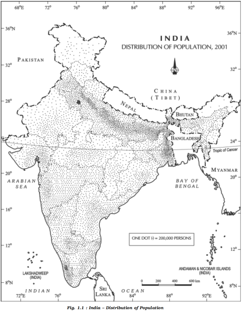
- Examine Fig. 1.1 and try to describe the patterns of spatial distribution of population shown on it
- It is clear that India has a highly uneven pattern of population distribution
- The percentage shares of population of the states and Union Territories in the country (Appendix–i) show that Uttar Pradesh has the highest population followed by Maharashtra, Bihar, West Bengal and Andhra Pradesh
- Update 2026
- After the 2014 bifurcation, Andhra Pradesh lost Telangana and dropped down the population ranking.
- Using Census 2011 (post-bifurcation figures), the top five states by population are:
1. Uttar Pradesh
2. Maharashtra
3. Bihar
4. West Bengal
5. Madhya Pradesh
- Check from the table (Appendix–i) that U.P., Maharashtra, Bihar, West Bengal, Andhra Pradesh along with Tamil Nadu, Madhya Pradesh, Rajasthan, Karnataka and Gujarat, together account for about 76 per cent of the total population of the country
- On the other hand, share of population is very small in the states like Jammu & Kashmir (0.98%), Arunachal Pradesh (0.11%) and Uttaranchal (0.83%) inspite of theses states having fairly large geographical area
- Factors influencing the distribution of population
- Geographical factors
- Availability of water
- Water is the most important factor for life
- So, people prefer to live in areas where fresh water is easily available
- Water is used for drinking, bathing and cooking – and also for cattle, crops, industries and navigation
- It is because of this that river valleys are among the most densely populated areas of the world
- Availability of water from rivers, such as the Ganga and Brahmaputra, leads to dense settlements.
- Example:
- Despite Rajasthan’s arid climate, irrigation facilities have allowed some areas to develop moderate population density.
- Landforms
- People prefer living on flat plains and gentle slopes
- This is because such areas are favorable for the production of crops and to build roads and industries
- The mountainous and hilly areas hinder the development of transport network and hence initially do not favour agricultural and industrial development
- Inhospitable terrains like the Himalayas and arid regions like Rajasthan have sparse population.
- So, these areas tend to be less populated
- The Ganga plains are among the most densely populated areas of the world while the mountains zones in the Himalayas are scarcely populated
- Climate
- An extreme climate such as very hot or cold deserts are uncomfortable for human habitation
- Areas with a comfortable climate, where there is not much seasonal variation attract more people
- Areas with very heavy rainfall or extreme and harsh climates have low population
- Mediterranean regions were inhabited from early periods in history due to their pleasant climate
- Soils
- Fertile soils are important for agricultural and allied activities
- Therefore, areas which have fertile loamy soils have more people living on them as these can support intensive agriculture
- Economic factors
- Minerals
- Areas with mineral deposits attract industries
- Mining and industrial activities generate employment
- So, skilled and semi–skilled workers move to these areas and make them densely populated
- Katanga Zambia copper belt in Africa is one such good example
- Urbanization
- Cities offer better employment opportunities, educational and medical facilities, better means of transport and communication
- Good civic amenities and the attraction of city life draw people to the cities
- It leads to rural to urban migration and cities grow in size
- Mega cities of the world continue to attract large number of migrants every year
- Urban centres like Delhi, Mumbai, Kolkata, Bengaluru, Chennai, Pune, Ahmedabad, and Jaipur exhibit high population density due to employment, services, and lifestyle factors.
- Industrialization
- Industrial belts provide job opportunities and attract large numbers of people
- These include not just factory workers but also transport operators, shopkeepers, bank employees, doctors, teachers and other service providers
- The Kobe-Osaka region of Japan is thickly populated because of the presence of a number of industries
- Example:
- Jharkhand, with its mineral and energy resources, has witnessed growth in population density through industrial activity.
- Technological factors
- Development of transport networks has improved connectivity and made previously inaccessible regions more habitable.
- Social and cultural factors
- Some places attract more people because they have religious or cultural significance
- In the same way – people tend to move away from places where there is social and political unrest
- Many a times governments offer incentives to people to live in sparsely populated areas or move away from overcrowded places
- Even in degraded environments like the Ganga plains, population remains high due to socio-economic roots.
- Historical settlement patterns—early civilizations along river valleys—have led to continued population concentrations.
- Historical and Political Factors
- Colonial-era infrastructure, ports, railways, and administrative centres influenced early population patterns.
- Post-independence development policies further reinforced existing distribution trends.
- Migration policies, displacement, and political unrest in some areas have also caused population shifts.
- Density of population
- Definition and calculation
- Density of population, is expressed as number of persons per unit area
- It is usually measured in persons per sq km
- Each unit of land has limited capacity to support people living on it
- Hence, it is necessary to understand the ratio between the numbers of people to the size of land
- It helps in getting a better understanding of the spatial distribution of population in relation to land
- Density of Population = Population/Area
- For example, area of Region X is 100 sq km and the population is 1,50,000 persons
- The density of population is calculated as: Density = 1,50,000 / 100 = 1,500 person/sq km
- Physiological and agricultural densities
- The density of population, as discussed in the earlier paragraph, is a crude measure of human and land relationship
- To get a better insight into the human-land ratio in terms of pressure of population on total cultivable land, the physiological and the agricultural densities should be found out which are significant for a country like India having a large agricultural population
- Physiological density = total population / net cultivated area
- Agricultural density = total agricultural population / net cultivable area
- Agricultural population includes cultivators and agricultural labourers and their family members
- Some examples:
- The density of population in India (2001) is 313 persons per sq km and ranks third among the most densely populated countries of Asia following Bangladesh (849 persons) and Japan (334 persons)
- There has been a steady increase of about 200 persons per sq km over the last 50 years as the density of population increased from 117 persons/ sq km in 1951 to 313 persons/sq km in 2001
- Spatial variation in India
-
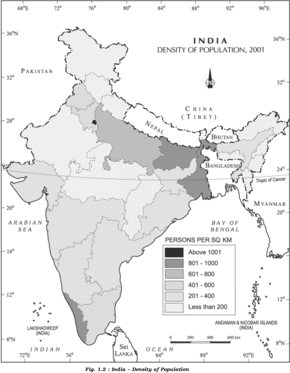
- The data shown in Appendix (i) give an idea of spatial variation of population densities in the country which ranges from as low as 13 persons per sq km in Arunachal Pradesh to 9,340 persons in the National Capital Territory of Delhi
- Among the northern Indian States, West Bengal (903), Bihar (880) and Uttar Pradesh (690) have higher densities, while Kerala (819) and Tamil Nadu (480) have higher densities among the peninsular Indian states
- States like Assam, Gujarat, Andhra Pradesh, Haryana, Jharkhand, Orissa have moderate densities
- The hill states of the Himalayan region and North eastern states of India (excluding Assam) have relatively low densities while the Union Territories (excluding Andaman and Nicobar islands) have very high densities of population (Fig. 1.2)
- Regional density
-
| Region |
Population (2025) |
Land Area (Km²) |
Density (P/Km²) |
World Share (%) |
| Asia |
4,835,320,060 |
31,033,131 |
156 |
58.74% |
| Africa |
1,549,867,579 |
29,648,481 |
52 |
18.83% |
| Europe |
744,398,832 |
22,134,900 |
34 |
9.04% |
| Latin America and the Caribbean |
667,888,552 |
20,139,378 |
33 |
8.11% |
| Northern America |
387,528,403 |
18,651,660 |
21 |
4.71% |
| Oceania |
46,609,644 |
8,486,460 |
5 |
0.57% |
- Global data 2026 (UN population estimates)
-
| Category |
Rank |
Country / Territory |
Region |
Population Density (persons per sq km) |
Official Source Basis |
| World Top 5 |
1 |
Macau (China) |
East Asia |
~21,000+ |
UN Population Division / National Statistics |
| 2 |
Monaco |
Europe |
~19,000+ |
UN Population Division |
| 3 |
Singapore |
Southeast Asia |
~8,300 |
Singapore Department of Statistics / UN |
| 4 |
Hong Kong (China) |
East Asia |
~6,700 |
Hong Kong Census & Statistics / UN |
| 5 |
Gaza Strip (Palestine) |
West Asia |
~6,000+ |
Palestinian Central Bureau of Statistics / UN |
| South Asia |
1 |
Bangladesh |
South Asia |
~1,300 |
Bangladesh Bureau of Statistics / UN |
| 2 |
Maldives |
South Asia |
~1,300 |
Maldives National Bureau of Statistics / UN |
| 3 |
India |
South Asia |
382 (Census 2011) |
Census of India 2011 (Official) |
| 4 |
Sri Lanka |
South Asia |
341 |
Department of Census & Statistics Sri Lanka |
| 5 |
Pakistan |
South Asia |
287 |
Pakistan Bureau of Statistics (2017 Census) |
| 6 |
Nepal |
South Asia |
203 |
Central Bureau of Statistics Nepal |
| 7 |
Afghanistan |
South Asia |
~59 |
National Statistics and Information Authority / UN |
| 8 |
Bhutan |
South Asia |
~20 |
National Statistics Bureau Bhutan |
- Population growth
-
- Definition
- The population growth or population change refers to the change in number of inhabitants of a territory during a specific period of time
- Its rate is expressed in percentage
- This change may be positive as well as negative
- It can be expressed either in terms of absolute numbers or in terms of percentage
- Population change in an area is an important indicator of economic development, social upliftment and historical and cultural background of the region
- Population growth has two components namely:
- Natural
- Natural growth is analysed by assessing the crude birth and death rates
- Induced
- Induced components are explained by the volume of inward and outward movement of people in any given area
- Basic concepts of population geography
- Growth of population
- Change of population in particular area between two points of time is known as growth of population
- For example, if we deduct the population of India 2001 (102.70 crore) from population of 2011 (121.02 crore) then we shall get the growth of population (18.15 crores) in actual numbers
- Growth rate of population
- This is the change of population expressed in percentage
- Natural growth of population
- This is the population increased by difference between births and deaths in a particular region between two points of time
- Natural Growth = Births – Deaths
- Actual growth of population
- This is Births – Deaths + In Migration – Out Migration
- Positive growth of population
- This happens when the birth rate is more than the death rate between two points of time or when people from other countries migrate permanently to a region
- Negative growth of population
- If the population decreases between two points of time it is known as negative growth of population
- It occurs when the birth rate falls below the death rate or people migrate to other countries
- Components of population change
- There are three components of population change – births, deaths and migration
- Crude birth rate (CBR)
- The crude birth rate (CBR) is expressed as number of live births in a year per thousand of population
- CBR = (Number of live births / Mid-year population of that year) × 1000
- Why the formula multiply by 1000?
- Suppose there 700 live births in a population of 1 million
- CBR = (700 / 1,000,000) will divide the 700 in a million people, i.e. 0.0007 live births per person
- If 1 person corresponds to 0.0007 births, then 1,000 persons correspond to how many births?
- That is a scaling up question, not a dividing question. So we do 0.0007 × 1000 = 0.7
- We get 0.7 births per 1,000 persons
- Why “per thousand” feels like division?
- Calculating per thousand does not mean to divide by 1,000 always, instead it's a bi-direction logic, if we start from per person then we have calculate per thousand then multiply by 1,000, but if we start from per thousand and have to calculate per person then we divide by 1,000
-
| Current Unit |
Operation |
Reason |
| Per 1 person -> Per 1,000 persons |
Multiply by 1,000 |
Scaling up from one person to one thousand persons |
| Per 1,000 persons -> Per 1 person |
Divide by 1,000 |
Scaling down from thousand persons to one person |
- Crude death rate (CDR)
- Death rate plays an active role in population change
- Population growth occurs not only by increasing births rate but also due to decreasing death rate
- Crude Death Rate (CDR) is a simple method of measuring mortality of any area
- CDR is expressed in terms of number of deaths in a particular year per thousand of population in a particular region
- CDR = (Number of deaths / Mid-year population of that year) x 1000
- By and large mortality rates are affected by the region’s demographic structure, social advancement and levels of its economic development
- Total Fertility Rate (TFR)
- TFR is the average number of children a woman would have over her lifetime if current age-specific fertility rates remain unchanged.
- TFR meaning
- TFR > 2.1 → population grows (eventually)
- TFR ≈ 2.1 → population stabilises (after lag)
- TFR < 2.1 → population shrinks (eventually)
- 2025 stats
- India = ~2.0 → just below replacement
- China = ~1.0–1.1 → deep trouble
- South Korea = ~0.7 → demographic free fall
- Japan = ~1.3 → classic ageing society
- Migration
- Apart from birth and death there is another way by which the population size changes
- When people move from one place to another, the place they move from is called the Place of Origin and the place they move to is called the Place of Destination
- The place of origin shows a decrease in population while the population increases in the place of destination
- Migration may be interpreted [explain the meaning of] as a spontaneous [occurring without apparent external cause] effort to achieve a better balance between population and resources
- Migration may be permanent, temporary or seasonal
- It may take place from rural to rural areas, rural to urban areas, urban to urban areas and urban to rural areas
- Do you realise that the same person is both an immigrant and an emigrant?
- Immigration
- Migrants who move into a new place are called Immigrants
- Emigration
- Migrants who move out of a place are called Emigrants
- Factors influencing migration
- People migrate for a better economic and social life
- There are two sets of factors that influence migration
- The Push factors
- Make the place of origin seem less attractive for reasons like unemployment, poor living conditions, political turmoil, unpleasant climate, natural disasters, epidemics and socio-economic backwardness
- The Pull factors
- Make the place of destination seem more attractive than the place of origin for reasons like better job opportunities and living conditions, peace and stability, security of life and property and pleasant climate
- Trends in population growth
- Historical overview
- The population on the earth is more than seven billion
- It has grown to this size over centuries
- In the early periods population of the world grew very slowly
- It is only during the last few hundred years that population has increased at an alarming rate
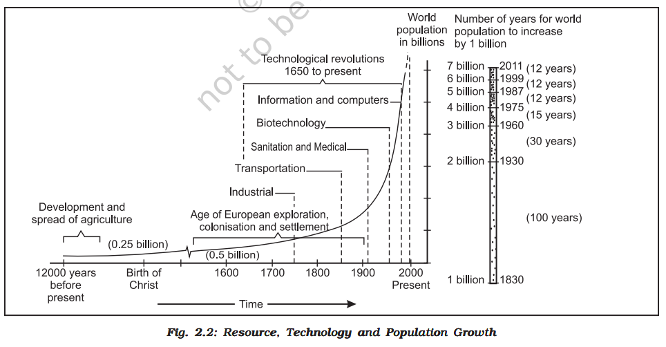
- Fig. 2.2 tells the story of population growth
- After the evolution and introduction of agriculture about 12,000 to 8,000 years ago, the size of population was small – roughly 8 million
- In the first century A.D. it was below 300 million
- The expanding world trade during the sixteenth and seventeenth century, set the stage for rapid population growth
- Around 1750, at the dawn of the Industrial Revolution, the world population was 550 million
- World population exploded in the eighteenth century after the Industrial Revolution
- Technological advancement achieved so far helped in the reduction of death rate and provided a stage for accelerated population growth
- Human population increased more than ten times in the past 500 hundred years
- In the twentieth century itself the population has increased four times
- Role of science and technology in Population Growth
- The steam engine replaced human and animal energy and also provided mechanized energy of water and wind
- This increased agricultural and industrial production
- Inoculation against epidemics and other communicable diseases, improvement in medical facilities and sanitation contributed to a rapid decline in death rates throughout the world
- Inoculation, in a medical context, refers to the process of introducing a pathogen, vaccine, or antigen into a person or animal to induce immunity against a specific disease
- Population doubling time
- Population doubling time is the time taken by any population to double itself at its current annual growth rate
- It took more than a million years for the human population to attain the one billion mark
- But it took only 12 years for it to rise from 5 billion to 6 billion
- Doubling time of world population
-
| Period |
Population |
Time in which Population Doubles |
| 10,000 B.C. |
5 million |
1,500 years |
| 1650 A.D. |
500 million |
154 years |
| 1804 A.D. |
1,000 million |
123 years |
| 1927 A.D. |
2,000 million |
47 years |
| 1974 A.D. |
4,000 million |
51 years |
| 2025 A.D. (Projected) |
8,000 million |
— |
- Regional variation
- There is a great variation among regions in doubling their population
- Developed countries take more time to double their population as compared to developing countries
- Most of the population growth is taking place in the developing world, where population is exploding
- Population growth in India
-
- The decadal and annual growth rates of population in India are both very high and steadily increasing over time
- The annual growth rate of India’s population is 2.4 per cent
- At this current rate of increase, it is estimated that the country’s population will double itself in another 36 years and even surpass population of China
- Phases of population growth in India
- The growth rate of population in India over the last one century has been caused by annual birth rate and death rate and rate of migration and thereby shows different trends
- There are four distinct phases of growth identified within this period:
-
Decadal Growth of Population in India (1901–2011)
| Census Year |
Total Population |
Absolute Growth |
Decadal Growth Rate (%) |
| 1901 |
238,396,327 |
— |
— |
| 1911 |
252,093,390 |
+13,697,063 |
+5.75 |
| 1921 |
251,321,213 |
−772,177 |
−0.31 |
| 1931 |
278,977,238 |
+27,656,025 |
+11.60 |
| 1941 |
318,660,580 |
+39,683,342 |
+14.22 |
| 1951 |
361,088,090 |
+42,427,510 |
+13.31 |
| 1961 |
439,234,771 |
+78,146,681 |
+21.51 |
| 1971 |
548,159,652 |
+108,924,881 |
+24.80 |
| 1981 |
683,329,097 |
+135,169,445 |
+24.66 |
| 1991 |
846,302,688 |
+162,973,591 |
+23.85 |
| 2001 |
1,028,610,328 |
+182,307,640 |
+21.54 |
| 2011 |
1,210,193,422 |
+181,583,094 |
+17.64 |
- Decadal Growth Rate = ((Population of the present year − Population of the base year) / Population of the base year) × 100
- Phase I
- The period from 1901-1921 is referred to as a period of stagnant or stationary phase of growth of India’s population, since in this period growth rate was very low, even recording a negative growth rate during 1911-1921
- Both the birth rate and death rate were high keeping the rate of increase low (Appendix–iii)
- Poor health and medical services, illiteracy of people at large and inefficient distribution system of food and other basic necessities were largely responsible for a high birth and death rates in this period
- Phase II
- The decades 1921-1951 are referred to as the period of steady population growth
- An overall improvement in health and sanitation throughout the country brought down the mortality rate
- At the same time better transport and communication system improved distribution system
- The crude birth rate remained high in this period leading to higher growth rate than the previous phase
- This is impressive at the backdrop of Great Economic Depression, 1920s and World War II
- Phase III
- The decades 1951-1981 are referred to as the period of population explosion in India, which was caused by a rapid fall in the mortality rate but a high fertility rate of population in the country
- The average annual growth rate was as high as 2.2 per cent
- It is in this period, after the Independence, that developmental activities were introduced through a centralised planning process and economy started showing up ensuring the improvement of living condition of people at large
- Consequently, there was a high natural increase and higher growth rate
- Besides, increased international migration bringing in Tibetans, Bangladeshis, Nepalies and even people from Pakistan contributed to the high growth rate
- Phase IV
- In the post 1981 till present, the growth rate of country’s population though remained high, has started slowing down gradually (Table 1.1)
- A downward trend of crude birth rate is held responsible for such a population growth
- This was, in turn, affected by an increase in the mean age at marriage, improved quality of life particularly education of females in the country
- Future projection
- The growth rate of population is, however, still high in the country, and it has been projected by World Development Report that population of India will touch 1,350 million by 2025
- The analysis done so far shows the average growth rate, but the country also has wide variation (Appendix–iv) in growth rates from one area to another which is discussed below
- Update as of July 2025
- United Nations/UNFPA estimate ~1.46 billion (146 crore).
- Regional variation in population growth
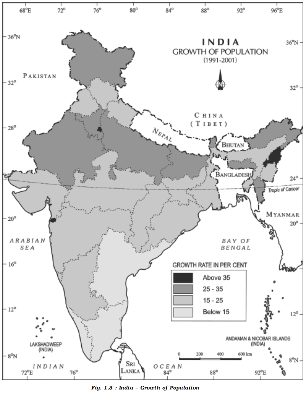
- The growth rate of population during 1991-2001 in Indian States and Union Territories shows very obvious pattern
- The States like Kerala, Karnataka, Tamil Nadu, Andhra Pradesh, Orissa, Pondicherry, and Goa show a low rate of growth not exceeding 20 per cent over the decade
- Kerala registered the lowest growth rate (9.4) not only in this group of states but also in the country as a whole
- A continuous belt of states from west to east in the north-west, north , and north central parts of the country has relatively high growth rate than the southern states
- It is in this belt comprising Gujarat, Maharashtra, Rajasthan, Punjab, Haryana, Uttar Pradesh, Uttaranchal, Madhya Pradesh, Sikkim, Assam, West Bengal, Bihar, Chhattisgarh, and Jharkhand, the growth rate on the average remained 20-25 per cent
- Adolescent population
- An important aspect of population growth in India is the growth of its adolescents
- At present the share of adolescents i.e. up to the age group of 10-19 years is about 22 per cent (2001), among which male adolescents constitute 53 per cent and female adolescents constitute 47 per cent
- The adolescent population, though, regarded as the youthful population having high potentials, but at the same time they are quite vulnerable if not guided and channelised properly
- There are many challenges for the society as far as these adolescents are concerned, some of which are:
- Lower age at marriage
- Illiteracy – particularly female illiteracy, school dropouts
- Low intake of nutrients
- High rate of maternal mortality of adolescent mothers
- High rates of HIV/AIDS infections
- Physical and mental disability or retardedness
- Drug abuse and alcoholism
- Juvenile delinquency and commitence of crimes, etc
- In view of these, the Government of India has undertaken certain policies to impart proper education to the adolescent groups so that their talents are better channelised and properly utilised
- The National Youth Policy is one example which has been designed to look into the overall development of our large youth and adolescent population
- The National Youth Policy of Government of India, launched in 2003, stresses on an all-round improvement of the youth and adolescents enabling them to shoulder responsibility towards constructive development of the country
- It also aims at reinforcing the qualities of patriotism and responsible citizenship
- The thrust of this policy is youth empowerment in terms of their effective participation in decision making and carrying the responsibility of an able leader
- Special emphasis was given in empowering women and girl child to bring parity in the male-female status
- Moreover, deliberate efforts were made to look into youth health, sports and recreation, creativity and awareness about new innovations in the spheres of science and technology
- It appears from the above discussion that the growth rate of population is widely variant over space and time in the country and also highlights various social problems related to the growth of population
- However, in order to have a better insight into the growth pattern of population it is also necessary to look into the social composition of population
- Change in population growth
- Spatial pattern of population change
- Overview
- Population growth in different parts of the world can be compared
- The growth of population is low in developed countries as compared to developing countries
- There is negative correlation between economic development and population growth
- Annual rate implications
- Although the annual rate of population change (1.4 per cent) seems to be low (Table 2.3), it is actually not so
- This is because:
- When a small annual rate is applied to a very large population, it will lead to a large population change
- Even if the growth rate continues to decline, the total population grows each year
- The infant mortality rate may have increased as has the death rate during childbirth
-
| Region |
Growth Rate (1990-95) |
Growth Rate (2010-15) |
| World |
1.6% |
1.2% |
| Africa |
2.4% |
2.6% |
| Europe |
0.2% |
0.1% |
| North America |
1.4% |
0.8% |
| Latin America & Caribbean |
1.7% |
1.1% |
| Asia |
1.6% |
1.0% |
| Oceania (Australia, New Zealand, Fiji) |
1.5% |
1.5% |
- Impact of population change
- A small increase in population is desirable in a growing economy
- However, population growth beyond a certain level leads to problems; of these the depletion of resources is the most serious
- Population decline is also a matter of concern. It indicates that resources that had supported a population earlier are now insufficient to maintain the population
- Specific impacts
- The deadly HIV/AIDS epidemics in Africa and some parts of the Commonwealth of Independent States (CIS) and Asia have pushed up death rates and reduced average life expectancy
- This has slowed down population growth
- Population growth rate
- The annual population growth rate in India is 1.64 per cent
- Some developed countries will take 318 years to double their population whereas some countries still do not show symptoms of doubling their population
- Demographic transition
-
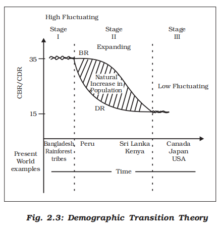
- Demographic transition theory can be used to describe and predict the future population of any area
- The theory tells us that population of any region changes from high births and high deaths to low births and low deaths as society progresses from rural agrarian and illiterate to urban industrial and literate society
- These changes occur in stages which are collectively known as the demographic cycle
- Demographic Transition:
- Rural Agrarian -------------> Urban Industrial
- Three-stage model (Fig. 2.3)
- First stage
- The first stage has high fertility and high mortality because people reproduce more to compensate for the deaths due to epidemics and variable food supply
- The population growth is slow and most of the people are engaged in agriculture where large families are an asset
- Life expectancy is low, people are mostly illiterate and have low levels of technology
- Two hundred years ago all the countries of the world were in this stage
- Fertility remains high in the beginning of second stage but it declines with time
- This is accompanied by reduced mortality rate
- Reduced mortality stage
- Improvements in sanitation and health conditions lead to decline in mortality
- Because of this gap the net addition to population is high
- Last stage
- In the last stage, both fertility and mortality decline considerably
- The population is either stable or grows slowly
- The population becomes urbanised, literate and has high technical know-how and deliberately controls the family size
- This shows that human beings are extremely flexible and are able to adjust their fertility
- Current global status
- In the present day, different countries are at different stages of demographic transition
- According to the United Nations population projections (medium variant):
- China’s population in 2100 (median projection) is ~633 million people. That’s roughly less than half of China’s current population (≈1.4 billion), which means a dramatic long-term decline over the 21st century.
- Demographic winter
- A situation where a country’s fertility rate stays very low for a long time, leading to:
- Fewer births
- Shrinking working-age population
- Rapid ageing
- Eventually, population decline
- The core technical condition
- Total Fertility Rate (TFR) < 2.1 (replacement level)
- And it stays there for decades, not one bad year
- Population control measures
- Family planning is the spacing or preventing the birth of children
- Access to family planning services is a significant factor in limiting population growth and improving women’s health
- Propaganda [form of communication aimed at influencing the opinions, beliefs, and actions of a target audience], free availability of contraceptives and tax disincentives for large families are some of the measures which can help population control
- Malthusian theory
- Thomas Malthus in his theory (1798) stated that the number of people would increase faster than the food supply
- Any further increase would result in a population crash caused by famine, disease and war
- The preventive checks are better than the physical checks
- For the sustainability of our resources, the world will have to control the rapid population increase
- Population composition
- Introduction
- Population composition is a distinct field of study within population geography with a vast coverage of analysis of age and sex, place of residence, ethnic characteristics, tribes, language, religion, marital status, literacy and education, occupational characteristics, etc
- People of any country are diverse in many respects
- Each person is unique in her/his own way
- Sex composition
- Definition and calculation
- The number of women and men in a country is an important demographic characteristic
- The ratio between the number of women and men in the population is called the Sex Ratio
- In some countries it is calculated as the number of males per thousand females:
- (Male Population/Female Population) x 1000
- In India, the sex ratio calculated as number of females per thousand males:
- (Female Population/Male Population) x 1000
- The sex ratio is an important information about the status of women in a country
- Social implications
- In regions where gender discrimination is rampant [flourishing or spreading unchecked], the sex ratio is bound to be unfavorable to women
- Such areas are those where the practice of female feticide, female infanticide and domestic violence against women are prevalent
- Female foeticide is the process of finding out the sex of the foetus and undergoing abortion if it is a girl. Although it is illegal, many people continue to practice it.
- Besides this, there are some communities which practice female infanticide - the practice of killing the girl child once she is born.
- One of the reasons could be lower socio-economic status of women in these areas
- You must remember that more women in the population does not mean they have a better status, it could be that the men might have migrated to other areas for employment
- Natural advantage v/s social disadvantage
- Females have a biological advantage over males as they tend to be more resilient than males yet this advantage is cancelled out by the social disadvantages and discriminations that they face
- Biological Advantage of Females
- Lower Infant Mortality:
- Female infants are more likely to survive the first year of life than male infants under similar conditions.
- This is due to genetic advantages (e.g., having two X chromosomes provides backup for mutations) and hormonal factors (e.g., estrogen has protective effects on the immune system).
- Higher Life Expectancy:
- Globally, women tend to live longer than men. This is consistent across most societies.
- This is partly due to lower rates of risky behavior, and biological protection against cardiovascular diseases (before menopause).
- Stronger Immunity:
- Women tend to mount stronger immune responses than men, making them more resilient to certain infections and diseases.
- Social Disadvantages and Discrimination
- Discrimination and Gender Bias:
- Preference for male children can lead to neglect of girl children, poor nutrition, and lower healthcare access.
- Practices such as female infanticide or sex-selective abortion directly impact female survival.
- Education and Opportunity Gap:
- Girls are often denied equal access to education, reducing long-term health and income outcomes.
- Early marriage and childbearing also put girls at higher reproductive and maternal risk.
- Domestic and Gender-Based Violence:
- Many women face physical and mental abuse, increasing health risks and reducing lifespan and well-being.
- Healthcare Neglect:
- Women's health needs, especially reproductive health, are often under-prioritized.
- Women may be less likely to be taken to hospitals, especially in rural or patriarchal societies.
- Global patterns
- On an average, the world population reflects a sex ratio of 102 males per 100 females
- The highest sex ratio in the world has been recorded in Latvia (and other Baltic States like Estonia, Lithuania) where there are 85 males per 100 females
- In contrast, in Qatar there are 311 males per 100 females
- The world pattern of sex ratio does not exhibit variations in the developed regions of the world
- The sex ratio is favorable for females in 139 countries of the world and unfavorable for them in the remaining 72 countries listed by the United Nations
- In general, Asia has a low sex ratio
- Countries like China, India, Saudi Arabia, Pakistan, Afghanistan have a lower sex ratio
- On the other extreme is greater part of Europe (including Russia) where males are in minority
- A deficit of males in the populations of many European countries is attributed to better status of women, and an excessively male-dominated out-migration to different parts of the world in the past
- India's latest official data (from 2021 Census) shows a sex ratio of 943 females per 1000 males,
- Kerala has the highest sex ration (1084 females / 1000 males) while Haryana ranking the lowest with sex ration of 879 females per 1000 males.
- If all ~2.2 million emigrants (assumed male) return to Kerala, the sex ratio would fall from about 1084 to roughly 950 females per 1000 males.
- Low Sex Ratio: Causes, Consequences, and Solutions
- Overview
- The sex ratio refers to the number of females per 1,000 males in a population.
- A balanced sex ratio is crucial for social stability and gender equality.
- However, many regions—particularly in South Asia, East Asia, and parts of Eastern Europe—exhibit significantly skewed sex ratios, primarily due to son preference and sex-selective practices.
- In India (Census 2011):
- Overall sex ratio:
- 943 females/1000 males.
- Child sex ratio (0–6 years):
- 919 females/1000 males.
- In China, the sex ratio at birth stood at 111 boys to 100 girls (2020), down from earlier decades where it exceeded 120.
- Causes of Skewed Sex Ratio
- 1. Patriarchal Societal Norms
- Deep-rooted preference for sons due to economic, religious, and cultural factors.
- Sons are considered breadwinners, carriers of family lineage, and providers in old age.
- 2. Sex-Selective Abortions
- Widespread misuse of ultrasound technology for prenatal sex determination.
- Particularly prevalent in countries like India, China, Vietnam, and South Korea (historically).
- Violates laws such as India’s PCPNDT Act (1994).
- 3. Dowry and Financial Pressures
- Daughters seen as economic liabilities due to dowry system (India, Bangladesh).
- Increases the cost of raising a girl child.
- 4. Lower Status and Education of Women
- Societies with lower female literacy and employment tend to have more biased sex ratios.
- Education helps shift perspectives towards gender equality.
- 5. Policy-driven Preferences (e.g., China’s One-Child Policy)
- China’s One-Child Policy (1979–2015), combined with son preference, led to a highly skewed sex ratio.
- Consequences of Low Sex Ratio
- 1. Marriage Squeeze
- Shortage of brides leads to forced marriages, bride trafficking, and import of women from other regions.
- Seen in parts of India (Haryana, Punjab) and China’s rural areas.
- 2. Increase in Gender-Based Violence
- Skewed sex ratios are often associated with rising crimes against women, including rape, domestic violence, and human trafficking.
- 3. Demographic Imbalance
- Affects long-term population growth and aging.
- Leads to economic inefficiencies and dependency burdens in the future.
- 4. Worsened Social Cohesion
- Gender imbalance distorts community structures, increases alienation, and social unrest among unmarried men.
- Government and Institutional Responses
- 1. Legal Measures
- Acts like PCPNDT Act bans sex-selective abortions in India.
- Pre-Conception and Pre-Natal Diagnostic Techniques (Prohibition of Sex Selection) Act
- 2. Social Campaigns and Behaviour Change
- Beti Bachao, Beti Padhao (2015) focused on saving and educating the girl child.
- Civil society and religious leaders have played an important role in mindset change.
- 3. Education and Empowerment of Girls
- Increasing female literacy and access to vocational training.
- Financial incentives like conditional cash transfer schemes for girls (e.g., Ladli, Dhanlakshmi in India).
- 4. Economic Incentives and Social Security
- Providing old-age security, pensions, and maternity benefits to reduce dependence on sons.
- Addressing dowry through strict enforcement of anti-dowry laws.
- 5. Monitoring and Technology
- Use of digital surveillance to track pregnancy registrations (India's PMSMA).
- Incentivizing ethical practices in private clinics and better enforcement through district authorities.
- Global Examples of Success
- South Korea saw normalization of its sex ratio due to a combination of economic development, education, and gender reforms.
- Vietnam strengthening the legal framework against sex determination has shown modest improvements.
- China shifted policies post-2015 toward increasing fertility and gender equality, though challenges remain.
- Age structure composition
- Age structure represents the number of people of different age groups
- This is an important indicator of population composition, since a large size of population in the age group of 15-59 indicates a large working population
- A greater proportion of population above 60 years represents an ageing population which requires more expenditure on health care facilities
- Similarly high proportion of young population would mean that the region has a high birth rate and the population is youthful
- Age-sex pyramid
- Definition
- The age-sex structure of a population refers to the number of females and males in different age groups
- A population pyramid is used to show the age-sex structure of the population
- The shape of the population pyramid reflects the characteristics of the population
- The left side shows the percentage of males while the right side shows the percentage of women in each age group
- Types of population pyramids
- Expanding populations (Triangle shaped)
-
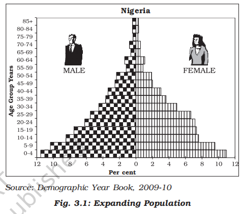
- The age-sex pyramid of Nigeria as you can see is a triangular shaped pyramid with a wide base and is typical of less developed countries
- These have larger populations in lower age groups due to high birth rates
- If you construct the pyramids for Bangladesh and Mexico, it would look the same
- Constant population (Bell shaped)
-
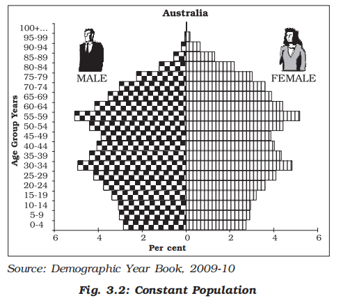
- Australia’s age-sex pyramid is bell shaped and tapered towards the top
- This shows birth and death rates are almost equal leading to a near constant population
- Declining populations (Inverse pyramid)
-
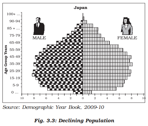
- The Japan pyramid has a narrow base and a tapered top showing low birth and death rates
- The population growth in developed countries is usually zero or negative
- Ageing population
- Population ageing is the process by which the share of the older population becomes proportionally larger
- This is a new phenomenon of the twentieth century
- In most of the developed countries of the world, population in higher age groups has increased due to increased life expectancy
- With a reduction in birth rates, the proportion of children in the population has declined
- Rural urban composition
- Definition and importance
- The division of population into rural and urban is based on the residence
- This division is necessary because rural and urban life styles differ from each other in terms of their livelihood and social conditions
- The age-sex-occupational structure, density of population and level of development vary between rural and urban areas
- Criteria
- The criteria for differentiating rural and urban population varies from country to country
- In general terms rural areas are those where people are engaged in primary activities and urban areas are those when majority of the working population is engaged in non-primary activities
- Rural-urban sex composition
-

- Composition of population by their respective places of residence is an important indicator of social and economic characteristics
- This becomes even more significant for a country like India where about 72 per cent of its total population lives in villages
- Fig. 3.4 shows rural urban sex composition of selected countries
- The rural and urban differences in sex ratio in Canada and West European countries like Finland are just the opposite of those in African and Asian countries like Zimbabwe and Nepal respectively
- In Western countries, males outnumber females in rural areas and females outnumber the males in urban areas
- The excess of females in urban areas of U.S.A., Canada and Europe is the result of influx of females from rural areas to avail of the vast job opportunities
- Farming in these developed countries is also highly mechanized and remains largely a male occupation
- In countries like Nepal, Pakistan and India the case is reverse
- By contrast the sex ratio in Asian urban areas remains male dominated due to the predominance of male migration
- It is also worth noting that in countries like India, female participation in farming activity in rural area is fairly high
- Shortage of housing, high cost of living, paucity of job opportunities and lack of security in cities, discourage women to migrate from rural to urban areas
- Indian rural-urban composition
- Do you know that India has 638,588 villages according to the Census 2001 out of which 593,731 (93 per cent) are inhabited villages?
- However, the distribution of rural population is not uniform throughout the country
- You might have noted that the states like Bihar and Sikkim have very high percentage of rural population
- The states of Goa and Maharashtra have only little over half of their total population residing in villages
- The Union Territories, on the other hand, have smaller proportion of rural population, except Dadra and Nagar Haveli (77.1 per cent)
- The size of villages also varies considerably
- It is less than 200 persons in the hill states of north-eastern India, Western Rajasthan and Rann of Kuchchh and as high as 17 thousand persons in the states of Kerala and in parts of Maharashtra
- A thorough examination of the pattern of distribution of rural population of India reveals that both at intra-State and inter-State levels, the relative degree of urbanisation and extent of rural-urban migration regulate the concentration of rural population
- You have noted that contrary to rural population, the proportion of urban population (27.8 per cent) in India is quite low but it is showing a much faster rate of growth over the decades
- In fact since 1931, the growth rate of urban population has accelerated due to enhanced economic development and improvement in health and hygienic conditions
- The distribution of urban population too, as in the case of total population, has a wide variation throughout the country (Appendix–iv)
- It is, however, noticed that in almost all the states and Union Territories, there has been a considerable increase of urban population
- This indicates both development of urban areas in terms of socio-economic conditions and an increased rate of rural-urban migration
- The rural-urban migration is conspicuous in the case of urban areas along the main road links and railroads in the North Indian Plains, the industrial areas around Kolkata, Mumbai, Bangalore – Mysore, Madurai – Coimbatore, Ahmedabad – Surat, Delhi – Kanpur and Ludhiana – Jalandhar
- In the agriculturally stagnant parts of the middle and lower Ganga Plains, Telengana, non-irrigated Western Rajasthan, remote hilly, tribal areas of northeast, along the flood prone areas of Peninsular India and along eastern part of Madhya Pradesh, the degree of urbanisation has remained low
- Literacy composition
- Proportion of literate population of a country in an indicator of its socio-economic development as it reveals the standard of living, social status of females, availability of educational facilities and policies of government
- Level of economic development is both a cause and consequence of literacy
- In India – literacy rate denotes the percentage of population above 7 years of age, who is able to read, write and have the ability to do arithmetic calculations with understanding
- India's latest official data (from 2021 Census) shows that overall literacy rate is 74.04%.
- Male literacy is 82.14%, and female literacy is 65.46%.
- Mizoram in india has highest literacy rate (98.2%), second is Kerala (96%), Andhra Pradesh ranking the lowest (72.6%) as per the PLFS 2023–24 survey data
- Occupational composition
- Definition
- The working population (i.e. women and men of the age group – 15 to 59) take part in various occupations ranging from agriculture, forestry, fishing, manufacturing construction, commercial transport, services, communication and other unclassified services
- Classification
- Agriculture, forestry, fishing and mining are classified as primary activities
- Manufacturing as secondary
- Trade, transport, communication and other services as tertiary
- The jobs related to research, information technology and developing ideas as quaternary activities
- Significance
- The proportion of working population engaged in these four sectors is a good indicator of the levels of economic development of a nation
- This is because only a developed economy with industries and infrastructure can accommodate more workers in the secondary, tertiary and quaternary sector
- If the economy is still in the primitive stages, then the proportion of people engaged in primary activities world be high as it involves extraction of natural resources
- Linguistic composition
- India is a land of linguistic diversity
- According to Grierson (Linguistic Survey of India, 1903 – 1928) there were 179 languages and as many as 544 dialects in the country
- In the context of modern India, there are about 18 scheduled languages (1991 census) and a number of non-scheduled languages
- See how many languages appear on a ten Rs note
- Among the scheduled languages, the speakers of Hindi have the highest percentage (40.42)
- The smallest language groups are Kashmiri and Sanskrit speakers (0.01 per cent each)
- However, it is noticed that the linguistic regions in the country do not maintain a sharp and distinct boundary, rather they gradually merge and overlap in their respective border zones
- Linguistic classification of India
- The speakers of major Indian languages belong to four language families, which have their sub-families and branches or groups
- This can be better understood from Table 1.2
-
| Family |
Sub-Family |
Branch/Group |
Speech Areas (States/Regions) |
Austro-Asiatic
(<1%) |
Mon-Khmer |
Nicobarese |
Nicobar Islands |
| Munda |
Kherwari, Mundari |
Jharkhand, Odisha, West Bengal, Bihar, Chhattisgarh, Assam, Maharashtra |
Dravidian (Dravida)
~20% |
South Dravidian |
Tamil, Kannada, Malayalam |
Tamil Nadu, Karnataka, Kerala |
| Central Dravidian |
Kolami–Parji |
Andhra Pradesh, Telangana, Madhya Pradesh, Odisha, Maharashtra |
| North Dravidian |
Kurukh, Malto |
Jharkhand, Odisha, Bihar, Madhya Pradesh, West Bengal |
Sino-Tibetan / Tibeto-Myanmari
~0.85% |
Tibeto-Himalayan |
Bodic (Tibetan), Himalayan |
Jammu & Kashmir, Himachal Pradesh, Sikkim |
| North Assam |
Mishing, Adi, Apatani |
Arunachal Pradesh, Assam |
| Siamese-Chinese |
Assam-Myanmari |
Nagaland, Manipur, Mizoram, Tripura, Meghalaya, Assam |
Indo-European (Aryan)
~73% |
Iranian |
Persian, Pashto (outside India) |
Primarily spoken outside India (Iran, Afghanistan) |
| Dardic |
Shina, Kashmiri |
Jammu & Kashmir |
| Indo-Aryan |
Hindi, Bengali, Marathi, Gujarati, Punjabi, Assamese, Odia, Urdu, etc. |
Jammu & Kashmir, Punjab, Himachal Pradesh, Uttarakhand, Uttar Pradesh, Rajasthan, Haryana, Madhya Pradesh, Bihar, Odisha, West Bengal, Assam, Gujarat, Maharashtra, Goa, Chhattisgarh, Jharkhand, Delhi |
- Religious composition
- Overview
- Religion is one of the most dominant forces affecting the cultural and political life of the most of Indians
- Since religion virtually permeates into almost all the aspects of people’s family and community lives, it is important to study the religious composition in detail
- The spatial distribution of religious communities in the country (Appendix–v) shows that there are certain states and districts having large numerical strength of one religion, while the same may be very negligibly represented in other states
- Distribution of religious communities
- Hindus
- Hindus are distributed as a major group in many states (ranging from 70 - 90 per cent and above) except the districts of states along Indo-Bangladesh border, Indo-Pak border, Jammu & Kashmir, Hill States of North-East and in scattered areas of Deccan Plateau and Ganga Plain
- Muslims
- Muslims, the largest religious minority, are concentrated in Jammu & Kashmir, certain districts of West Bengal and Kerala, many districts of Uttar Pradesh , in and around Delhi and in Lakshadweep
- They form majority in Kashmir valley and Lakshadweep
- Christians
- The Christian population is distributed mostly in rural areas of the country
- The main concentration is observed along the Western coast around Goa, Kerala and also in the hill states of Meghalaya, Mizoram, Nagaland, Chotanagpur area and Hills of Manipur
- Sikhs
- Sikhs are mostly concentrated in relatively small area of the country, particularly in the states of Punjab, Haryana and Delhi
- Jains and Buddhists
- Jains and Buddhists, the smallest religious groups in India have their concentration only in selected areas of the country
- Jains have major concentration in the urban areas of Rajasthan, Gujarat and Maharashtra, while the Buddhists are concentrated mostly in Maharashtra
- The other areas of Buddhist majority are Sikkim, Arunachal Pradesh, Ladakh in Jammu & Kashmir, Tripura, and Lahul and Spiti in Himachal Pradesh
- Religion and landscapes
- Formal expression of religions on landscape is manifested through sacred structures, use of cemeteries and assemblages of plants and animals, groves of trees for religious purposes
- Sacred structures are widely distributed throughout the country
- These may range from inconspicuous village shrines to large Hindu temples, monumental masjids or ornately designed cathedrals in large metropolitan cities
- These temples, masjids, gurudwaras, monasteries and churches differ in size, form, space – use and density, while attributing a special dimension to the total landscape of the area
- The other religions of India include Zoroastrians, tribal and other indigenous faiths and beliefs
- These groups are concentrated in small pockets scattered throughout the country
- Composition of working population
-
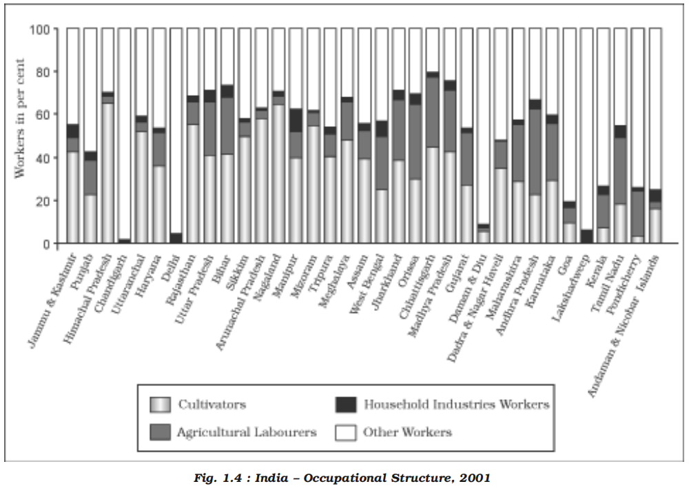
- Overview
- The population of India according to their economic status is divided into three groups, namely:
- Main workers
- Main Worker is a person who works for at least 183 days in a year
- Marginal workers
- Marginal Worker is a person who works for less than 183 days in a year
- Non-workers
- It is observed that in India, the proportion of workers (both main and marginal) is only 39 per cent (2001) leaving a vast majority of 61 per cent as non-workers
- This indicates an economic status in which there is a larger proportion of dependent population, further indicating possible existence of large number of unemployed or under employed people
- The proportion of working population, of the states and Union Territories show a moderate variation from about 25 per cent in Goa to about 53 per cent in Mizoram
- The states with larger percentages of workers are Himachal Pradesh, Sikkim, Chhattisgarh, Andhra Pradesh, Karnataka, Arunachal Pradesh, Nagaland, Manipur and Meghalaya
- Among the Union Territories, Dadra and Nagar Haveli and Daman and Diu have higher participation rate
- It is understood that, in the context of a country like India, the work participation rate tends to be higher in the areas of lower levels of economic development since number of manual workers are needed to perform the subsistence or near subsistence economic activities
- Occupational composition
- The occupational composition (see box) of India’s population (which actually means engagement of an individual in farming, manufacturing trade, services or any kind of professional activities) shows a large proportion of primary sector workers compared to secondary and tertiary sectors
- About 58.2 per cent of total working population are cultivators and agricultural labourers, whereas only 4.2% of workers are engaged in household industries and 37.6 % are other workers including non-household industries, trade, commerce, construction and repair and other services
- As far as the occupation of country’s male and female population is concerned, male workers out-number female workers in all the three sectors (Fig.1.4 and Table 1.4)
- Occupational categories
- The 2001 Census has divided the working population of India into four major categories:
- 1. Cultivators
- 2. Agricultural Labourers
- 3. Household Industrial Workers
- 4. Other Workers
- The number of female workers is relatively high in primary sector, though in recent years there has been some improvement in work participation of women in secondary and tertiary sectors
- It is important to note that the proportion of workers in the agricultural sector in India has been on a consistent decline over the past few decades — from around 66.5% in 1991 to 58.2% in 2001, and further to approximately 54.6% in 2011
-
| Sector |
1991 Census |
2001 Census |
2011 Census |
| Male (M) |
Female (F) |
Total (%) |
Male (M) |
Female (F) |
Total (%) |
Male (M) |
Female (F) |
Total (%) |
| Primary (Agriculture, Forestry, Fishing, Mining) |
120.1 M |
74.9 M |
66.5% |
142.7 M |
91.3 M |
58.2% |
151.0 M |
112.1 M |
54.6% |
| Secondary (Manufacturing, Construction, Electricity) |
19.2 M |
15.8 M |
12.0% |
8.74 M |
8.21 M |
10.5% |
39.4 M |
24.0 M |
13.2% |
| Tertiary (Trade, Transport, Education, Services) |
47.0 M |
16.0 M |
21.5% |
123.5 M |
27.7 M |
31.3% |
142.6 M |
32.7 M |
32.2% |
- Consequently, the participation rate in secondary and tertiary sector has registered an increase
- This indicates a shift of dependence of workers from farm-based occupations to non-farm based ones, indicating a sectoral shift in the economy of the country
- Spatial variation
- The spatial variation of work participation rate in different sectors in the country (Appendix–v) is very wide
- For instance, the states like Himachal Pradesh and Nagaland have very large shares of cultivators
- On the other hand states like Andhra Pradesh, Chhattisgarh, Orissa, Jharkhand, West Bengal and Madhya Pradesh have higher proportion of agricultural labourers
- The highly urbanised areas like Delhi, Chandigarh and Pondicherry have a very large proportion of workers being engaged in other services
- This indicates not only availability of limited farming land, but also large scale urbanisation and industrialisation requiring more workers in non-farm sectors
- Migration
- Introduction
- Case study: Ram Babu
- Ram Babu, working as an engineer in Bhilai Steel Plant, Chhattisgarh, was born in a small village of district Bhojpur, Bihar
- At an early age of twelve he moved to a nearby town Ara to complete his intermediate level studies
- He went to Sindri, Jharkhand for his engineering degree and he got a job at Bhilai, where he is living for the last 31 years
- His parents were illiterate and the only source of their livelihood was meagre income from agriculture
- They spent their whole life in that village
- Ram Babu has three children who got their education up to the intermediate level at Bhilai and then moved to different places for higher education
- First one studied at Allahabad and Mumbai and is presently working in Delhi as a scientist
- The second child got her higher education from different universities in India and is now working in USA
- The third one after finishing her education settled at Surat after marriage
- Overview
- This is not a story of only Ram Babu and his children but such movements are increasingly becoming universal trend
- People have been moving from one village to another, from villages to towns, from smaller towns to bigger towns and from one country to another
- In your Book Fundamentals of Human Geography you have already learnt about the concept and definition of migration
- Migration has been an integral part and a very important factor in redistributing population over time and space
- India has witnessed the waves of migrants coming to the country from Central and West Asia and also from Southeast Asia
- In fact, the history of India is a history of waves of migrants coming and settling one after another in different parts of the country
- In the words of a renowned poet Firaque Gorakhpuri:
- SAR ZAMIN-E-HIND PAR AQWAM-E-ALAM KE FIRAQUE CARVAN BASTE GAYE, HINDOSTAN BANTA GAYA
- (The carvans of people from all parts of the world kept on coming and settling in India and led to the formation of India.)
- Similarly, large numbers of people from India too have been migrating to places in search of better opportunities specially to the countries of the Middle-East, Western Europe, America, Australia and East and South East Asia
- Indian diaspora [spread of a people from their original homeland]
- First wave
- During colonial period (British period) millions of the indentured labourers were sent to Mauritius, Caribbean islands Trinidad, Tobago and Guyana), Fiji and South Africa by British from Uttar Pradesh and Bihar; to Reunion Island, Guadeloupe, Martinique and Surinam by French and Dutch and by Portuguese from Goa, Daman and Diu to Angola, Mozambique to work as plantation workers
- All such migrations were covered under the time-bound contract known as Girmit Act (Indian Emigration Act)
- However, the living conditions of these indentured labourers were not better than the slaves
- Second wave
- The second wave of migrants ventured out into the neighbouring countries in recent times as professionals, artisans, traders and factory workers, in search of economic opportunities to Thailand, Malaysia, Singapore, Indonesia, Brunei and African countries, etc. and the trend still continues
- There was a steady outflow of India’s semi-skilled and skilled labour in the wake of the oil boom in West Asia in the 1970s
- There was also some outflow of entrepreneurs, storeowners, professionals, businessmen to Western Countries
- Third wave
- Third wave, of migrant was comprised professionals like doctors, engineers (1960s onwards), software engineers, management consultants, financial experts, media persons (1980s onwards), and others migrated to countries such as USA, Canada, UK, Australia, New Zealand and Germany, etc
- These professional enjoy the distinction of being one of highly educated, the highest earning and prospering groups
- After liberalisation, in the 90s education and knowledge–based Indian emigration has made Indian Diaspora one of the most powerful diasporas in the world
- In all these countries, Indian diaspora has been playing an important role in the development of the respective countries
- Migration data in India
- Overview
- You are familiar with Census in India
- It contains information about migration in the country
- Actually migration was recorded beginning from the first Census of India conducted in 1881
- This data were recorded on the basis of place of birth
- However, the first major modification was introduced in 1961 Census by bringing in two additional components viz; place of birth i.e. village or town and duration of residence (if born elsewhere)
- Further in 1971, additional information on place of last residence and duration of stay at the place of enumeration were incorporated
- Information on reasons for migration were incorporated in 1981 Census and modified in consecutive Censuses
- Census questions on migration
- In the Census the following questions are asked on migration:
- Is the person born in this village or town? If no, then further information is taken on rural/urban status of the place of birth, name of district and state and if outside India then name of the country of birth
- Has the person come to this village or town from elsewhere? If yes, then further questions are asked about the status (rural/urban) of previous place of residence, name of district and state and if outside India then name of the country
- In addition, reasons for migration from the place of last residence and duration of residence in place of enumeration are also asked
- Bases of enumeration
- In the Census of India migration is enumerated on two bases:
- 1. Place of birth
- If the place of birth is different from the place of enumeration (known as life-time migrant)
- It just checks if the last location was place of birth or not, if yes then it classifies as a migrant by birth, if other than birth then it classfies as migrant by residance.
- Example:
- Born in Bihar -> Living in Delhi during census -> Migrant (place of birth basis)
- 2. Place of residence
- If the place of last residence is different from the place of enumeration (known as migrant by place of last residence)
- Example:
- Born in Bihar -> Lived in Kolkata -> Now living in Delhi
- Can you imagine the proportion of migrants in the population of India?
- As per 2001 census, out of 1,029 million people in the country, 307 million (30 per cent) were reported as migrants by place of birth
- However, this figure was 315 million (31 per cent) in case of place of last residence
- Streams of migration
-
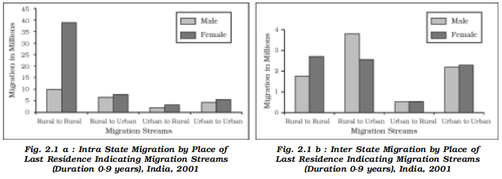
- Overview
- A few facts pertaining to the internal migration (within the country) and international migration (out of the country and into the country from other countries) are presented here
- Internal migration
- Under the internal migration, four streams are identified:
- (a) Rural to Rural (R-R)
- (b) Rural to Urban (R-U)
- (c) Urban to Urban (U-U)
- (d) Urban to Rural (U-R)
- In India, during 2001, out of 315 million migrants, enumerated on the basis of the last residence, 98 million had changed their place of residence in the last ten years
- Out of these, 81 million were intra-state migrants
- The stream was dominated by female migrants
- Most of these were migrants related to marriage
- The distribution of male and female migrants in different streams of intra-state and inter-state migration is presented in Fig. 2.1 a and 2.1 b
- It is clearly evident that females predominate the streams of short distance rural to rural migration in both types of migration
- Contrary to this, men predominate the rural to urban stream of inter-state migration due to economic reasons
- International migration
- Apart from these streams of internal migration, India also experiences immigration from and emigration to the neighbouring countries
- Table 2.1 presents the details of migrants from neighbouring countries
- Indian Census 2001 has recorded that more than 5 million person have migrated to India from other countries
- Out of these, 96 per cent came from the neighbouring countries: Bangladesh (3.0 million) followed by Pakistan (0.9 million) and Nepal (0.5 million)
- Included in this are 0.16 million refugees from Tibet, Sri Lanka, Bangladesh, Pakistan, Afghanistan, Iran, and Myanmar
- As far as emigration from India is concerned it is estimated that there are around 20 million people of Indian Diaspora, spread across 110 countries
-
| Country/Region |
No. of Immigrants |
% of Total Immigrants |
| Total International Migration |
5.16 million |
100% |
| Migration from Neighbouring Countries |
4.92 million |
95.5% |
| Afghanistan |
9,194 |
0.2% |
| Bangladesh |
3.08 million |
59.8% |
| Bhutan |
8,337 |
0.2% |
| China |
23,721 |
0.5% |
| Myanmar |
49,086 |
1.0% |
| Nepal |
5.97 lakh |
11.6% |
| Pakistan |
9.97 lakh |
19.3% |
| Sri Lanka |
1.49 lakh |
2.9% |
- Spatial variation in migration
- Some states like Maharashtra, Delhi, Gujarat and Haryana attract migrants from other states such as Uttar Pradesh, Bihar, etc. (see Appendix–vii for detail)
- Maharashtra occupied first place in the list with 2.3 million net in-migrants, followed by Delhi, Gujarat and Haryana
- On the other hand, Uttar Pradesh (-2.6 million) and Bihar (-1.7 million) were the states, which had the largest number of net out-migrants from the state
- Among the urban agglomeration (UA), Greater Mumbai received the higher number of in migrants
- Intra-states migration constituted the largest share in it
- These differences are largely due to the size of the state in which these Urban Agglomeration are located
- Causes of Migration
-
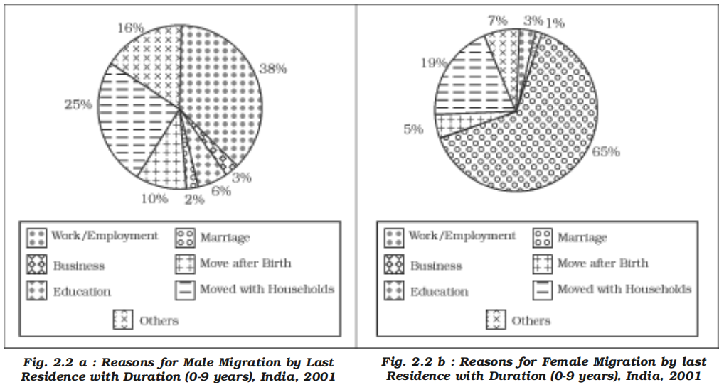
- Overview
- Migration is a multidimensional socio-economic process involving the movement of people across geographical boundaries due to a combination of factors.
- Despite emotional and cultural attachment to native regions, millions migrate due to both distress and aspiration.
- Migration can be classified on the basis of motive:
- Push factors – that compel people to leave the place of origin
- Pull factors – that attract them to the destination
- Push factors
- Economic distress:
- Agrarian stagnation, disguised unemployment, and rural indebtedness force people to seek alternate livelihoods.
- Fragmentation of land holdings and poor mechanisation limit income generation in rural areas.
- Environmental causes:
- Natural disasters such as floods (Assam, Bihar), droughts (Bundelkhand), cyclones (Odisha, Andhra coast), and earthquakes (Gujarat, Himalayan belt) result in displacement.
- Infrastructural deficit:
- Poor access to education, healthcare, transport, and housing facilities push people, especially youth, to urban centers.
- Socio-political instability:
- Migration is often triggered by caste or communal conflicts, insurgency (Northeast, Chhattisgarh), and even evictions due to development projects like dams and highways.
- Marriage:
- Women leave house after marriage.
- Pull factors
- Economic opportunities:
- Industrial hubs and urban centers offer jobs in manufacturing, construction, transport, services, and informal sectors.
- Higher wages, even in informal jobs, attract large rural populations.
- Urban amenities [a desirable or useful feature or facility of a building or place]:
- Better access to hospitals, educational institutions, roads, power supply, internet, and sanitation compared to rural areas.
- Social networks:
- Chain migration is common where earlier migrants facilitate the relocation of relatives and neighbors.
- Aspirational mobility:
- Desire for improved quality of life, social mobility, and access to modern lifestyle amenities.
- Gender dimension of migration
- Migration patterns are highly gendered in India.
- As per Census 2011:
- Around 65% of female migration is due to marriage.
- In contrast, 38% of male migration is driven by employment-related reasons.
- This reflects the patriarchal and patrilocal structure of Indian society where women shift to their husband’s residence post-marriage.
- In tribal and matrilineal societies such as Meghalaya, women's migration for education and employment is relatively higher.
- Female economic migration is often underreported due to classification under ‘accompanying family’.
- Policy implications
- Migration is both a challenge and an opportunity for development planning.
- It requires coordinated efforts across states for labour rights, portable social security (like e-Shram cards), and improved urban infrastructure.
- Gender-sensitive migration policies must recognize unpaid and invisible contributions of women migrants.
- Migration data needs periodic updating beyond decadal Census to frame responsive public policies.
- Consequences of Migration
- Positive Consequences
- Economic Benefits
- Remittances from migrants boost the source region’s economy
- India received about US$11 billion in remittances [transfers of money from an individual abroad back to their home country, often to support family members and communities] in 2002
- States like Kerala, Punjab, and Tamil Nadu depend heavily on these inflows
- Internal remittances support rural households in Bihar, Odisha, Uttar Pradesh, etc.
- Migration contributed to agricultural modernization, e.g., Green Revolution success in Punjab and Haryana
- Provides labor supply to growing industries and urban services
- Demographic Advantages
- Redistributes population, relieving pressure on densely populated rural areas
- Migration predominantly involves working-age population, contributing to urban economic growth
- Helps urban centers develop diversified human resources and skills
- Social and Cultural Integration
- Migrants act as vectors for diffusion of new ideas: education, healthcare, family planning
- Promotes cultural exchange, leading to composite cultural identities and social pluralism
- Migrants enhance social mobility and exposure to modern lifestyles
- Empowerment of Women
- Migration for education and employment increases women’s autonomy and decision-making power
- Enhances women’s participation in the economy and social spheres
- Negative Consequences
- Economic Challenges
- Brain drain and loss of skilled manpower from source regions hampers local development
- Unregulated migration causes urban overcrowding and strain on infrastructure
- Growth of informal settlements and slums in metropolitan areas like Mumbai, Delhi, Bengaluru
- Unequal economic benefits: rural areas continue to suffer despite remittances
- Demographic Imbalances
- Age and sex selective migration causes skewed population structure in source and destination areas
- Out-migration leads to depopulation and ageing in states like Uttarakhand, Rajasthan, Madhya Pradesh
- Male-dominated migration results in altered sex ratios and social stress
- Social Disruption
- Migrants often experience alienation, social exclusion, and identity crises in host communities
- Increased vulnerability to crime, substance abuse, and anti-social behavior in crowded urban spaces
- Breakdown of traditional social networks and support systems
- Environmental Degradation
- Overpopulation in cities leads to over-exploitation of natural resources: water, air, land
- Unplanned urban sprawl causes deterioration of urban environment and health hazards
- Challenges in waste management and pollution control exacerbate urban living conditions
- Gender-Specific Strains
- Male selective out-migration increases workload and psychological burden on women left behind
- Migrant women face vulnerabilities including exploitation, harassment, and social isolation in urban centers
- Political and Administrative Issues
- Pressure on urban governance and public services due to rapid and unplanned migration
- Potential for social conflicts and communal tensions in heterogeneous migrant-receiving areas
- Difficulty in planning and implementing development policies due to dynamic migration patterns
- Deterioration of public image
- Some immigrants start begging on roads, public buildings, offices, corporates due to unemployment.
- This creates a distorted image of the city/state/nation to the outsiders.
- Prices of such places plummet, negatively impacting the locality.
- Human development
- Introduction
- Case study: Rekha
- Sixty years ago, Rekha was born in a family of small farmer in Uttaranchal
- She helped her mother in household chores
- While her brothers went to school, she did not receive any education
- She was dependent on her in laws after she was widowed immediately after marriage
- She could not be economically independent and faced neglect
- Her brother helped her to migrate to Delhi
- For the first time, she travelled by bus and train and was exposed to a large city like Delhi
- After a while, the same city which attracted her with its buildings, roads, avenues and facilities and amenities disillusioned her
- With greater familiarity of the city, she could comprehend the paradoxes
- The jhuggi and slum clusters, traffic jams, congestion, crimes, poverty, small children begging on traffic lights, people sleeping on footpaths, polluted water and air revealed another face of development
- She used to think whether development and under-development coexist?
- Whether development help some segments of population more than the other?
- Does development create haves and have nots?
- Let us examine these paradoxes and try to understand the phenomena
- Overview
- Of all the paradoxes of our times mentioned in the story, development is the most significant one
- Development of a few regions, individuals brought about in a short span of time leads to poverty and malnutrition for many along with large scale ecological degradation
- Is development class biased?
- Apparently, it is believed that “Development is freedom” which is often associated with modernisation, leisure, comfort and affluence
- In the present context, computerisation, industrialisation, efficient transport and communication network, large education system, advanced and modern medical facilities, safety and security of individuals, etc. are considered as the symbols of development
- Every individual, community and government measures its performance or levels of development in relation to the availability and access to some of these things
- But, this may be partial and one-sided view of development
- It is often called the western or euro-centric view of development
- For a postcolonial country like India, colonisation, marginalisation, social discrimination and regional disparity, etc. show the other face of development
- Thus, for India, development is a mixed bag of opportunities as well as neglect and deprivations
- There are a few areas like the metropolitan centres and other developed enclaves that have all the modern facilities available to a small section of its population
- At the other extreme of it, there are large rural areas and the slums in the urban areas that do not have basic amenities like potable water, education and health infrastructure available to majority of this population
- The situation is more alarming if one looks at the distribution of the development opportunities among different sections of our society
- It is a well-established fact that majority of the scheduled castes, scheduled tribes, landless agricultural labourers, poor farmers and slums dwellers, etc. are the most marginalised lot
- A large segment of female population is the worst sufferers among all
- It is also equally true that the relative as well as absolute conditions of the majority of these marginalised sections have worsened with the development happening over the years
- Consequently, vast majority of people are compelled to live under abject [experienced or present to the maximum degree] poverty and subhuman conditions
- Growth and development
- Both growth and development refer to changes over a period of time
- Growth
- Growth is quantitative and value neutral, it may have a positive or a negative sign
- This means that the change may be either positive (showing an increase) or negative (indicating a decrease)
- Development
- Development means a qualitative change which is always value positive
- This means that development cannot take place unless there is an increment or addition to the existing conditions
- Development occurs when positive growth takes place, when there is a positive change in quality
- Yet, positive growth does not always lead to development
- Example
- For example, if the population of a city grows from one lakh to two lakhs over a period of time, we say the city has grown
- However, if facilities like housing, provision [supply] of basic services and other characteristics remain the same, then this growth has not been accompanied by development
- Evolution of development concepts
- For many decades, a country’s level of development was measured only in terms of its economic growth
- This meant that the bigger the economy of the country, the more developed it was considered, even though this growth did not really mean much change in the lives of most people
- The idea that the quality of life people enjoy in a country, the opportunities they have and freedoms they enjoy, are important aspects of development, is not new
- These ideas were clearly spelt out for the first time in the late eighties and early nineties
- The works of two South Asian economists, Mahbub-ul-Haq and Amartya Sen are important in this regard
- Environmental and social impact
- There is yet another inter-related aspect of development that has direct bearings on the deteriorating human conditions
- It pertains to the environmental pollution leading to ecological crisis
- Air, soil, water and noise pollutions have not only led to the ‘tragedy of commons’ but these have also threatened the existence of our society
- Consequently, the poor are being subjected to three inter-related processes of declining capabilities; i.e.
- Social capabilities – due to displacement and weakening social ties (social capital)
- Environmental capabilities – due to pollution
- Personal capabilities – due to increasing incidence of diseases and accidents
- This, in turn, has adverse effects on their quality of life and human development
- Critical perspective
- Based on the above experiences, it can be said that the present development has not been able to address the issues of social injustice, regional imbalances and environmental degradation
- On the contrary, it is being widely considered as the prime cause of the social distributive injustices, deterioration in the quality of life and human development, ecological crisis and social unrest
- Does development create, reinforce and perpetuate these crises?
- Thus, it was thought to take up human development as a separate issue against the prevalent western views of development which considers development as the remedy to all the ills including human development, regional disparities and environmental crisis
- Concerted efforts were made to look at development critically at various times in the past
- But, most systematic effort towards this was the publication of the First Human Development Report by United Nations Development Programme (UNDP) in 1990
- Since then, this organisation has been bringing out World Human Development Report every year
- This report does not only define human development, make amendments and changes its indicators but also ranks all the countries
- Concept of human development
- “Human development is a process of enlarging the range of people’s choices, increasing their opportunities for education, health care, income and empowerment and covering the full range of human choices from a sound physical environment to economic, social and political freedom.”
- Thus, enlarging the range of people’s choices is the most significant aspect of human development
- People’s choices may involve a host of other issues, but, living a long and healthy life, to be educated and have access to resources needed for a decent standard of living including political freedom, guaranteed human rights and personal self-respect, etc. are considered some of the non-negotiable aspects of the human development
- According to the Human Development Report 1993, “progressive democratisation and increasing empowerment of people are seen as the minimum conditions for human development”
- Moreover, it also mentions that “development must be woven around people, not the people around development” as was the case previously
- The concept of human development was introduced by Dr Mahbub-ul-Haq
- Dr Haq has described human development as development that enlarges people’s choices and improves their lives
- People are central to all development under this concept
- These choices are not fixed but keep on changing
- The basic goal of development is to create conditions where people can live meaningful lives
- A meaningful life is not just a long one
- It must be a life with some purpose
- This means that people must be healthy, be able to develop their talents, participate in society and be free to achieve their goals
- Contributions of key thinkers
- Dr Mahbub-ul-Haq and Prof Amartya Sen were close friends and have worked together under the leadership of Dr Haq to bring out the initial Human Development Reports
- Both these South Asian economists have been able to provide an alternative view of development
- A man of vision and compassion, Pakistani economist Dr Mahbub-ul-Haq created the Human Development Index in 1990
- According to him, development is all about enlarging people’s choices in order to lead long, healthy lives with dignity
- The United Nations Development Programme has used his concept of human development to publish the Human Development Report annually since 1990
- Dr Haq’s flexibility of mind and ability to think out of the box can be illustrated from one of his speeches where he quoted Shaw saying, “‘You see things that are, and ask why? I dream of things that never were, and ask why not?’”
- Nobel Laureate Prof Amartya Sen saw an increase in freedom (or decrease in unfreedom) as the main objective of development
- Interestingly, increasing freedoms is also one of the most effective ways of bringing about development
- His work explores the role of social and political institutions and processes in increasing freedom
- The works of these economists are path breaking and have succeeded in bringing people to the centre of any discussion on development
- Application example
- The Government of India has introduced Beti Bachao Beti Padhao programme to address the issue of decline in child sex ratio
- Discuss with your peers how it will lead to more meaningful life for girls
- Key aspects
- Leading a long and healthy life, being able to gain knowledge and having enough means to be able to live a decent life are the most important aspects of human development
- Therefore, access to resources, health and education are the key areas in human development
- Suitable indicators have been developed to measure each of these aspects
- Barriers to choices
- Very often, people do not have the capability and freedom to make even basic choices
- This may be due to their inability to acquire knowledge, their material poverty, social discrimination, inefficiency of institutions and other reasons
- This prevents them from leading healthy lives, being able to get educated or to have the means to live a decent life
- Building people’s capabilities in the areas of health, education and access to resources is therefore, important in enlarging their choices
- If people do not have capabilities in these areas, their choices also get limited
- For example, an uneducated child cannot make the choice to be a doctor because her choice has got limited by her lack of education
- Similarly, very often poor people cannot choose to take medical treatment for disease because their choice is limited by their lack of resources
- The four pillars of human development
- Overview
- Just as any building is supported by pillars, the idea of human development is supported by the concepts of equity, sustainability, productivity and empowerment
- Equity
- Equity refers to making equal access to opportunities available to everybody
- The opportunities available to people must be equal irrespective of their gender, race, income and in the Indian case, caste
- Yet this is very often not the case and happens in almost every society
- For example, in any country, it is interesting to see which group the most of the school dropouts belong to
- This should then lead to an understanding of the reasons for such behaviour
- In India, a large number of women and persons belonging to socially and economically backward groups drop out of school
- This shows how the choices of these groups get limited by not having access to knowledge
- Sustainability
- Sustainability means continuity in the availability of opportunities
- To have sustainable human development, each generation must have the same opportunities
- All environmental, financial and human resources must be used keeping in mind the future
- Misuse of any of these resources will lead to fewer opportunities for future generations
- A good example is about the importance of sending girls to school
- If a community does not stress the importance of sending its girl children to school, many opportunities will be lost to these young women when they grow up
- Their career choices will be severely curtailed and this would affect other aspects of their lives
- So each generation must ensure the availability of choices and opportunities to its future generations
- Productivity
- Productivity here means human labour productivity or productivity in terms of human work
- Such productivity must be constantly enriched by building capabilities in people
- Ultimately, it is people who are the real wealth of nations
- Therefore, efforts to increase their knowledge, or provide better health facilities ultimately leads to better work efficiency
- Empowerment
- Empowerment means to have the power to make choices
- Such power comes from increasing freedom and capability
- Good governance and people-oriented policies are required to empower people
- The empowerment of socially and economically disadvantaged groups is of special importance
- Mnemonic to remember:
- PEES
- P -> Productivity
- E -> Equity
- E -> Empowerment
- S -> Sustainibility
-

- Approaches to human development
- There are many ways of looking at the problem of human development
- Some of the important approaches are:
- The income approach
- One of the oldest approaches to human development, linking development to income. A higher level of income is associated with greater freedom and higher human development.
- The welfare approach
- Views human beings as beneficiaries of development. Advocates for higher government spending on education, health, and social amenities to improve human development.
- Minimum needs approach
- Proposed by the International Labour Organisation (ILO). Focuses on providing six basic needs: health, education, food, water supply, sanitation, and housing.
- Capabilities approach
- Associated with Prof. Amartya Sen. Emphasizes building human capabilities in health, education, and access to resources to enhance human development.
- Mnemonic to remember:
- We Minimize Income Capabilities
- We -> Welfare approach
- Minimize -> Minimum needs approach
- Income -> Income approach
- Capabilities -> Capabilities approach
- Measuring human development
- Human Development Index (HDI)
- The human development index (HDI) ranks the countries based on their performance in the key areas of health, education and access to resources
- Dimensions
- Life expectancy
- The indicator chosen to assess health is the life expectancy at birth
- A higher life expectancy means that people have a greater chance of living longer and healthier lives
- Literacy rate and Gross enrolment ratio
- The adult literacy rate and the gross enrolment ratio represent access to knowledge
- The number of adults who are able to read and write and the number of children enrolled in schools show how easy or difficult it is to access knowledge in a particular country
- Purchasing power
- Access to resources is measured in terms of purchasing power (in U.S. dollars)
- Each of these dimensions is given a weightage of 1/3
- The human development index is a sum total of the weights assigned to all these dimensions
- HDI = (Health Index × Education Index × Income Index)^(1/3)
- These rankings are based on a score between 0 to 1 that a country earns from its record in the key areas of human development
- The closer a score is to one, the greater is the level of human development
- Therefore, a score of 0.983 would be considered very high while 0.268 would mean a very low level of human development
- The human development index measures attainments in human development
- It reflects what has been achieved in the key areas of human development
- Yet it is not the most reliable measure, this is because it does not say anything about the distribution
- Human Poverty Index (HPI)
- The human poverty index is related to the human development index
- This index measures the shortfall in human development. It is a non-income measure.
- Dimensions
- HPI-1 (For Developing Countries)
- Focuses on the most basic "survival" deprivations.
- Longevity:
- Probability at birth of not surviving to age 40.
- Knowledge:
- Adult illiteracy rate.
- Decent Standard of Living:
- Percentage of people without access to clean water.
- Percentage of people without access to health services.
- Percentage of malnourished/underweight children under five.
- HPI-2 (For Developed Countries/OECD)
- Since survival to 40 is common in rich nations, the bar is set higher.
- Longevity:
- Probability at birth of not surviving to age 60.
- Knowledge:
- Percentage of adults lacking functional literacy skills.
- Standard of Living:
- Percentage of people living below the poverty line (defined as 50% of median adjusted household disposable income).
- Social Exclusion:
- Rate of long-term unemployment (12 months or more).
- Since 1990, the United Nations Development Programme (UNDP) has been publishing the Human Development Report every year
- This report provides a rank-wise list of all member countries according to the level of human development
- The Human Development index and the Human Poverty index are two important indices to measure human development used by the UNDP
- Often the human poverty index is more revealing than the human development index
- Looking at both these measures of human development together gives an accurate picture of the human development situation in a country
- Modern Successor:
- In 2010, the measurement became even more granular with the introduction of Multidimensional Poverty Index (MPI).
- Multidimensional Poverty Index (MPI)
- The Multidimensional Poverty Index is used to measure poverty beyond income
- It captures multiple deprivations faced by individuals at the same time
- MPI was developed by the United Nations Development Programme (UNDP) and the Oxford Poverty and Human Development Initiative (OPHI)
- It is published annually in the Human Development Report
- MPI complements income-based poverty measures and the Human Development Index (HDI)
- It is a non-income, deprivation-based measure of poverty
- Dimensions and Indicators (Total: 3 dimensions, 10 indicators)
- Health (Weight: 1/3)
- Nutrition:
- Any adult or child in the household is malnourished
- Child Mortality:
- Any child has died in the household
- Education (Weight: 1/3)
- Years of Schooling:
- No household member has completed at least six years of schooling
- School Attendance:
- Any school-aged child is not attending school
- Living Standards (Weight: 1/3)
- Cooking Fuel:
- Household uses solid fuel for cooking
- Sanitation:
- Household has no improved sanitation facility or it is shared
- Drinking Water:
- Household lacks access to safe drinking water or water source is distant
- Electricity:
- Household has no electricity
- Housing:
- Household has inadequate housing (floor, roof or walls)
- Assets:
- Household lacks basic assets (such as radio, TV, phone, bicycle, etc.)
- Identification of the Poor
- A person is considered multidimensionally poor if deprived in at least 33 percent of the weighted indicators
- Calculation of MPI
- MPI = H × A
- H = Headcount Ratio (proportion of people who are multidimensionally poor)
- A = Intensity of Poverty (average deprivation among the poor)
- MPI provides information on:
- Incidence of poverty (how many are poor)
- Intensity of poverty (how poor they are)
- MPI gives a more comprehensive picture of poverty by showing overlapping deprivations
- National Multidimensional Poverty Index (National MPI)
- India’s National Multidimensional Poverty Index is developed by NITI Aayog
- It is based on the global MPI framework of UNDP and OPHI
- It uses National Family Health Survey (NFHS) data
- It is used to measure multidimensional poverty at national, state, district and sub-district levels
- It supports evidence-based policymaking and targeted welfare interventions
- That's why India required it's own dedicated index, so that policies can be made based on government collected data
- Dimensions and Indicators (Total: 3 dimensions, 12 indicators)
- Health
- Nutrition:
- Any adult or child in the household is malnourished
- Child and Adolescent Mortality:
- Any child or adolescent has died in the household
- Maternal Health:
- A woman in the household did not receive adequate maternal health care
- Education
- Years of Schooling:
- No household member has completed at least six years of schooling
- School Attendance:
- Any school-aged child is not attending school
- Standard of Living
- Cooking Fuel:
- Household uses solid fuel for cooking
- Sanitation:
- Household lacks improved sanitation facility
- Drinking Water:
- Household lacks access to safe drinking water
- Electricity:
- Household has no electricity
- Housing:
- Household has inadequate housing
- Bank Account:
- Household has no access to a bank account
- Assets:
- Household lacks basic assets
- Identification of the Poor
- A household is considered multidimensionally poor if deprived in at least 33 percent of the weighted indicators
- Calculation
- MPI = H × A
- H = Headcount Ratio (proportion of multidimensionally poor population)
- A = Intensity of Poverty (average deprivation among the poor)
- Importance
- Enables monitoring of poverty reduction across states and districts
- Helps identify specific deprivations contributing to poverty
- Supports targeted implementation of government schemes
- India’s National MPI is aligned with Sustainable Development Goal (SDG) 1: No Poverty
- Gross National Happiness (GNH)
- Bhutan is the only country in the world to officially proclaim the Gross National Happiness (GNH) as the measure of the country’s progress
- Material progress and technological developments are approached more cautiously taking into consideration the possible harm they might bring to the environment or the other aspects of cultural and spiritual life of the Bhutanese
- This simply means material progress cannot come at the cost of happiness
- GNH encourages us to think of the spiritual, non-material and qualitative aspects of development
- International comparisons
- Overview
- International comparisons of human development are interesting
- Size of the territory and per capita income are not directly related to human development
- Often smaller countries have done better than larger ones in human development
- Similarly, relatively poorer nations have been ranked higher than richer neighbours in terms of human development
- For example, Sri Lanka, Trinidad and Tobago have a higher rank than India in the human development index despite having smaller economies
- Similarly, within India, Kerala performs much better than Punjab and Gujarat in human development despite having lower per capita income
- Classification
- Countries can be classified into four groups on the basis of the human development scores earned by them (Table 4.2)
-
| Level of Human Development |
Score in Development Index |
Number of Countries |
| Very High |
Above 0.800 |
59 |
| High |
Between 0.701 up to 0.799 |
53 |
| Medium |
Between 0.550 up to 0.700 |
39 |
| Low |
Below 0.549 |
38 |
- Very high human development
- Countries with very high human development index are those which have a score of over 0.800
- According to the Human Development Report of 2018, this group includes 59 countries
-
| Rank |
Country |
Rank |
Country |
| 1 |
Norway |
6 |
Iceland |
| 2 |
Switzerland |
7 |
Hong Kong |
| 3 |
Australia |
8 |
Sweden |
| 4 |
Ireland |
9 |
Singapore |
| 5 |
Germany |
10 |
Netherlands |
- High human development
- High level of human development group has 53 countries
- Providing education and healthcare is an important government priority
- Countries with higher human development are those where a lot of investment in the social sector has taken place
- Altogether, a higher investment in people and good governance has set this group of countries apart from the others
- You will notice that many of these countries have been the former imperial powers
- The degree of social diversity in these countries is not very high
- Many of the countries with a high human development score are located in Europe and represent the industrialised western world
- Yet there are striking numbers of non-European countries also who have made it to this list
- Medium human development
- Countries with medium levels of human development form the largest group
- There are 39 countries in the medium level of human development
- Most of these are countries which have emerged in the period after the Second World War
- Some countries from this group were former colonies while many others have emerged after the break up of the erstwhile Soviet Union in 1990
- Many of these countries have been rapidly improving their human development score by adopting more people-oriented policies and reducing social discrimination
- Most of these countries have a much higher social diversity than the countries with higher human development scores
- Many in this group have faced political instability and social uprisings at some point of time in their recent history
- Low human development
- As many as 38 countries record low levels of human development
- A large proportion of these are small countries which have been going through political turmoil and social instability in the form of civil war, famine or a high incidence of diseases
- There is an urgent need to address the human development requirements of this group through well thought out policies
- Analysis of comparisons
- International comparisons of human development can show some very interesting results
- Often people tend to blame low levels of human development on the culture of the people
- For example, X country has lower human development because its people follow Y religion, or belong to Z community
- Such statements are misleading
- To understand why a particular region keeps reporting low or high levels of human development it is important to look at the pattern of government expenditure on the social sector
- The political environment of the country and the amount of freedom people have is also important
- Countries with high levels of human development invest more in the social sectors and are generally free from political turmoil and instability
- Distribution of the country’s resources is also far more equitable
- On the other hand, places with low levels of human development tend to spend more on defence rather than social sectors
- This shows that these countries tend to be located in areas of political instability and have not been able to initiate accelerated economic development
- Human development in India
- Overview
- India with a population of over 1.09 billion is ranked 127 among 172 countries of the world in terms of the Human Development Index (HDI)
- With the composite HDI value of 0.602 India finds herself grouped with countries showing medium human development (UNDP 2005)
-
| Country |
HDI Value |
Country |
HDI Value |
| Norway |
0.963 |
U.S.A. |
0.944 |
| Australia |
0.955 |
Japan |
0.943 |
| Sweden |
0.949 |
U.K. |
0.939 |
| Switzerland |
0.947 |
France |
0.938 |
| Thailand |
0.778 |
Nepal |
0.526 |
| Sri Lanka |
0.751 |
Germany |
0.930 |
| Iran |
0.736 |
Bangladesh |
0.520 |
| Indonesia |
0.697 |
Argentina |
0.863 |
| Egypt |
0.659 |
Kenya |
0.474 |
| India |
0.602 |
Cuba |
0.817 |
| Myanmar |
0.578 |
Zambia |
0.394 |
| Pakistan |
0.527 |
Russia |
0.795 |
| Brazil |
0.792 |
Chad |
0.341 |
| Niger |
0.281 |
China |
0.797 |
- Critiques
- Low scores in the HDI is a matter of serious concern but, some reservations have been expressed about the approach as well as indicators selected to calculate the index values and ranking of the states/countries
- Historical factors like:
- Colonisation
- Imperialism
- Neo-imperialism
- Socio-cultural factors like:
- Human rights violation
- Social discrimination on the basis of race
- Religion
- Gender and caste
- Social problems like:
- Crimes
- Terrorism
- War and political factors like:
- Nature of the state
- Forms of the government (democracy or dictatorship)
- Level of empowerment
- These aspects have special significance in case of India and many other developing countries
- Indian context
- Using the indicators selected by the UNDP, the Planning Commission of India also prepared the Human Development Report for India
- It used states and the Union Territories as the units of analysis
- Subsequently, each state government also started preparing the state level Human Development Reports, using districts as the units of analysis
- Although, the final HDI by the Planning Commission of India has been calculated by taking the three indicators as discussed in the book entitled, “Fundamentals of Human Geography”, yet, this report also discussed other indicators like economic attainment, social empowerment, social distributive justice, accessibility, hygiene and various welfare measures undertaken by the state
- Some of the important indicators have been discussed in the following pages
- Key indicators of human development (Indian example)
- Indicators of economic attainments
- Overview
- Rich resource base and access to these resources by all, particularly the poor, down trodden and the marginalised is the key to productivity, well-being and human development
- Gross National Product (GNP) and its per capita availability are taken as measures to assess the resource base/ endowment of any country
- For India, it is estimated that its GDP was Rs. 3200 thousand crores (at current Price) and accordingly, per capita income was Rs. 20,813 at current prices
- Apparently, these figures indicate an impressive performance but, prevalence of poverty, deprivation, malnutrition, illiteracy, various types of prejudices and above all social distributive injustices and large-scale regional disparities belie all the so-called economic achievements
- Regional disparities
- There are a few developed States like Maharashtra, Punjab, Haryana, Gujarat and Delhi that have per capita income more than Rs. 4,000 (figure at 1980-81 prices) per year and there are a large number of poorer States like Uttar Pradesh, Bihar, Orissa, Madhya Pradesh, Assam, Jammu and Kashmir, etc. which have recorded per capita income less than Rs. 2,000
- Corresponding to these disparities, the developed states have higher per capita consumption expenditure as compared to the poorer states
- It was estimated to be more than Rs. 690 per capita per month in States like Punjab, Haryana, Kerala, Maharashtra and Gujarat and below Rs. 520 per capita per month in States like Uttar Pradesh, Bihar, Orissa and Madhya Pradesh, etc
- These variations are indicative of some other deep-seated economic problems like poverty, unemployment and under-employment
- Poverty
- The disaggregated data of poverty for the states show that there are States like Orissa and Bihar which have recorded more than 40 per cent of their population living below the poverty line
- The States of Madhya Pradesh, Sikkim, Assam, Tripura, Arunachal Pradesh, Meghalaya, Nagaland have more than 30 per cent of their population below poverty line
- “Poverty is a state of deprivation. In absolute terms it reflects the inability of an individual to satisfy certain basic needs for a sustained, healthy and reasonably productive living.”
- Employment rate for educated youth is 25 per cent
- Jobless growth and rampant unemployment are some of the important reasons for higher incidences of poverty in India
| State / UT |
BPL % (1999–2000)
(Lakdawala) |
BPL % (2011–12)
(Tendulkar) |
Post-2015 Trend
(MPI based) |
| Andhra Pradesh | 15.77 | 9.20 | Low poverty, further decline |
| Arunachal Pradesh | 33.47 | 25.92 | Moderate poverty |
| Assam | 36.09 | 31.98 | Moderate poverty, uneven decline |
| Bihar | 42.60 | 33.74 | High poverty, fastest absolute reduction |
| Chhattisgarh | N/A | 39.93 | Moderate–High poverty |
| Goa | 4.40 | 5.09 | Very low poverty |
| Gujarat | 14.07 | 16.63 | Low–Moderate poverty |
| Haryana | 8.47 | 11.16 | Low poverty |
| Himachal Pradesh | 7.63 | 8.06 | Very low poverty |
| Jharkhand | N/A | 36.96 | High poverty |
| Karnataka | 20.04 | 20.91 | Moderate poverty |
| Kerala | 12.72 | 7.05 | Very low poverty |
| Madhya Pradesh | 37.43 | 31.65 | Moderate poverty, sharp decline |
| Maharashtra | 25.02 | 17.35 | Moderate poverty |
| Manipur | 28.54 | 36.89 | Moderate poverty |
| Meghalaya | 33.87 | 11.87 | Low–Moderate poverty |
| Mizoram | 19.47 | 20.40 | Low–Moderate poverty |
| Nagaland | 32.67 | 18.88 | Moderate poverty |
| Odisha | 47.15 | 32.59 | Major improvement |
| Punjab | 6.16 | 8.26 | Low poverty |
| Rajasthan | 15.28 | 14.71 | Moderate poverty |
| Sikkim | 36.55 | 8.19 | Very low poverty |
| Tamil Nadu | 21.12 | 11.28 | Low–Moderate poverty |
| Tripura | 34.44 | 14.05 | Moderate poverty |
| Uttar Pradesh | 31.15 | 29.43 | Moderate–High poverty |
| Uttarakhand | N/A | 11.26 | Low poverty |
| West Bengal | 27.02 | 19.98 | Moderate poverty |
| India (Overall) | 26.10 | 21.92 | MPI ~11% (2022–23) |
- Indicators of healthy life
- Overview
- Life free from illness and ailment and living a reasonably long life span are indicative of a healthy life
- Availability of pre and post natal health care facilities in order to reduce infant mortality and post delivery deaths among mothers, old age health care, adequate nutrition and safety of individual are some important measures of a healthy and reasonably long life
- India has done reasonably well in some of the health indicators like decline in death rate from 25.1 per thousand in 1951 to 8.1 per thousand in 1999 and infant mortality from 148 per thousand to 70 during the same period
- Similarly, it also succeeded in increasing life expectancy at birth from 37.1 years to 62.3 years for males and 36.2 to 65.3 years for females from 1951 to 1999
- Though, these are great achievements, a lot needs to be done
- Similarly, it has also done reasonably well in bringing down birth rate from 40.8 to 26.1 during the same years, but it still is much higher than many developed countries
- Gender and regional disparities
- The situation is more alarming when seen in the context of gender specific and rural and urban health indicators
- India has recorded declining female sex ratio
- The findings of 2001 Census of India are very disturbing particularly in case of child sex ratio between 0-6 age groups
- The other significant features of the report are, with the exception of Kerala, the child sex ratio has declined in all the states and it is the most alarming in the developed state of Haryana and Punjab where it is below 800 female children per thousand male children
- Indicators of social empowerment
- Overview
- “Development is freedom”
- Freedom from hunger, poverty, servitude, bondage, ignorance, illiteracy and any other forms of domination is the key to human development
- Freedom in real sense of the term is possible only with the empowerment and participation of the people in the exercise of their capabilities and choices in the society
- Access to knowledge about the society and environment are fundamental to freedom. Literacy is the beginning of access to such a world of knowledge and freedom
- The Supreme Court has consistently held that education is intrinsic to the right to life under Article 21, as it enables human dignity, personal development, and informed choice. In Mohini Jain and Unni Krishnan cases, the Court emphasised that access to education is essential for the meaningful exercise of fundamental rights and freedoms.
- Recognising this, the Constitution was amended to insert Article 21A, making free and compulsory education a Fundamental Right. Thus, education is not merely a social welfare measure but a necessary condition for real freedom in a democratic society.
- Literacy in India
-
| State / UT |
Total Literacy Rate (%)
2001 Census |
Female Literacy Rate (%)
2001 Census |
Total Literacy Rate (%)
2011 Census |
Female Literacy Rate (%)
2011 Census |
| States |
| Andhra Pradesh | 61.11 | 51.17 | 67.02 | 59.15 |
| Arunachal Pradesh | 54.74 | 44.24 | 65.38 (2'nd lowest) | 57.70 |
| Assam | 64.28 | 56.03 | 72.19 | 66.27 |
| Bihar | 47.53 (lowest) | 33.57 (lowest) | 61.80 (lowest) | 51.50 (lowest) |
| Chhattisgarh | 65.18 | 52.40 | 70.28 | 60.24 |
| Goa | 82.32 (3'rd highest) | 75.51 (3'rd highest) | 88.70 (3'rd highest) | 84.66 (3'rd highest) |
| Gujarat | 69.97 | 58.60 | 78.03 | 69.68 |
| Haryana | 68.59 | 56.31 | 75.55 | 65.94 |
| Himachal Pradesh | 77.13 | 68.08 | 82.80 | 75.93 |
| Jammu & Kashmir | 54.46 (3'rd lowest) | 41.82 (3'nd lowest) | 67.16 | 56.43 |
| Jharkhand | 54.13 (2'nd lowest) | 39.38 (2'nd lowest) | 66.41 | 55.42 (3'rd lowest) |
| Karnataka | 67.04 | 57.45 | 75.36 | 68.08 |
| Kerala | 90.92 (highest) | 87.86 (highest) | 94.00 (highest) | 91.07 (highest) |
| Madhya Pradesh | 64.11 | 50.28 | 69.32 | 59.24 |
| Maharashtra | 77.27 | 67.51 | 82.34 | 75.87 |
| Manipur | 68.87 | 59.70 | 76.94 | 70.26 |
| Meghalaya | 63.31 | 60.41 | 74.43 | 72.89 |
| Mizoram | 88.49 (2'nd highest) | 86.13 (2'nd highest) | 91.33 (2'nd highest) | 89.27 (2'nd highest) |
| Nagaland | 67.11 | 61.92 | 79.55 | 76.11 |
| Odisha | 63.61 | 50.97 | 72.87 | 64.01 |
| Punjab | 69.95 | 63.55 | 75.84 | 70.73 |
| Rajasthan | 61.03 | 44.34 | 66.11 (3'rd lowest) | 52.12 (2'nd lowest) |
| Sikkim | 69.68 | 61.46 | 81.42 | 75.61 |
| Tamil Nadu | 73.47 | 64.55 | 80.09 | 73.44 |
| Tripura | 73.66 | 65.41 | 87.22 | 82.73 |
| Uttar Pradesh | 57.36 | 42.98 | 67.68 | 57.18 |
| Uttarakhand | 72.28 | 60.26 | 78.82 | 70.01 |
| West Bengal | 69.22 | 60.22 | 76.26 | 70.54 |
| Union Territories |
| Andaman & Nicobar Islands | 81.18 | 75.29 | 86.63 | 81.84 (2'nd highest) |
| Chandigarh | 85.65 (2'nd highest) | 76.65 (2'nd highest) | 86.05 | 81.19 |
| Dadra & Nagar Haveli | 60.03 (lowest) | 42.99 (lowest) | 76.34 (lowest) | 64.32 (lowest) |
| Daman & Diu | 81.09 | 70.37 | 87.10 (2'nd highest) | 79.55 (second lowest) |
| Delhi | 81.82 | 75.00 | 86.21 | 80.76 |
| Lakshadweep | 87.52 (highest) | 81.56 (highest) | 91.85 (highest) | 87.95 (highest) |
| Puducherry | 81.49 | 74.13 | 85.85 | 80.67 |
| Overall |
| India (Overall) |
65.38 |
54.16 |
74.04 |
65.46 |
- Table 3.3 showing the percentage of literates in India reveals some interesting features:
- Overall literacy in India is approximately 65.4 per cent (2001) while female literacy is 54.16 per cent
- Total literacy as well as female literacy is higher than the national average in most of the states from south India
- There are wide regional disparities in literacy rate across the states of India
- There is a state like Bihar which has very low (47.53 per cent) literacy and there are states like Kerala and Mizoram which have literacy rates of 90.92 and 88.49 per cent respectively
- Apart from the spatial variations, percentage of literates in the rural areas and among the marginalised sections of our society such as females, scheduled castes, scheduled tribes, agricultural labourers, etc. is very low
- It is worth mentioning here that though, there has been improvement in the percentage of literates among the marginalised section yet the gap between the richer and the marginalised sections of the population has increased over the years
- There is a close relation betweeen, female literacy rate and total literacy rate, states which have high female literacy rate also have high total literacy rate
- Apart from general statistical advantage of improved figures, this data shows the role of women in the upliftment of the society
- Jammu & Kashmir and Ladakh were reorganised into a Union Territories in 2019, but the census is till 2011 only.
- Human development index in India
- Overview
- In the backdrop of the above-mentioned important indicators the Planning Commission calculated the human development index by taking states and union territories as the unit of analysis
-
| Rank |
State / UT |
HDI |
| States (Highest → Lowest) |
| 1 | Goa | 0.801 |
| 2 | Kerala | 0.799 |
| 3 | Uttarakhand | 0.758 |
| 4 | Himachal Pradesh | 0.757 |
| 5 | Sikkim | 0.753 |
| 6 | Mizoram | 0.751 |
| 7 | Punjab | 0.738 |
| 8 | Haryana | 0.737 |
| 9 | Maharashtra | 0.736 |
| 10 | Tamil Nadu | 0.732 |
| 11 | Telangana | 0.705 |
| 12 | Gujarat | 0.698 |
| 13 | Manipur | 0.686 |
| 14 | Arunachal Pradesh | 0.684 |
| 15 | West Bengal | 0.674 |
| 16 | Tripura | 0.667 |
| 17 | Dadra & Nagar Haveli | 0.662 |
| 18 | Odisha | 0.649 |
| 19 | Andhra Pradesh | 0.648 |
| 20 | Rajasthan | 0.638 |
| 21 | Chhattisgarh | 0.629 |
| 22 | Jharkhand | 0.618 |
| 23 | Madhya Pradesh | 0.608 |
| 24 | Uttar Pradesh | 0.592 |
| 25 | Bihar | 0.551 |
| Union Territories (Highest → Lowest) |
| 1 | Chandigarh | 0.793 |
| 2 | Puducherry | 0.782 |
| 3 | Delhi | 0.777 |
| 4 | Jammu & Kashmir | 0.760 |
| 5 | Lakshadweep | 0.751 |
| 6 | Andaman & Nicobar Islands | 0.746 |
| 7 | Daman & Diu | 0.695 |
| 8 | Dadra & Nagar Haveli | 0.662 |
|
Source: United Nations Development Programme (UNDP), Sub-national Human Development Index (HDI) estimates (based on latest available data, largely 2017–2019; published subsequently)
|
- Factors influencing HDI
- There are several socio-political, economic and historical reasons for such a state of affairs
- Kerala is able to record the highest value in the HDI largely due to its impressive performance in achieving near hundred per cent literacy (90.92 per cent) in 2001
- In a different scenario the states like Bihar, Madhya Pradesh, Orissa, Assam and Uttar Pradesh have very low literacy
- For example, total literacy rate for Bihar was as low as 60.32 per cent during the same year
- States showing higher total literacy rates have less gaps between the male and female literacy rates
- For Kerala, it is 6.34 per cent, while it is 26.75 per cent in Bihar and 25.95 per cent in Madhya Pradesh
- Apart from the educational attainment, the levels of economic development too play significant impacts on HDI
- Economically developed states like Maharashtra, Tamil Nadu and Punjab and Haryana have higher value of HDI as compared to states like Assam, Bihar, Madhya Pradesh, etc
- Regional distortions and social disparities which developed during the colonial period continue to play an important role in the Indian economy, polity and society
- The Government of India has made concerted efforts to institutionalise the balanced development with its main focus on social distributive justice through planned development
- It has made significant achievements in most of the fields but, these are still below the desired level
- Factors influencing Human Development Index (HDI) in India (2001)
- Literacy and Educational Attainment
- Kerala recorded the highest HDI value largely due to its impressive literacy rate of 90.92% in 2001.
- States like Bihar, Madhya Pradesh, Orissa, Assam, and Uttar Pradesh had very low literacy levels.
- For example, Bihar’s literacy rate was only 60.32% in 2001.
- States with higher literacy rates tend to have smaller gender gaps in literacy.
- Kerala’s male-female literacy gap was 6.34%, while Bihar and Madhya Pradesh had gaps of 26.75% and 25.95%, respectively.
- Female literacy plays a critical role in improving HDI, as it influences health, nutrition, and social awareness.
- Economic Development and Income Levels
- Economically developed states such as Maharashtra, Tamil Nadu, Punjab, and Haryana showed higher HDI values.
- Poorer states like Assam, Bihar, and Madhya Pradesh recorded lower HDI due to lagging income and economic activities.
- Economic prosperity enhances access to healthcare, education, and better living conditions.
- Healthcare and Life Expectancy
- States with better healthcare infrastructure and higher life expectancy scored higher on the HDI.
- Access to quality health services reduces infant mortality and improves overall population health.
- Nutrition and Sanitation
- Poor nutrition and inadequate sanitation are major contributors to low human development in certain states.
- Malnutrition and waterborne diseases disproportionately affect poorer and less literate regions, negatively impacting HDI.
- Gender Inequality
- Large gender disparities in education, healthcare access, and employment opportunities reduce HDI.
- States with lower female literacy and participation show lower human development outcomes.
- Regional and Historical Disparities
- Regional imbalances and social inequalities, rooted in colonial and post-colonial history, persist and affect development.
- Some regions benefited from early industrialization and better infrastructure; others were left behind.
- Urbanization and Infrastructure
- Higher urbanization levels generally correspond with better infrastructure, education, and healthcare access.
- Urbanized states offer more employment and social services, contributing positively to HDI.
- Government Policy and Social Justice
- The Government of India’s planned development approach focuses on balanced regional growth and social distributive justice.
- Significant progress has been made, but disparities remain below desired targets.
- Policies aimed at improving literacy, health, and gender equality are crucial for raising HDI.
- Social Inclusion and Caste Factors
- Social stratification and caste-based discrimination limit access to education and employment for marginalized groups.
- Inclusive policies are necessary to ensure equitable human development across all social sections.
- Political Stability and Governance
- Effective governance and political stability create an enabling environment for implementing development programs.
- States with better governance records tend to have higher HDI scores.
- Population, environment and development
- Overview
- Development in general and human development in particular is a complex concept used in social sciences
- It is complex because for ages it was thought that development is a substantive concept and once it is achieved it will address all the socio-cultural and environmental ills of the society
- Though, development has brought in significant improvement in the quality of life in more than one way but increasing regional disparities, social inequalities, discriminations, deprivations, displacement of people, abuse of human rights and undermining human values and environmental degradation have also increased
- UNDP’s perspective
- Considering the gravity and sensitivity of the issues involved, the UNDP in its Human Development Report 1993, tried to amend some of the implicit biases and prejudices which were entrenched in the concept of development
- People’s participation and their security were the major issues in the Human Development Report of 1993
- It also emphasised on progressive democratisation and increasing empowerment of people as minimum conditions for human development
- The report recognised greater constructive role of ‘Civil Societies’ in bringing about peace and human development
- The civil society should work for building up opinion for reduction in the military expenditure, demobilisation of armed forces, transition from defence to production of basic goods and services and particularly disarmament and reduction in the nuclear warheads by the developed countries
- In a nuclearised world, peace and well-being are major global concerns
- Neo-Malthusian and ecological views
- At the other extreme of this approach lie the views expressed by the Neo-Malthusians, environmentalists and radical ecologists
- They believe that for a happy and peaceful social life proper balance between population and resources is a necessary condition
- According to these thinkers, the gap between the resources and population has widened after eighteenth century
- There have been marginal expansion in the resources of the world in the last three hundred years but there has been phenomenal growth in the human population
- Development has only contributed in increasing the multiple uses of the limited resources of the world while there has been enormous increase in the demand for these resources
- Therefore, the prime task before any development activity is to maintain parity between population and resources
- Scholar like Sir Robert Malthus was the first one to voice his concern about the growing scarcity of resources as compared to the human population
- Apparently this argument looks logical and convincing, but a critical look will reveal certain intrinsic flaws such as resources are not a neutral category
- It is not the availability of resources that is as important as their social distribution
- Resources everywhere are unevenly distributed
- Rich countries and people have access to large resource baskets while the poor find their resources shrinking
- Moreover, unending pursuit for the control of more and more resources by the powerful and use of the same for exhibiting ones prowess is the prime cause of conflicts as well as the apparent contradictions between population-resource and development
- Indian perspective
- Indian culture and civilisation have been very sensitive to the issues of population, resource and development for a long time
- It would not be incorrect to say that the ancient scriptures were essentially concerned about the balance and harmony among the elements of nature
- Mahatma Gandhi in the recent times advocated the reinforcement of the harmony and balance between the two
- He was quite apprehensive about the on-going development particularly the way industrialisation has institutionalised the loss of morality, spirituality, self-reliance, non-violence and mutual cooperation and environment
- In his opinion, austerity for individual, trusteeship of social wealth and non-violence are the key to attain higher goals in the life of an individual as well as that of a nation
- His views were also re-echoed in the Club of Rome Report “Limits to Growth” (1972), Schumacher’s book “Small is Beautiful” (1974), Brundtland Commission’s Report “Our Common Future” (1987) and finally in the “Agenda-21 Report of the Rio Conference” (1993)
- Primary activities
- Introduction
- Overview
- Human activities which generate income are known as economic activities
- Economic activities are broadly grouped into primary, secondary, tertiary and quaternary activities
- Primary activities are directly dependent on environment as these refer to utilisation of earth’s resources such as land, water, vegetation, building materials and minerals
- It, thus includes, hunting and gathering, pastoral activities, fishing, forestry, agriculture, and mining and quarrying
- Terminology
- People engaged in primary activities are called red-collar workers due to the outdoor nature of their work
- Hunting and gathering
-
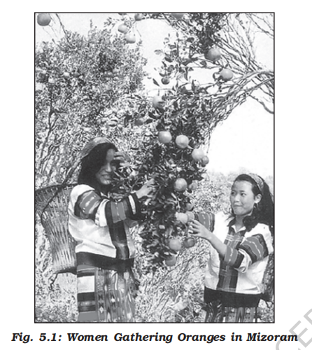
- Historical context
- The earliest human beings depended on their immediate environment for their sustenance
- They subsisted on:
- Animals which they hunted
- The edible plants which they gathered from forests in the vicinity
- Primitive societies depended on wild animals
- People located in very cold and extremely hot climates survived on hunting
- The people in the coastal areas still catch fish though fishing has experienced modernisation due to technological progress
- Many species, now have become extinct or endangered due to illegal hunting (poaching)
- The early hunters used primitive tools made of stones, twigs or arrows so the number of animals killed was limited
- Characteristics
- Gathering and hunting are the oldest economic activity known
- These are carried out at different levels with different orientations
- Gathering is practised in regions with harsh climatic conditions
- It often involves primitive societies, who extract, both plants and animals to satisfy their needs for food, shelter and clothing
- This type of activity requires a small amount of capital investment and operates at very low level of technology
- The yield per person is very low and little or no surplus is produced
- Geographical distribution
- Gathering is practised in:
- High latitude zones which include northern Canada, northern Eurasia and southern Chile
- Low latitude zones such as the Amazon Basin, tropical Africa, Northern fringe of Australia and the interior parts of Southeast Asia (Fig. 5.2)
-
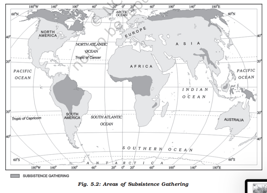
- Commercial aspects
- In modern times some gathering is market-oriented and has become commercial
- Gatherers collect valuable plants such as leaves, barks of trees and medicinal plants and after simple processing sell the products in the market
- They use various parts of the plants, for example, the bark is used for quinine, tanin extract and cork— leaves supply materials for beverages, drugs, cosmetics, fibres, thatch and fabrics; nuts for food and oils and tree trunk yield rubber, balata, gums and resins
- The name of the part of the chewing gum after the flavour is gone?
- It is called Chicle — it is made from the milky juice of zapota tree
-

- Limitations
- Gathering has little chance of becoming important at the global level
- Products of such an activity cannot compete in the world market
- Moreover, synthetic products often of better quality and at lower prices, have replaced many items supplied by the gatherers in tropical forests
- Pastoralism
- Overview
- At some stage in history, with the realization that hunting is an unsustainable activity, human beings might have thought of domestication of animals
- People living in different climatic conditions selected and domesticated animals found in those regions
- Depending on the geographical factors, and technological development, animal rearing today is practised either at the subsistence [just to survive and no more] or at the commercial level
- Nomadic herding
-
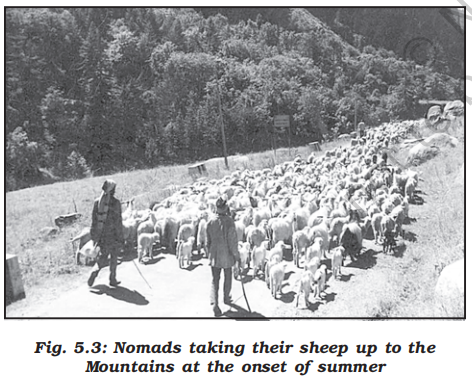
- Definition
- Nomadic herding or pastoral nomadism is a primitive subsistence activity, in which the herders rely on animals for food, clothing, shelter, tools and transport
- They move from one place to another along with their livestock, depending on the amount and quality of pastures and water
- Each nomadic community occupies a well-identified territory as a matter of tradition
- Livestock
- A wide variety of animals is kept in different regions
- In tropical Africa, cattle are the most important livestock, while in Sahara and Asiatic deserts, sheep, goats and camel are reared
- In the mountainous areas of Tibet and Andes, yak and llamas and in the Arctic and sub Arctic areas, reindeer are the most important animals
- Regions (three important regions)
-
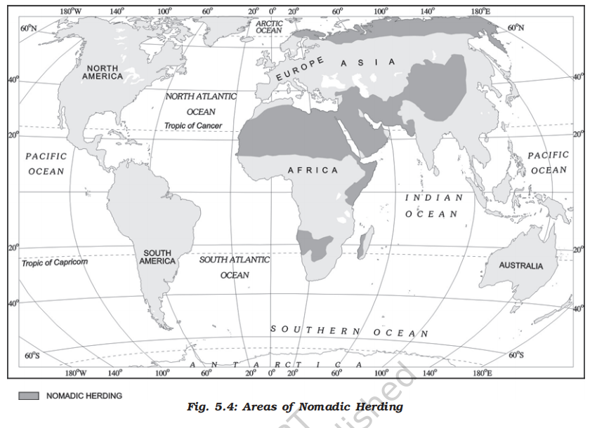
- 1. North Africa and central asia
- The core region extends from the Atlantic shores of North Africa eastwards across the Arabian peninsula into Mongolia and Central China
- Side note
- This is the classic horse–nomad zone because horses thrive in open grasslands.
- It is the reason India had to import horses from this region as it lacked the right ecology for breeding large numbers of high-quality war horses.
- Horses could survive in India, but breeding strong, fast cavalry horses at scale was difficult in India. Horses bred in India from the same original breeds were often smaller, less durable for long campaigns and less suited for heavy cavalry warfare
- This is also a reason why horses were brought in as adults and not as foals, if they were brought as foals, then their development in India would lead them to a weaker horse as compared to it's original counterpart
- This is similar to athletes that train at high altitude because low oxygen forces physiological adaptation, and they compete at lower altitude to cash in those adaptations. But this these are reversible adaptations and last only for few weeks in comparison to a person who is born and became an adult at those altitudes, they will have more structural advantages like larger lung volumes, chest dimensions, capillary density, etc
- 2. Tundra region of Eurasia
- The region extends over the tundra region of Eurasia
- 3. South-west Africa and on the island of Madagascar
- In the southern hemisphere there are small areas in South-west Africa and on the island of Madagascar (Fig. 5.4)
- Movement
- Movement in search of pastures is undertaken either over vast horizontal distances or vertically from one elevation to another in the mountainous regions
- The process of migration from plain areas to pastures on mountains during summers and again from mountain pastures to plain areas during winters is known as transhumance
- In mountain regions, such as Himalayas, Gujjars, Bakarwals, Gaddis and Bhotiyas migrate from plains to the mountains in summers and to the plains from the high altitude pastures in winters
- Similarly, in the tundra regions, the nomadic herders move from south to north in summers and from north to south in winters
- Challenges
- The number of pastoral nomads has been decreasing and the areas operated by them shrinking
- This is due to
- Imposition of political boundaries
- New settlement plans by different countries
- Commercial livestock rearing
-
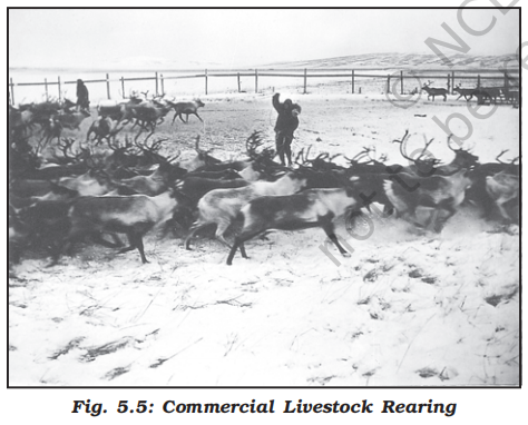
- Definition
- Unlike nomadic herding, commercial livestock rearing is more organised and capital intensive
- Commercial livestock ranching is essentially associated with western cultures and is practised on permanent ranches
- These ranches cover large areas and are divided into a number of parcels, which are fenced to regulate the grazing
- When the grass of one parcel is grazed, animals are moved to another parcel
- The number of animals in a pasture is kept according to the carrying capacity of the pasture
-
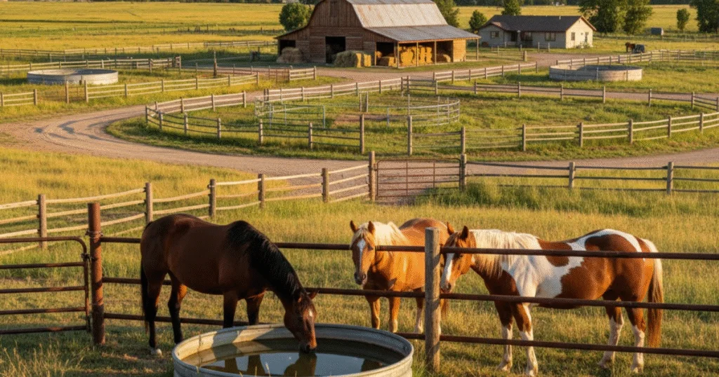
- Characteristics
- This is a specialized activity in which only one type of animal is reared
- Important animals include sheep, cattle, goats and horses
- Products such as meat, wool, hides and skin are processed and packed scientifically and exported to different world markets
- Rearing of animals in ranching is organized on a scientific basis
- The main emphasis is on breeding, genetic improvement, disease control and health care of the animals
- Regions
- New Zealand, Australia, Argentina, Uruguay and United States of America are important countries where commercial livestock rearing is practiced (Fig. 5.6)
-
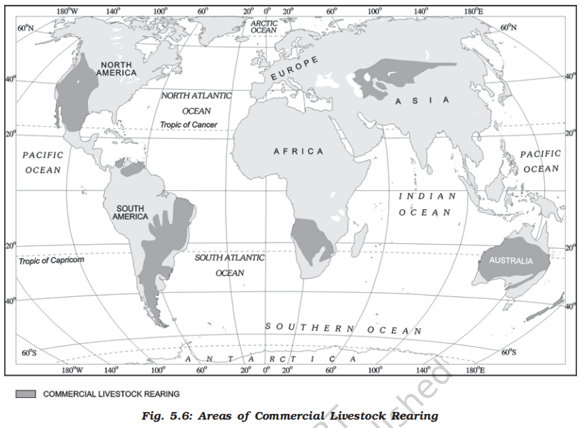
- Agriculture
- Overview
- Agriculture is practised under multiple combinations of physical and socio-economic conditions, which gives rise to different types of agricultural systems
- Based on methods of farming, different types of crops are grown and livestock raised
- The following are the main agricultural systems
- Farming organisation types
- Overview
- Types of farming can also be categorised according to the farming organisation
- Farming organisation is affected by the way in which farmers own their farms and various policies of the government which help to run these farms
- Co-operative farming
- A group of farmers form a co-operative society by pooling in their resources voluntarily for more efficient and profitable farming
- Individual farms remain intact and farming is a matter of cooperative initiative
-
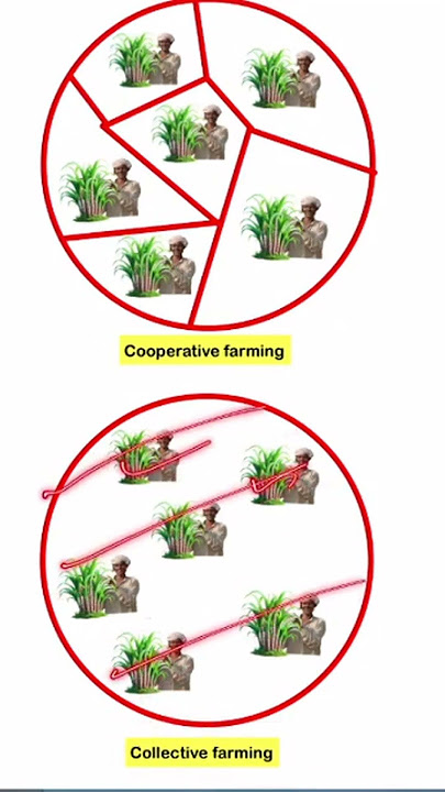
- Co-operative societies help farmers, to procure all important inputs of farming, sell the products at the most favourable terms and help in processing of quality products at cheaper rates
- Co-operative movement originated over a century ago and has been successful in many western European countries like Denmark, Netherlands, Belgium, Sweden, Italy etc.
- In Denmark, the movement has been so successful that practically every farmer is a member of a co-operative
- Collective farming
- The basic principle behind this type of farming is based on social ownership of the means of production and collective labour
- Collective farming or the model of Kolkhoz was introduced in erstwhile Soviet Union to improve upon the inefficiency of the previous methods of agriculture and to boost agricultural production for self-sufficiency
- The farmers used to pool in all their resources like land, livestock and labour
- However, they were allowed to retain very small plots to grow crops in order to meet their daily requirements
- Subsistence agriculture
- Definition
- Subsistence agriculture is one in which the farming areas consume all, or nearly so, of the products locally grown
- It can be grouped in two categories:
- Primitive subsistence agriculture or Shifting cultivation
- Description
- Primitive subsistence agriculture or shifting cultivation is widely practised by many tribes in the tropics, especially in Africa, south and central America and south east Asia (Fig. 5.7)
- The vegetation is usually cleared by fire, and the ashes add to the fertility of the soil
- Shifting cultivation is thus, also called slash and burn agriculture
- The cultivated patches are very small and cultivation is done with very primitive tools such as sticks and hoes
- After sometime (3 to 5 years) the soil loses its fertility and the farmer shifts to another parts and clears other patch of the forest for cultivation
- The farmer may return to the earlier patch after sometime
- One of the major problems of shifting cultivation is that the cycle of jhum becomes less and less due to loss of fertility in different parcels
- Regions and names
- It is prevalent in tropical region in different names, e.g. Jhuming in North eastern states of India, Milpa in central America and Mexico and Ladang in Indonesia and Malaysia
-
- Intensive subsistence agriculture
- This type of agriculture is largely found in densely populated regions of monsoon Asia
- Basically, there are two types of intensive subsistence agriculture
- 1. Intensive subsistence agriculture dominated by wet paddy cultivation
- This type of agriculture is characterised by dominance of the rice crop
- Land holdings are very small due to the high density of population
- Farmers work with the help of family labour leading to intensive use of land
- Use of machinery is limited and most of the agricultural operations are done by manual labour
- Farm yard manure is used to maintain the fertility of the soil
- In this type of agriculture, the yield per unit area is high but per labour productivity is low
- 2. Intensive subsistence agriculture dominated by crops other than paddy
- Due to the difference in relief, climate, soil and some of the other geographical factors, it is not practical to grow paddy in many parts of monsoon Asia
- Wheat, soyabean, barley and sorghum are grown in northern China, Manchuria, North Korea and North Japan
- In India wheat is grown in western parts of the Indo-Gangetic plains and millets are grown in dry parts of western and southern India
- Most of the characteristics of this type of agriculture are similar to those dominated by wet paddy except that irrigation is often used
-
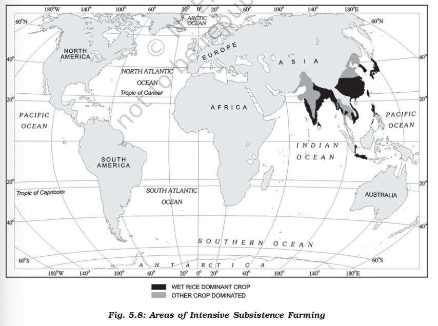
- Plantation agriculture
-

- Historical context
- Plantation agriculture as mentioned above was introduced by the Europeans in colonies situated in the tropics
- Characteristics
- Some of the important plantation crops are tea, coffee, cocoa, rubber, cotton, oil palm, sugarcane, bananas and pineapples
- The characteristic features of this type of farming are large estates or plantations, large capital investment, managerial and technical support, scientific methods of cultivation, single crop specialisation, cheap labour, and a good system of transportation which links the estates to the factories and markets for the export of the products
- Examples
-
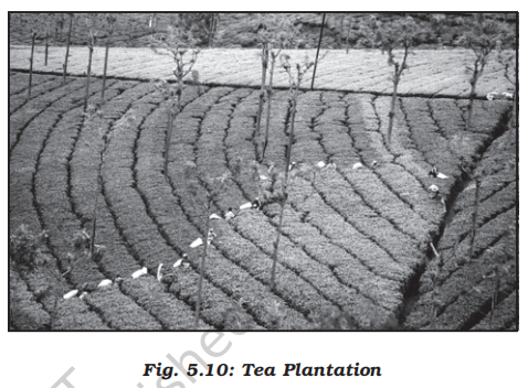
- The French established cocoa and coffee plantations in west Africa
- The British set up large tea gardens in India and Sri Lanka, rubber plantations in Malaysia and sugarcane and banana plantations in West Indies
- Spanish and Americans invested heavily in coconut and sugarcane plantations in the Philippines
- The Dutch once had monopoly over sugarcane plantation in Indonesia
- Some coffee fazendas (large plantations) in Brazil are still managed by Europeans
- Today, ownership of the majority of plantations has passed into the hands of the government or the nationals of the countries concerned
- Extensive commercial grain cultivation
-
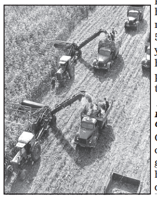
- Description
- Commercial grain cultivation is practised in the interior parts of semi-arid lands of the mid-latitudes
- Wheat is the principal crop, though other crops like corn, barley, oats and rye are also grown
- The size of the farm is very large, therefore entire operations of cultivation from ploughing to harvesting are mechanised (Fig. 5.11)
- There is low yield per acre but high yield per person
- Regions
- This type of agriculture is best developed in Eurasian steppes, the Canadian and American Prairies, the Pampas of Argentina, the Velds of South Africa, the Australian Downs and the Canterbury Plains of New Zealand (Locate these areas on the world map)
-
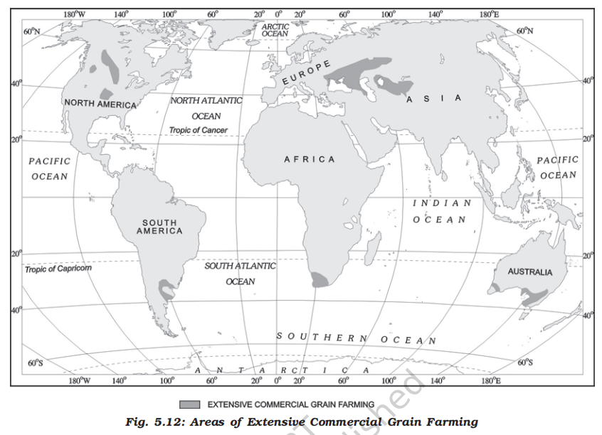
- Mixed farming
- Description
- This form of agriculture is found in the highly developed parts of the world, e.g. North-western Europe, Eastern North America, parts of Eurasia and the temperate latitudes of Southern continents (Fig. 5.14)
- Mixed farms are moderate in size and usually the crops associated with it are wheat, barley, oats, rye, maize, fodder and root crops
- Fodder crops are an important component of mixed farming
- Crop rotation and inter-cropping play an important role in maintaining soil fertility
- Equal emphasis is laid on crop cultivation and animal husbandry
- Animals like cattle, sheep, pigs and poultry provide the main income along with crops
- Mixed farming is characterized by high capital expenditure on farm machinery and building, extensive use of chemical fertilizers and green manures and also by the skill and expertise of the farmers
-

- Dairy farming
-
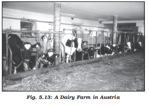
- Description
- Dairy is the most advanced and efficient type of rearing of milch animals
- It is highly capital intensive
- Animal sheds, storage facilities for fodder, feeding and milching machines add to the cost of dairy farming
- Special emphasis is laid on cattle breeding, health care and veterinary services
- It is highly labour intensive as it involves rigorous care in feeding and milching
- There is no off season during the year as in the case of crop raising
- It is practised mainly near urban and industrial centres which provide neighbourhood market for fresh milk and dairy products
- The development of transportation, refrigeration, pasteurisation and other preservation processes have increased the duration of storage of various dairy products
- Regions (three main regions)
- 1. North Western Europe (largest)
- 2. Canada
- 3. South Eastern Australia, New Zealand and Tasmania
-
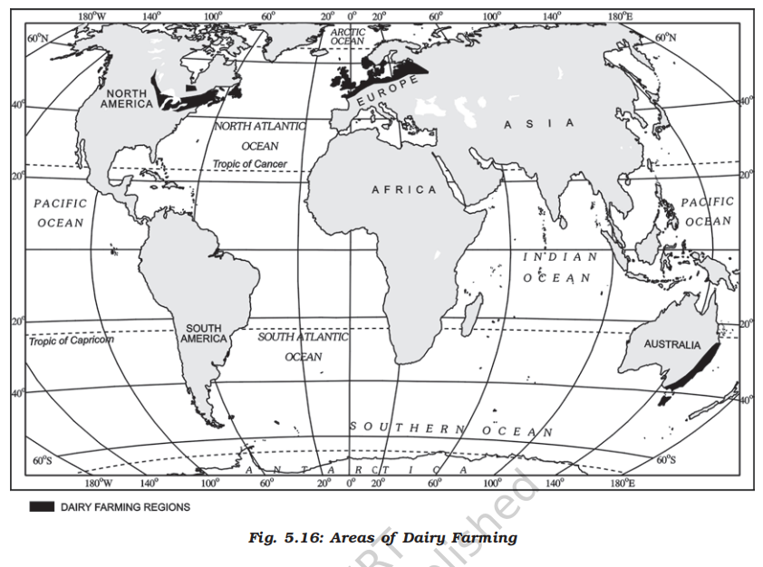
- Mediterranean agriculture
-
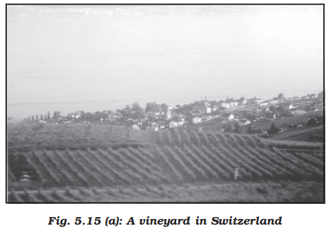
-
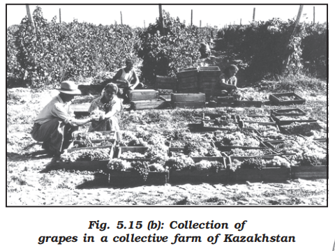
- Description
- Mediterranean agriculture is highly specialised commercial agriculture
- It is practised in the countries on either side of the Mediterranean sea in Europe and in north Africa from Tunisia to Atlantic coast, southern California, central Chile, south western parts of South Africa and south and south western parts of Australia
- This region is an important supplier of citrus fruits
- Viticulture or grape cultivation is a speciality of the Mediterranean region
- Best quality wines in the world with distinctive flavours are produced from high quality grapes in various countries of this region
- The inferior grapes are dried into raisins and currants
- This region also produces olives and figs
- The advantage of Mediterranean agriculture is that more valuable crops such as fruits and vegetables are grown in winters when there is great demand in European and North American markets
- Market gardening and horticulture
-
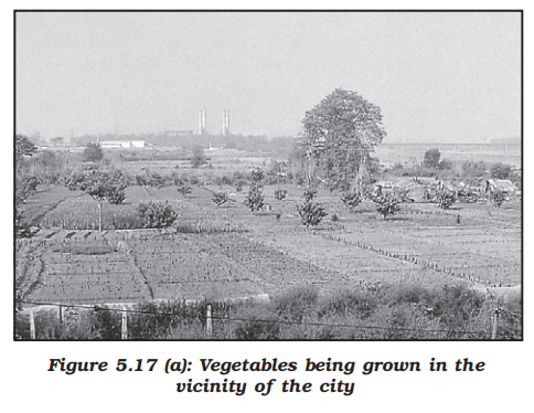
- Description
- Market gardening and horticulture specialise in the cultivation of high value crops such as vegetables, fruits and flowers, solely for the urban markets
- Farms are small and are located where there are good transportation links with the urban centre where high income group of consumers is located
- It is both labour and capital intensive and lays emphasis on the use of irrigation, HYV seeds, fertilisers, insecticides, greenhouses and artificial heating in colder regions
- This type of agriculture is well developed in densely populated industrial districts of north west Europe, north eastern United States of America and the Mediterranean regions
- The Netherlands specialises in growing flowers and horticultural crops especially tulips, which are flown to all major cities of Europe
- Truck farming
-
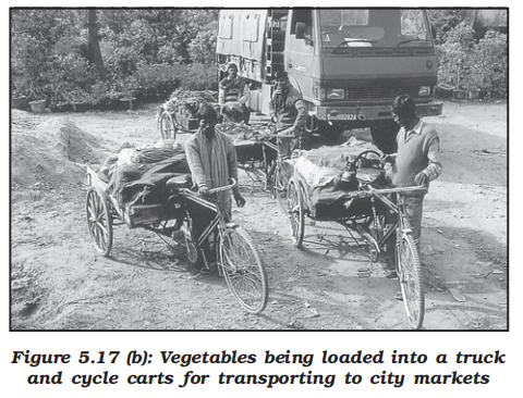
- Truck farming is a specialized form of commercial gardening where high-value, perishable crops—mainly vegetables, fruits, and flowers—are grown on a large scale for sale in urban markets.
- The distance of truck farms from the market is governed by the distance that a truck can cover overnight, hence the name truck farming
- Factory farming
-
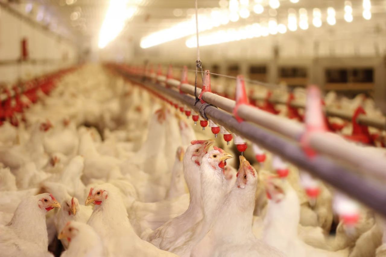
- In addition to market gardening, a modern development in the industrial regions of Western Europe and North America is factory farming
- Livestock, particularly poultry and cattle rearing, is done in stalls and pens, fed on manufactured feedstuff and carefully supervised against diseases
- This requires heavy capital investment in terms of building, machinery for various operations, veterinary services and heating and lighting
- One of the important features of poultry farming and cattle rearing is breed selection and scientific breeding
- Mining
-
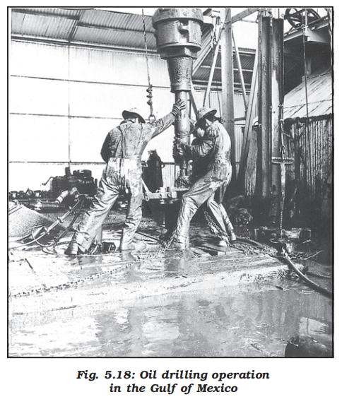
- Historical context
- The discovery of minerals in the history of human development, is reflected in many stages in terms of copper age, bronze age and iron age
- The use of minerals in ancient times was largely confined to the making of tools, utensils and weapons
- The actual development of mining began with the industrial revolution and its importance is continuously increasing
- Factors affecting mining activity
- The profitability of mining operations thus, depends on two main factors:
- 1. Physical factors
- These include the size, grade and the mode of occurrence of the deposits
- 2. Economic factors
- Such as the demand for the mineral, technology available and used, capital to develop infrastructure and the labour and transport costs
- Methods of mining
-
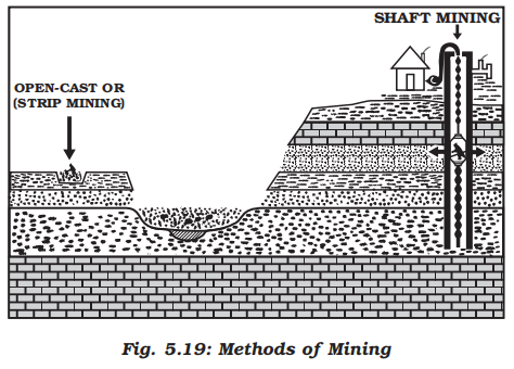
- Depending on the mode of occurrence and the nature of the ore, mining is of two types
- Surface mining
- The surface mining also known as open-cast mining is the easiest and the cheapest way of mining minerals that occur close to the surface
- Overhead costs such as safety precautions and equipment is relatively low in this method
- The output is both large and rapid
- Underground mining
- When the ore lies deep below the surface, underground mining method (shaft method) has to be used
- In this method, vertical shafts have to be sunk, from where underground galleries radiate to reach the minerals
- Minerals are extracted and transported to the surface through these passages
- It requires specially designed lifts, drills, haulage vehicles, ventilation system for safety and efficient movement of people and material
- This method is risky
- Poisonous gases, fires, floods and caving in lead to fatal accidents
- Global trends
- The developed economies are retreating from mining, processing and refining stages of production due to high labour costs, while the developing countries with large labour force and striving for higher standard of living are becoming more important
- Several countries of Africa and few of south America and Asia have over fifty per cent of the earnings from minerals alone
- Secondary activities
- Introduction
- All economic activities namely primary, secondary, tertiary and quaternary, revolve around obtaining and utilising resources necessary for survival
- Secondary activities add value to natural resources by transforming raw materials into valuable products
- Cotton in the boll has limited use but after it is transformed into yarn, becomes more valuable and can be used for making clothes
- Iron ore, cannot be used; directly from the mines, but after being converted into steel it gets its value and can be used for making many valuable machines, tools, etc.
- The same is true of most of the materials from the farm, forest, mine and the sea
- Secondary activities, therefore, are concerned with manufacturing, processing and construction (infrastructure) industries
- Manufacturing
- Definition
- Manufacturing involves a full array of production from handicrafts to moulding iron and steel and stamping out plastic toys to assembling delicate computer components or space vehicles
- In each of these processes, the common characteristics are the application of power, mass production of identical products and specialised labour in factory settings for the production of standardised commodities
- Manufacturing may be done with modern power and machinery or it may still be very primitive
- Most of the Third World countries still ‘manufacture’ in the literal sense of the term
- It is difficult to present a full picture of all the manufacturers in these countries
- More emphasis is given to the kind of ‘industrial’ activity which involves less complicated systems of production
- Characteristics of modern large scale manufacturing
- Specialisation of skills/methods of production
- Under the ‘craft’ method factories produce only a few pieces which are made-to-order
- So the costs are high
- On the other hand, mass production involves production of large quantities of standardised parts by each worker performing only one task repeatedly
- ‘Manufacturing’ industry and ‘manufacturing industry’
- Manufacturing literally means ‘to make by hand’
- However, now it includes goods ‘made by machines’
- It is essentially a process which involves transforming raw materials into finished goods of higher value for sale in local or distant markets
- Conceptually, an industry is a geographically located manufacturing unit maintaining books of accounts and, records under a management system
- As the term industry is comprehensive, it is also used as synonymous with ‘manufacturing’
- When one uses terms like ‘steel industry’ and ‘chemical industry’ one thinks of factories and processes
- But there are many secondary activities which are not carried on in factories such as what is now called the ‘entertainment industry’ and Tourism industry, etc.
- So for clarity the longer expression ‘manufacturing industry’ is used
- Mechanisation
- Mechanisation refers to using gadgets which accomplish tasks
- Automation (without aid of human thinking during the manufacturing process) is the advanced stage of mechanisation
- Automatic factories with feedback and closed-loop computer control systems where machines are developed to ‘think’, have sprung up all over the world
- Technological innovation
- Technological innovations through research and development strategy are an important aspect of modern manufacturing for quality control, eliminating waste and inefficiency, and combating pollution
- Organisational structure and stratification
- Modern manufacturing is characterised by:
- A complex machine technology
- Extreme specialisation and division of labour for producing more goods with less effort, and low costs
- Vast capital
- Large organisations
- Executive bureaucracy
- Uneven geographic distribution
- Major concentrations of modern manufacturing have flourished in a few number of places
- These cover less than 10 per cent of the world’s land area
- These nations have become the centres of economic and political power
- However, in terms of the total area covered, manufacturing sites are much less conspicuous [clearly visible] and concentrated on much smaller areas than that of agriculture due to greater intensity of processes
- For example, 2.5 sq km of the American corn belt usually includes about four large farms employing about 10-20 workers supporting 50-100 persons
- But this same area could contain several large integrated factories and employ thousands of workers
- Factors influencing industrial locations
- Industries maximise profits by reducing costs
- Therefore, industries should be located at points where the production costs are minimum
- Some of the factors influencing industrial locations are as under:
- Access to market
- The existence of a market for manufactured goods is the most important factor in the location of industries
- ‘Market’ means people who have a demand for these goods and also have the purchasing power (ability to purchase) to be able to purchase from the sellers at a place
- Remote areas inhabited by a few people offer small markets
- The developed regions of Europe, North America, Japan and Australia provide large global markets as the purchasing power of the people is very high
- The densely populated regions of South and South-east Asia also provide large markets
- Some industries, such as aircraft manufacturing, have a global market
- The arms industry also has global markets
- Access to raw material
- Raw material used by industries should be cheap and easy to transport
- Industries based on cheap, bulky and weight-losing material (ores) are located close to the sources of raw material such as steel, sugar, and cement industries
- Perishability is a vital factor for the industry to be located closer to the source of the raw material
- Agro-processing and dairy products are processed close to the sources of farm produce or milk supply respectively
- Access to labour supply
- Labour supply is an important factor in the location of industries
- Some types of manufacturing still require skilled labour
- Increasing mechanisation, automation and flexibility of industrial processes have reduced the dependence of industry upon the labours
- Access to sources of energy
- Industries which use more power are located close to the source of the energy supply such as the aluminium industry
- Earlier coal was the main source of energy, today hydroelectricity and petroleum are also important sources of energy for many industries
- Access to transportation and communication facilities
- Speedy and efficient transport facilities to carry raw materials to the factory and to move finished goods to the market are essential for the development of industries
- The cost of transport plays an important role in the location of industrial units
- Western Europe and eastern North America have a highly developed transport system which has always induced the concentration of industries in these areas
- Modern industry is inseparably tied to transportation systems
- Improvements in transportation led to integrated economic development and regional specialisation of manufacturing
- Communication is also an important need for industries for the exchange and management of information
- Government policy
- Governments adopt ‘regional policies’ to promote ‘balanced’ economic development and hence set up industries in particular areas
- Access to agglomeration economies/links between industries
- Many industries benefit from nearness to a leader-industry and other industries
- These benefits are termed as agglomeration economies
- Savings are derived from the linkages which exist between different industries
- These factors operate together to determine industrial location
- Foot loose industries
- Foot loose industries can be located in a wide variety of places
- They are not dependent on any specific raw material, weight losing or otherwise
- They largely depend on component parts which can be obtained anywhere
- They produce in small quantity and also employ a small labour force
- These are generally not polluting industries
- The important factor in their location is accessibility by road network
- Classification of manufacturing industries
-
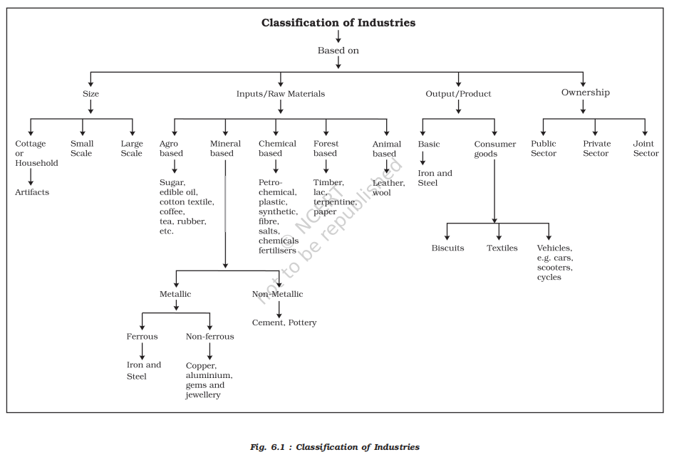
- Overview
- Manufacturing industries are classified on the basis of their size, inputs/raw materials, output/products and ownership (Fig. 6.1)
- Industries based on size
- Overview
- The amount of capital invested, number of workers employed and volume of production determine the size of industry
- Accordingly, industries may be classified into household or cottage, small-scale and large-scale
- Household industries or cottage industries
-
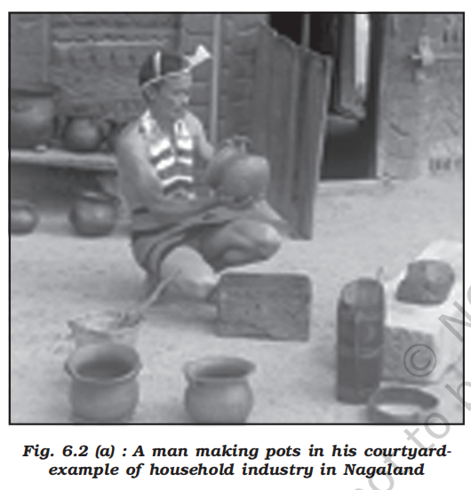
- It is the smallest manufacturing unit
- The artisans use local raw materials and simple tools to produce everyday goods in their homes with the help of their family members or part-time labour
- Finished products may be for consumption in the same household or, for sale in local (village) markets, or, for barter
-

- Capital and transportation do not wield much influence as this type of manufacturing has low commercial significance and most of the tools are devised locally
- Some common everyday products produced in this sector of manufacturing include foodstuffs, fabrics, mats, containers, tools, furniture, shoes, and figurines from wood lot and forest, shoes, thongs and other articles from leather; pottery and bricks from clays and stones
- Goldsmiths make jewellery of gold, silver and bronze
- Some artefacts and crafts are made out of bamboo, wood obtained locally from the forests
-

- Small scale manufacturing
- Small scale manufacturing is distinguished from household industries by its production techniques and place of manufacture (a workshop outside the home/cottage of the producer)
- This type of manufacturing uses local raw material, simple power-driven machines and semi-skilled labour
- It provides employment and raises local purchasing power
- Therefore, countries like India, China, Indonesia and Brazil, etc. have developed labour-intensive small scale manufacturing in order to provide employment to their population
- Large scale manufacturing
-
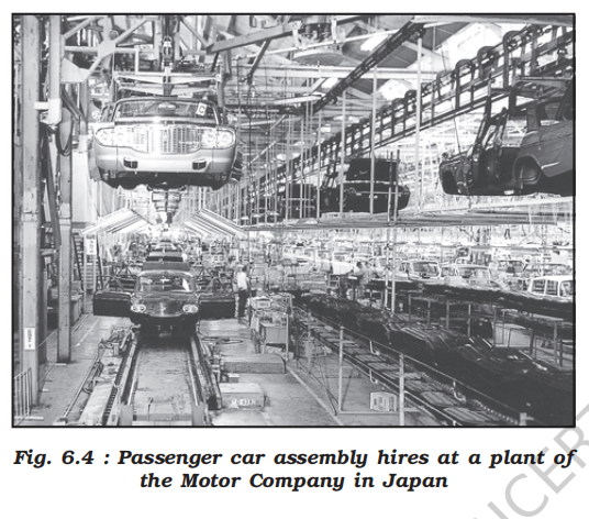
- Large scale manufacturing involves a large market, various raw materials, enormous energy, specialised workers, advanced technology, assembly-line mass production and large capital
- This kind of manufacturing developed in the last 200 years, in the United Kingdom, north-eastern U.S.A. and Europe
- Now it has diffused to almost all over the world
- On the basis of the system of large scale manufacturing, the world’s major industrial regions may be grouped under two broad types, namely
- 1. Traditional large-scale industrial regions
- These are thickly clustered in a few more developed countries
- 2. High-technology large scale industrial regions
- These have diffused to less developed countries
- Industries based on inputs/raw materials
- Agro based industries
-
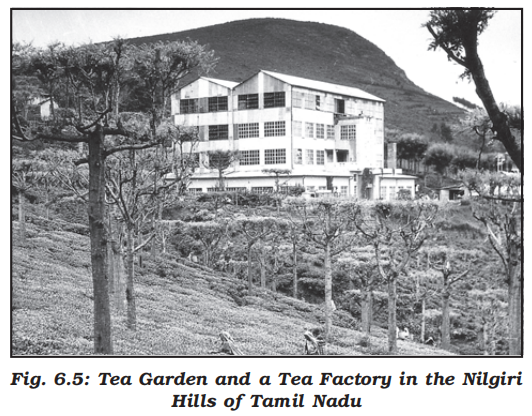
- Agro processing involves the processing of raw materials from the field and the farm into finished products for rural and urban markets
- Major agro-processing industries are food processing, sugar, pickles, fruits juices, beverages (tea, coffee and cocoa), spices and oils fats and textiles (cotton, jute, silk), rubber, etc.
- Food processing
- Agro processing includes canning, producing cream, fruit processing and confectionery
- While some preserving techniques, such as drying, fermenting and pickling, have been known since ancient times, these had limited applications to cater to the pre-Industrial Revolution demands
- Agri-business is commercial farming on an industrial scale often financed by business whose main interests lie outside agriculture, for example, large corporations in tea plantation business
- Agri-business farms are mechanised, large in size, highly structured, reliant on chemicals, and may be described as ‘agro-factories’
- Mineral based industries
- These industries use minerals as a raw material
- Some industries use ferrous metallic minerals which contain ferrous (iron), such as iron and steel industries but some use non-ferrous metallic minerals, such as aluminium, copper and jewellery industries
- Many industries use non-metallic minerals such as cement and pottery industries
- Chemical based industries
- Such industries use natural chemical minerals, e.g. mineral-oil (petroleum) is used in petrochemical industry
- Salts, sulphur and potash industries also use natural minerals
- Chemical industries are also based on raw materials obtained from wood and coal
- Synthetic fibre, plastic, etc. are other examples of chemical based industries
- Forest based raw material using industries
-
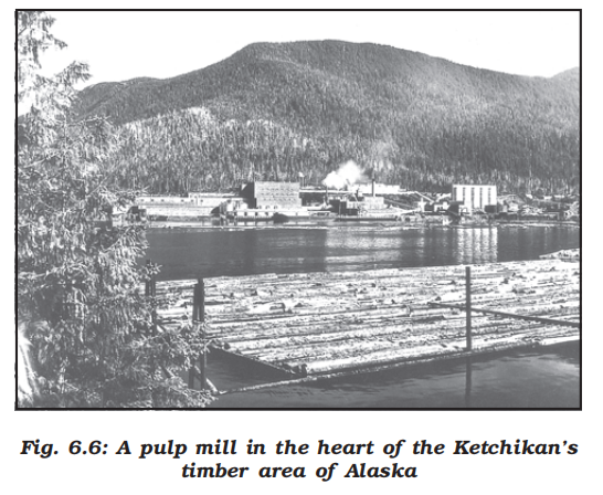
- The forests provide many major and minor products which are used as raw material
- Timber for furniture industry, wood, bamboo and grass for paper industry, lac for lac industries come from forests
- Animal based industries
- Leather for leather industry and wool for woollen textiles are obtained from animals
- Besides, ivory is also obtained from elephant’s tusks
- Industries based on output / use of product
- I. Basic (Intermediate Goods) Industries
- Definition:
- Industries whose output is used as raw material or input by other industries.
- Nature of output:
- Not meant for direct consumption.
- Used for further production.
- Role in economy:
- Form the base of industrial development.
- Support multiple downstream industries.
- Examples:
- Iron and steel industry
- Cement industry
- Chemical industry
- Power generation industry
- II. Consumer Goods (Non-Basic) Industries
- Definition:
- Industries whose output is directly consumed by consumers.
- Nature of output:
- Final goods.
- Not used for further industrial processing.
- Sub-types:
- a. Durable Consumer Goods
- Goods with long usable life.
- Examples:
- Televisions
- Refrigerators
- Automobiles
- b. Non-Durable Consumer Goods
- Goods consumed quickly.
- Examples:
- Bread and biscuits
- Tea
- Soaps and toiletries
- Paper for writing
- Industries based on ownership
- Public Sector Industries are owned and managed by governments
- In India, there were a number of Public Sector Undertakings (PSUs)
- Socialist countries have many state owned industries
- Mixed economies have both Public and Private sector enterprises
- Private Sector Industries are owned by individual investors
- These are managed by private organisations
- In capitalist countries, industries are generally owned privately
- Joint Sector Industries
- Joint Sector Industries are managed by joint stock companies or sometimes the private and public sectors together establish and manage the industries
- Can you make a list of such industries?
- Traditional large-scale industrial regions
- Overview
- These are based on heavy industry, often located near coal-fields and engaged in metal smelting, heavy engineering, chemical manufacture or textile production
- These industries are now known as smokestack industries
- Traditional industrial regions can be recognised by:
- High proportion of employment in manufacturing industry
- High-density housing, often of inferior type, and poor services
- Unattractive environment, for example, pollution, waste heaps, and so on
- Problems of unemployment, emigration and derelict land areas caused by closure of factories because of a worldwide fall in demand
- The Ruhr coal-field, Germany
- This has been one of the major industrial regions of Europe for a long time
- Coal and iron and steel formed the basis of the economy, but as the demand for coal declined, the industry started shrinking
- Even after the iron ore was exhausted, the industry remained, using imported ore brought by waterways to the Ruhr
- The Ruhr region is responsible for 80 per cent of Germany’s total steel production
- Changes in the industrial structure have led to the decay of some areas, and there are problems of industrial waste and pollution
- The future prosperity of the Ruhr is based less on the products of coal and steel, for which it was initially famous, and more on the new industries like the huge Opel car assembly plant, new chemical plants, universities
- Out-of-town shopping centres have appeared resulting in a ‘New Ruhr’ landscape
- Iron and steel industry
- Overview
- The iron and steel industry forms the base of all other industries and, therefore, it is called a basic industry
- It is basic because it provides raw material for other industries such as machine tools used for further production
- It may also be called a heavy industry because it uses large quantities of bulky raw materials and its products are also heavy
- Process
- Iron is extracted from iron ore by smelting in a blast furnace with carbon (coke) and limestone
- The molten iron is cooled and moulded to form pig iron which is used for converting into steel by adding strengthening materials like manganese
- Location
- The large integrated steel industry is traditionally located close to the sources of raw materials – iron ore, coal, manganese and limestone – or at places where these could be easily brought, e.g. near ports
- But in mini steel mills access to markets is more important than inputs
- Mini mills
- These are less expensive to build and operate and can be located near markets because of the abundance of scrap metal, which is the main input
- Traditionally, most of the steel was produced at large integrated plants, but mini mills are limited to just one-step process – steel making – and are gaining ground
- Distribution
- The industry is one of the most complex and capital-intensive industries and is concentrated in the advanced countries of North America, Europe and Asia
- In U.S.A, most of the production comes from the north Appalachian region (Pittsburgh), Great Lake region (Chicago-Gary, Erie, Cleveland, Lorain, Buffalo and Duluth) and the Atlantic Coast (Sparrows Point and Morisville)
- The industry has also moved towards the southern state of Alabama
- Pittsburg area is now losing ground, it has now become the “rust bowl” of U.S.A
- In Europe, U.K., Germany, France, Belgium, Luxembourgh, the Netherlands and Russia are the leading producers
- The important steel centres are Scun Thorpe, Port Talbot, Birmingham and Sheffield in the U.K.; Duisburg, Dortmund, Dusseldorf and Essen in Germany; Le Creusot and St. Ettienne in France; and Moscow, St. Petersburgh, Lipetsk, Tula, in Russia and Krivoi Rog, and Donetsk in Ukraine
- In Asia, the important centres include Nagasaki and Tokyo-Yokohama in Japan; Shanghai, Tienstin and Wuhan in China; and Jamshedpur, Kulti-Burnpur, Durgapur, Rourkela, Bhilai, Bokaro, Salem, Visakhapatnam and Bhadravati in India
- Cotton textile industry
- Overview
- Cotton textile industry has three sub-sectors:
- Handloom
- Handloom sector is labour-intensive and provides employment to semi-skilled workers. It requires small capital investment
- Why did Mahatma Gandhi propagate Khadi as part of the independence movement?
- This sector involves spinning, weaving and finishing of the fabrics
- Powerloom
- The powerloom sector introduces machines and becomes less labour intensive and the volume of production increases
- Mill sector
- Cotton textile mill sector is highly capital intensive and produces fine clothes in bulk
- Production and competition
- Cotton textile manufacturing requires good quality cotton as raw material
- India, China, U.S.A, Pakistan, Uzbekistan, Egypt produce more than half of the world’s raw cotton
- The U.K, NW European countries and Japan also produce cotton textile made from imported yarn
- Europe alone accounts for nearly half of the world’s cotton imports
- The industry has to face very stiff competition with synthetic fibres hence it has now shown a declining trend in many countries
- With the scientific advancement and technological improvements the structure of industries changes
- For example, Germany recorded constant growth in cotton textile industry since Second World War till the seventies but now it has declined
- It has shifted to less developed countries where labour costs are low
- Concept of high technology industry
- Definition
- High technology, or simply high-tech, is the latest generation of manufacturing activities
- It is best understood as the application of intensive research and development (R and D) efforts leading to the manufacture of products of an advanced scientific and engineering character
- Professional (white collar) workers make up a large share of the total workforce
- These highly skilled specialists greatly outnumber the actual production (blue collar) workers
- Robotics on the assembly line, computer-aided design (CAD) and manufacturing, electronic controls of smelting and refining processes, and the constant development of new chemical and pharmaceutical products are notable examples of a high-tech industry
- Characteristics
- Neatly spaced, low, modern, dispersed, office-plant-lab buildings rather than massive assembly structures, factories and storage areas mark the high-tech industrial landscape
- Planned business parks for high-tech start-ups have become part of regional and local development schemes
- Technopolies
- High-tech industries which are regionally concentrated, self-sustained and highly specialised are called technopolies
- The Silicon Valley near San Francisco and Silicon Forest near Seattle are examples of technopolies
- Are some technopolies developing in India?
- Significance
- Manufacturing contributes significantly to the world economy
- Iron and steel, textiles, automobiles, petrochemicals and electronics are some of the world’s most important manufacturing industries
- Tertiary and quaternary activities
- Introduction
- Overview
- Today most people are service workers
- When you fall ill you go to your family doctor or you call a doctor
- Sometimes your parents take you to a hospital for treatment
- While in school, you are taught by your teachers
- In the event of any dispute, legal opinion is obtained from a lawyer
- Likewise, there are many professionals who provide their services against payment of their fee
- Thus, all types of services are special skills provided in exchange of payments
- Health, education, law, governance and recreation etc. require professional skills
- These services require other theoretical knowledge and practical training
- Tertiary activities are related to the service sector
- Manpower is an important component of the service sector as most of the tertiary activities are performed by skilled labour, professionally trained experts and consultants
- Economic context
- In the initial stages of economic development, larger proportion of people worked in the primary sector
- In a developed economy, the majority of workers get employment in tertiary activity and a moderate proportion is employed in the secondary sector
- Characteristics
- Tertiary activities involve the commercial output of services rather than the production of tangible goods
- Tertiary activities include both production and exchange
- Production
- The production involves the ‘provision’ of services that are ‘consumed’
- The output is indirectly measured in terms of wages and salaries
- Exchange
- Exchange, involves trade, transport and communication facilities that are used to overcome distance
- They are not directly involved in the processing of physical raw materials
- Common examples are the work of a plumber, electrician, technician, launderer, barber, shopkeeper, driver, cashier, teacher, doctor, lawyer and publisher etc.
- The main difference between secondary activities and tertiary activities is that the expertise provided by services relies more heavily on specialised skills, experience and knowledge of the workers rather than on the production techniques, machinery and factory processes
- Types of tertiary activities
-
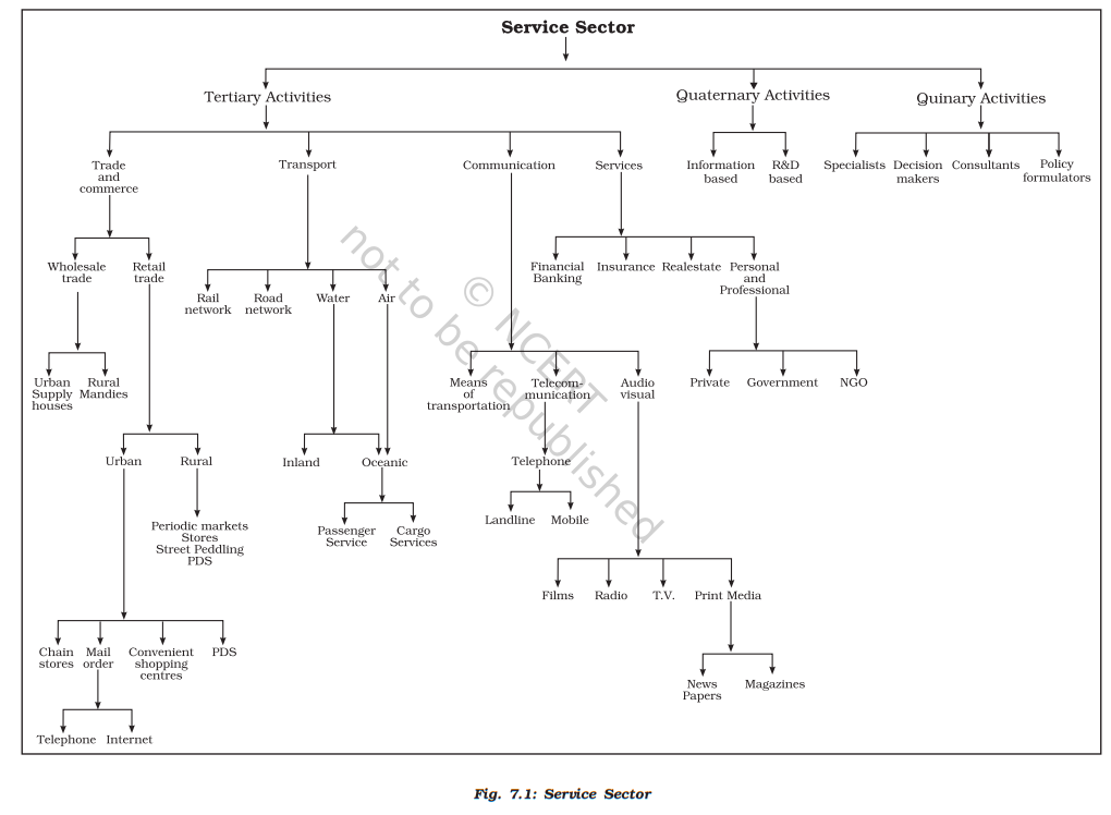
- Overview
- By now you know that you purchase your books, stationery from traders shop, travel by bus or rail, send letters, talk on telephone and obtain services of teachers for studies and doctors at the time of illness
- Thus, trade, transport, communication and services are some of the tertiary activities discussed in this section
- The chart provides the basis for classifying the tertiary activities
- Trade and commerce
- Definition
- Trade is essentially buying and selling of items produced elsewhere
- All the services in retail and wholesale trading or commerce are specifically intended for profit
- The towns and cities where all these works take place are known as trading centres
- Evolution
- The rise of trading from barter at the local level to money-exchange of international scale has produced many centres and institutions such as trading centres or collection and distribution points
- Trading centres
-
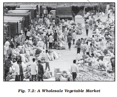
- Trading centres may be divided into rural and urban marketing centres
- Rural marketing centres
- Rural marketing centres cater to nearby settlements
- These are quasi-urban centres
- They serve as trading centres of the most rudimentary type
- Here personal and professional services are not well-developed
- These form local collecting and distributing centres
- Most of these have mandis (wholesale markets) and also retailing areas
- They are not urban centres per se but are significant centres for making available goods and services which are most frequently demanded by rural folk
- Periodic markets in rural areas are found where there are no regular markets and local periodic markets are organised at different temporal intervals
- These may be weekly, bi-weekly markets from where people from the surrounding areas meet their temporally accumulated demand
- These markets are held on specified dates and move from one place to another
- The shopkeepers thus, remain busy on all the days while a large area is served by them
- Urban marketing centres
- Urban marketing centres have more widely specialised urban services
- They provide ordinary goods and services as well as many of the specialised goods and services required by people
- Urban centres, therefore, offer manufactured goods as well as many specialised markets develop, e.g. markets for labour, housing, semi or finished products
- Services of educational institutions and professionals such as teachers, lawyers, consultants, physicians, dentists and veterinary doctors are available
- Retail trading
-
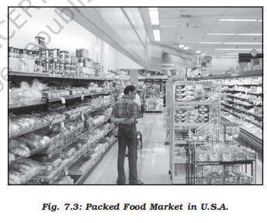
- This is the business activity concerned with the sale of goods directly to the consumers
- Most of the retail trading takes place in fixed establishments or stores solely devoted to selling
- Street peddling, handcarts, trucks, door-to-door, mail-order, telephone, automatic vending machines and internet are examples of non-store retail trading
- More on stores
- Consumer cooperatives were the first of the large-scale innovations in retailing
- Departmental stores delegate the responsibility and authority to departmental heads for purchasing of commodities and for overseeing the sale in different sections of the stores
- Chain stores are able to purchase merchandise most economically, often going so far as to direct the goods to be manufactured to their specification
- They employ highly skilled specialists in many executive tasks
- They have the ability to experiment in one store and apply the results to many
- Wholesale trading
- Wholesale trading constitutes bulk business through numerous intermediary merchants and supply houses and not through retail stores
- Some large stores including chain stores are able to buy directly from the manufacturers
- However, most retail stores procure supplies from an intermediary source
- Wholesalers often extend credit to retail stores to such an extent that the retailer operates very largely on the wholesaler’s capital
- Transport
- Definition
- Transport is a service or facility by which people, materials and manufactured goods are physically carried from one location to another
- It is an organised industry created to satisfy man’s basic need of mobility
- Modern society requires speedy and efficient transport systems to assist in the production, distribution and consumption of goods
- At every stage in this complex system, the value of the material is significantly enhanced by transportation
- Measurement
- Transport distance can be measured as: km distance or actual distance of route length; time distance or the time taken to travel on a particular route; and cost distance or the expense of travelling on a route
- In selecting the mode of transport, distance, in terms of time or cost, is the determining factor
- Isochrone lines are drawn on a map to join places equal in terms of the time taken to reach them
- Network and accessibility
- As transport systems develop, different places are linked together to form a network
- Networks are made up of nodes and links
- A node is the meeting point of two or more routes, a point of origin, a point of destination or any sizeable town along a route
- Every road that joins two nodes is called a link
- A developed network has many links, which means that places are well-connected
- Factors affecting transport
- Demand for transport is influenced by the size of population
- The larger the population size, the greater is the demand for transport
- Routes depend on: location of cities, towns, villages, industrial centres and raw materials, pattern of trade between them, nature of the landscape between them, type of climate, and funds available for overcoming obstacles along the length of the route
- Communication
- Definition
- Communication services involve the transmission of words and messages, facts and ideas
- The invention of writing preserved messages and helped to make communication dependent on means of transport
- These were actually carried by hand, animals, boat, road, rail and air
- That is why all forms of transport are also referred to as lines of communication
- Where the transport network is efficient, communications are easily disseminated [having spread throughout an organ or the body]
- Certain developments, such as mobile telephony and satellites, have made communications independent of transport
- All forms are not fully disassociated because of the cheapness of the older systems
- Thus, very large volumes of mail continue to be handled by post offices all over the world
- Telecommunications
- The use of telecommunications is linked to the development of modern technology
- It has revolutionised communications because of the speed with which messages are sent
- The time reduced is from weeks to minutes
- Besides, the recent advancements like mobile telephony have made communications direct and instantaneous at any time and from anywhere
- The telegraph, morse code and telex have almost become things of the past
- Radio and television also help to relay news, pictures, and telephone calls to vast audiences around the world and hence they are termed as mass media
- They are vital for advertising and entertainment
- Newspapers are able to cover events in all corners of the world
- Satellite communication relays information of the earth and from space
- The internet has truly revolutionised the global communication system
- Services
- Overview
- Services occur at many different levels
- Some are geared to industry, some to people, and some to both industry and people, e.g. the transport systems
- Low-order services, such as grocery shops and laundries, are more common and widespread than high-order services or more specialised ones like those of accountants, consultants and physicians
- Services are provided to individual consumers who can afford to pay for them
- For example, the gardener, the launderers and the barber do primarily physical labour
- Teacher, lawyers, physicians, musicians and others perform mental labour
- Regulated services
- Many services have now been regulated
- Making and maintaining highways and bridges, maintaining fire fighting departments and supplying or supervising education and customer-care are among the important services most often supervised or performed by governments or companies
- State and union legislation have established corporations to supervise and control the marketing of such services as transport, telecommunication, energy and water supply
- Professional services
- Professional services are primarily health care, engineering, law and management
- The location of recreational and entertainment services depends on the market
- Multiplexes and restaurants might find location within or near the Central Business District (CBD), whereas a golf course would choose a site where land costs are lower than in the CBD
- Personal services
- Personal services are made available to the people to facilitate their work in daily life
- The workers migrate from rural areas in search of employment and are unskilled
- They are employed in domestic services as housekeepers, cooks, and gardeners
- This segment of workers is generally unorganised
- One such example in India is Mumbai’s dabbawala (Tiffin) service provided to about 1,75,000 customers all over the city
-
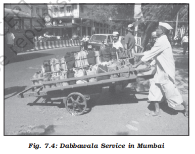
- Emerging sectors
- Tourism
-
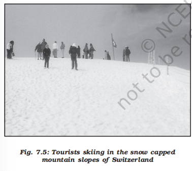
- Definition
- Tourism is travel undertaken for purposes of recreation rather than business
- Tourism has emerged as the world’s largest tertiary activity in terms of employment generation and revenue, accounting for a significant share of global service-sector output.
- Tourism is not a single industry. It is a composite activity that includes transport (air, rail, road, sea), hotels and accommodation, food services, travel agencies, entertainment, retail linked to visitors.
- Besides, many local persons, are employed to provide services like accommodation, meals, transport, entertainment and special shops serving the tourists
- Tourism fosters the growth of infrastructure industries, retail trading, and craft industries (souvenirs)
- In some regions, tourism is seasonal because the vacation period is dependent on favourable weather conditions, but many regions attract visitors all the year round
- Tourist regions
- The warmer places around the Mediterranean Coast and the West Coast of India are some of the popular tourist destinations in the world
- Others include winter sports regions, found mainly in mountainous areas, and various scenic landscapes and national parks, which are scattered
- Historic towns also attract tourists, because of the monument, heritage sites and cultural activities
- Burj Khalifa attracts millions of tourists, and ticket revenues are somewhere close to $550 - $600 million annually
- Factors affecting tourism
- Demand
- Since the last century, the demand for holidays has increased rapidly
- Improvements in the standard of living and increased leisure time, permit many more people to go on holidays for leisure
- Transport
- The opening-up of tourist areas has been aided by improvement in transport facilities
- Travel is easier by car, with better road systems
- More significant in recent years has been the expansion in air transport
- For example, air travel allows one to travel anywhere in the world in a few hours of flying-time from their homes
- The advent of package holidays has reduced the costs
- Tourist attractions
- Climate
- Most people from colder regions expect to have warm, sunny weather for beach holidays
- This is one of the main reasons for the importance of tourism in Southern Europe and the Mediterranean lands
- The Mediterranean climate offers almost consistently higher temperatures, than in other parts of Europe, long hours of sunshine and low rainfall throughout the peak holiday season
- People taking winter holidays have specific climatic requirements, either higher temperatures than their own homelands, or snow cover suitable for skiing
- Landscape
- Many people like to spend their holidays in an attractive environment, which often means mountains, lakes, spectacular sea coasts and landscapes not completely altered by man
- History and art
- The history and art of an area have potential attractiveness
- People visit ancient or picturesque towns and archaeological sites, and enjoy exploring castles, palaces and churches
- Culture and economy
- These attract tourists with a penchant for experiencing ethnic and local customs
- Besides, if a region provides for the needs of tourists at a cheap cost, it is likely to become very popular
- Home-stay has emerged as a profitable business such as heritage homes in Goa, Madikere and Coorg in Karnataka
- Medical tourism
- Definition
- When medical treatment is combined with international tourism activity, it lends itself to what is commonly known as medical tourism
- Overview
- About 55,000 patients from U.S.A. visited India in 2005 for treatment
- This is still a small number compared with the millions of surgeries performed each year in the U.S. healthcare system
- India has emerged as the leading country of medical tourism in the world
- World class hospitals located in metropolitan cities cater to patients all over the world
- Medical tourism brings abundant benefits to developing countries like India, Thailand, Singapore and Malaysia
- Beyond medical tourism, is the trend of outsourcing of medical tests and data interpretation
- Hospitals in India, Switzerland and Australia have been performing certain medical services – ranging from reading radiology images, to interpreting Magnetic Resonance Images (MRIs) and ultrasound tests
- Outsourcing holds tremendous advantages for patients, if it is focused on improving quality or providing specialised care
- Quaternary activities
- Overview
- What do a CEO of an MNC in Copenhagen, at New York and a medical transcriptionist at Bangalore have in common?
- All these people work in a segment of the service sector that is knowledge oriented
- This sector can be divided into quaternary and quinary activities
- Quaternary activities involve some of the following: the collection, production and dissemination of information or even the production of information
- Quaternary activities centre around research, development and may be seen as an advanced form of services involving specialised knowledge and technical skills
- The quaternary sector
- The Quaternary Sector along with the Tertiary Sector has replaced most of the primary and secondary employment as the basis for economic growth
- Over half of all workers In developed economies are in the ‘Knowledge Sector’ and there has been a very high growth in demand for and consumption of information-based services from mutual fund managers to tax consultants, software developers and statisticians
- Personnel working in office buildings, elementary schools and university classrooms, hospitals and doctors’ offices, theatres, accounting and brokerage firms all belong to this category of services
- Quinary activities
- Overview
- The highest level of decision makers or policy makers perform quinary activities
- These are subtly different from the knowledge based industries that the quinary sector in general deals with
- Quinary activities are services that focus on the creation, re-arrangement and interpretation of new and existing ideas; data interpretation and the use and evaluation of new technologies
- Often referred to as ‘gold collar’ professions, they represent another subdivision of the tertiary sector representing special and highly paid skills of senior business executives, government officials, research scientists, financial and legal consultants, etc.
- Their importance in the structure of advanced economies far outweighs their numbers
- Additional concepts
- Outsourcing
- Overview
- Outsourcing or contracting out is giving work to an outside agency to improve efficiency and to reduce costs
- When outsourcing involves transferring work to overseas locations, it is described by the term off shoring, although both off-shoring and outsourcing are used together
- Business activities that are outsourced include information technology (IT), human resources, customer support and call centre services and at times also manufacturing and engineering
- Data processing is an IT related service easily be carried out in Asian, East European and African countries
- In these countries IT skilled staff with good English language skills are available at lower wages than those in the developed countries
- Thus, a company in Hyderabad or Manila does work on a project based on GIS techniques for a country like U.S.A or Japan
- Overhead costs are also much lower making it profitable to get job-work carried out overseas, whether it is in India, China or even a less populous country like Botswana in Africa
- Impact
- Impact on destination countries
- Outsourcing has resulted in the opening up of a large number of call centres in India, China, Eastern Europe, Israel, Philippines and Costa Rica. It has created new jobs in these countries
- Outsourcing is coming to those countries where cheap and skilled workers are available. These are also out-migrating countries
- With the work available though outsourcing, the migration in these countries may come down
- Impact on country of origin
- Outsourcing countries are facing resistance from job-seeking youths in their respective countries
- The comparative advantage is the main reason for continuing outsourcing
- New trends
- New trends in quinary services include Knowledge Processing Outsourcing (KPO) and ‘home shoring’, the latter as an alternative to outsourcing
- KPO industry
- The KPO industry is distinct from Business Process Outsourcing (BPO) as it involves highly skilled workers
- It is information driven knowledge outsourcing
- KPO enables companies to create additional business opportunities
- Examples of KPOs include research and development (R&D) activities, e-learning, business research, intellectual property (IP) research, legal profession and the banking sector
- The digital divide
- Opportunities emerging from the Information and Communication Technology based development is unevenly distributed across the globe
- There are wide ranging economic, political and social differences among countries
- How quickly countries can provide ICT access and benefits to its citizens is the deciding factor
- While developed countries in general have surged forward, the developing countries have lagged behind and this is known as the digital divide
- Similarly digital divides exist within countries
- For example, in a large country like India or Russia, it is inevitable that certain areas like metropolitan centres possess better connectivity and access to the digital world versus peripheral rural areas
- Transport and communication
- Introduction
- Natural resources, economic activities and markets are rarely found in one place
- Transport, communication and trade establish links between producing centres and consuming centres
- The system of mass production and exchange is complex
- Each region produces the items for which it is best suited
- Trade or the exchange of such commodities relies on transportation and communication
- Likewise, the high living standards and quality of life depend on efficient transportation, communications and trade
- In earlier days, the means of transport and communication were the same
- But today both have acquired distinct and specialised forms
- Transport provides the network of links and carriers through which trade takes place
- Transport
- Definition
- Transport is a service or facility for the carriage of persons and goods from one place to the other using humans, animals and different kinds of vehicles
- Such movements take place over land, water and air
- Roads and railways form part of land transport; while shipping and waterways and airways are the other two modes
- Pipelines carry materials like petroleum, natural gas, and ores in liquidified form
- Moreover, transportation is an organised service industry created to satisfy the basic needs of society
- It includes transport arteries, vehicles to carry people and goods, and the organisation to maintain arteries, and to handle loading, unloading and delivery
- Every nation has developed various kinds of transportation for defence purposes
- Assured and speedy transportation, along with efficient communication, promote cooperation and unity among scattered peoples
- What is a transport network?
- Several places (nodes) joined together by a series of routes (links) to form a pattern
- Modes of transportation
- Overview
- The principal modes of world transportation, as already mentioned are land, water, air and pipelines
- These are used for inter-regional and intra-regional transport, and each one (except pipelines) carries both passengers and freight [a large ship or aircraft designed to carry goods in bulk]
- The significance of a mode depends on the type of goods and services to be transported, costs of transport and the mode available
- International movement of goods is handled by ocean freighters
- Road transport is cheaper and faster over short distances and for door-to-door services
- Railways are most suited for large volumes of bulky materials over long distances within a country
- High-value, light and perishable goods are best moved by airways
- In a well-managed transport system, these various modes complement each other
- Land transport
-
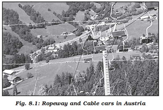
- Overview
- Most of the movement of goods and services takes place over land
- In early days, humans themselves were carriers
- Later animals were used as beasts of burden
- With the invention of the wheel, the use of carts and wagons became important
- The revolution in transport came about only after the invention of the steam engine in the eighteenth century
- Perhaps the first public railway line was opened in 1825 between Stockton and Darlington in northern England and then onwards, railways became the most popular and fastest form of transport in the nineteenth century
- It opened up continental interiors for commercial grain farming, mining and manufacturing in U.S.A.
- The invention of the internal combustion engine revolutionised road transport in terms of road quality and vehicles (motor cars and trucks) plying over them
- Among the newer developments in land transportation are pipelines, ropeways and cableways
- Liquids like mineral oil, water, sludge and sewers are transported by pipelines
- The great freight carriers are the railways, ocean vessels, barges, boats and motor trucks and pipelines
- In general, the old and elementary forms like the human porter, pack animal, cart or wagon are the most expensive means of transportation and large freighters are the cheapest
- They are important in supplementing modern channels and carriers which penetrate the interiors in large countries
- In the densely populated districts of India and China, overland transport still takes place by human porters or carts drawn or pushed by humans
- Pack animals
-
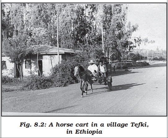
- Horses are used as a draught [denoting an animal used for pulling heavy loads] animal even in the Western countries
- Dogs and reindeer are used in North America, North Europe and Siberia to draw sledges over snow-covered ground
- Mules are preferred in the mountainous regions; while camels are used for caravan movement in deserts
- In India, bullocks are used for pulling carts
- Roads
- Overview
- Road transport is the most economical for short distances compared to railways
- Freight transport by road is gaining importance because it offers door-to-door service
- But unmetalled roads, though simple in construction, are not effective and serviceable for all seasons
- During the rainy season these become unmotorable and even the metalled ones are seriously handicapped during heavy rains and floods
- In such conditions, the high embankment of rail-tracks and the efficient maintenance of railway transport service, is an effective solution
- But the rail kilometrage being small cannot serve the needs of vast and developing countries at a low cost
- Roads, therefore, play a vital role in a nation’s trade and commerce and for promoting tourism
- The quality of the roads varies greatly between developed and developing countries because road construction and maintenance require heavy expenditure
- In developed countries good quality roads are universal and provide long-distance links in the form of motorways, autobahns (Germany), and inter–state highways for speedy movement
- Lorries, of increasing size and power to carry heavy loads, are common
- But unfortunately, the world’s road system is not well developed
- The world’s total motorable road length is only about 15 million km, of which North America accounts for 33 per cent
- The highest road density and the highest number of vehicles are registered in this continent compared to Western Europe
- Traffic flows
- Traffic on roads has increased dramatically in recent years
- When the road network cannot cope with the demands of traffic, congestion occurs
- City roads suffer from chronic traffic congestion
- Peaks (high points) and troughs (low points) of traffic flow can be seen on roads at particular times of the day, for example, peaks occurring during the rush hour before and after work
- Most of the cities in the world have been facing the problem of congestion
- Highways (Outdated data alert)
-
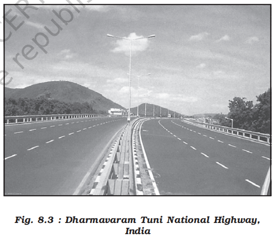
- Highways are metalled roads connecting distant places
- They are constructed in a manner for unobstructed vehicular movement
- As such these are 80 m wide, with separate traffic lanes, bridges, flyovers and dual carriageways to facilitate uninterrupted traffic flow
- In developed countries, every city and port town is linked through highways
- In North America, highway density is high, about 0.65 km per sq km
- Every place is within 20 km distance from a highway
- Cities located on the Pacific coast (west) are well-connected with those of the Atlantic Coast (east)
- Likewise, the cities of Canada in the north are linked with those of Mexico in the south
- The Trans-Canadian Highway links Vancouver in British Columbia (west coast) to St. John’s City in Newfoundland (east coast) and the Alaskan Highway links Edmonton (Canada) to Anchorage (Alaska)
- The Pan-American Highway, a large portion of which has been constructed, will connect the countries of South America, Central America and U.S.A.-Canada
- The Trans-Continental Stuart Highway connects Darwin (north coast) and Melbourne via Tennant Creek and Alice Springs in Australia
- Europe has a large number of vehicles and a well-developed highway network
- But highways face a lot of competition from railways and waterways
- In Russia, a dense highway network is developed in the industrialised region west of the Urals with Moscow as the hub
- The important Moscow-Vladivostok Highway serves the region to the east
- Due to the vast geographical area, highways in Russia are not as important as railways
- In China, highways criss-cross the country connecting all major cities such as Tsungtso (near Vietnam boundary), Shanghai (central China), Guangzhou (south) and Beijing (north)
- A new highway links Chengdu with Lhasa in Tibet
- In India, there are many highways linking the major towns and cities
- For example, National Highway No. 7 (NH 7), connecting Varanasi with Kanya Kumari, is the longest in the country
- The Golden Quadrilateral (GQ) or Super Expressway is underway to connect the four metropolitan cities — New Delhi, Mumbai, Bangalore, Chennai, Kolkata and Hyderabad
- In Africa, a highway joins Algiers in the north to Conakry in Guinea
- Similarly, Cairo is also connected to Cape Town
- Border roads
- Roads laid along international boundaries are called border roads
- They play an important role in integrating people in remote areas with major cities and providing defence
- Almost all countries have such roads to transport goods to border villages and military camps
- Railways
-
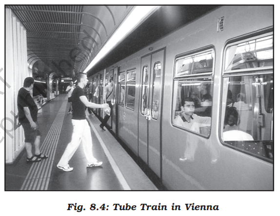
- Overview
- Railways are a mode of land transport for bulky goods and passengers over long distances
- The railway gauges vary in different countries and are roughly classified as:
- Broad (more than 1.5 m)
- Standard gauge (1.44 m)
- Metre gauge (1 m) and smaller gauges
- The standard gauge is used in the U.K.
- Commuter trains are very popular in U.K., U.S.A, Japan and India
- These carry millions of passengers daily to and fro in the city
- There are about 13 lakh km of railways open for traffic in the world
- Regional distribution (Outdated data alert)
- Europe has one of the most dense rail networks in the world
- There are about 4,40,000 km of railways, most of which is double or multiple-tracked
- Belgium has the highest density of 1 km of railway for every 6.5 sq kms area
- The industrial regions exhibit some of the highest densities in the world
- The important rail heads are London, Paris, Brussels, Milan, Berlin and Warsaw
- Passenger transport is more important than freight in many of these countries
- Underground railways are important in London and Paris
- Channel Tunnel, operated by Euro Tunnel Group through England, connects London with Paris
- Trans-continental railway lines have now lost their importance to quicker and more flexible transport systems of airways and roadways
- In Russia, railways account for about 90 per cent of the country’s total transport with a very dense network west of the Urals
- Moscow is the most important rail head with major lines radiating to different parts of the country’s vast geographical area
- Underground railways and commuter trains are also important in Moscow
- North America has one of the most extensive rail networks accounting for nearly 40 per cent of the world’s total
- In contrast to many European countries, the railways are used more for long-distance bulky freight like ores, grains, timber and machinery than for passengers
- The most dense rail network is found in the highly industrialised and urbanised region of East Central U.S.A. and adjoining Canada
- In Canada, railways are in the public sector and distributed all over the sparsely populated areas
- The transcontinental railways carry the bulk of wheat and coal tonnage
- Australia has about 40,000 km of railways, of which 25 per cent are found in New South Wales alone
- The west-east Australian National Railway line runs across the country from Perth to Sydney
- New Zealand’s railways are mainly in the North Island to serve the farming areas
- In South America, the rail network is the most dense in two regions, namely, the Pampas of Argentina and the coffee growing region of Brazil which together account for 40 per cent of South America’s total route length
- Only Chile, among the remaining countries has a considerable route length linking coastal centres with the mining sites in the interior
- Peru, Bolivia, Ecuador, Colombia and Venezuela have short single-track rail-lines from ports to the interior with no inter-connecting links
- There is only one trans-continental rail route linking Buenos Aires (Argentina) with Valparaiso (Chile) across the Andes Mountains through the Uspallatta Pass located at a height of 3,900 m
- In Asia, rail network is the most dense in the thickly populated areas of Japan, China and India
- Other countries have relatively few rail routes
- West Asia is the least developed in rail facilities because of vast deserts and sparsely populated regions
- Africa continent, despite being the second largest, has only 40,000 km of railways with South Africa alone accounting for 18,000 km due to the concentration of gold, diamond and copper mining activities
- The important routes of the continent are:
- The Benguela Railway through Angola to Katanga-Zambia Copper Belt
- The Tanzania Railway from the Zambian Copper Belt to Dar-es-Salaam on the coast
- The Railway through Botswana and Zimbabwe linking the landlocked states to the South African network
- The Blue Train from Cape Town to Pretoria in the Republic of South Africa
- Elsewhere, as in Algeria, Senegal, Nigeria, Kenya and Ethiopia, railway lines connect port cities to interior centres but do not form a good network with other countries
- Trans–continental railways
-
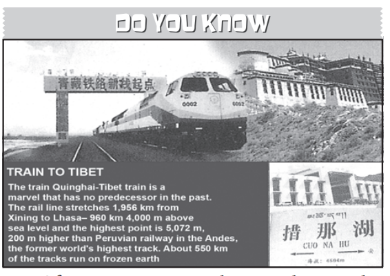
- Overview
- Trans–continental railways run across the continent and link its two ends
- They were constructed for economic and political reasons to facilitate long runs in different directions
- The following are the most important of these:
- Trans–Siberian Railway
-
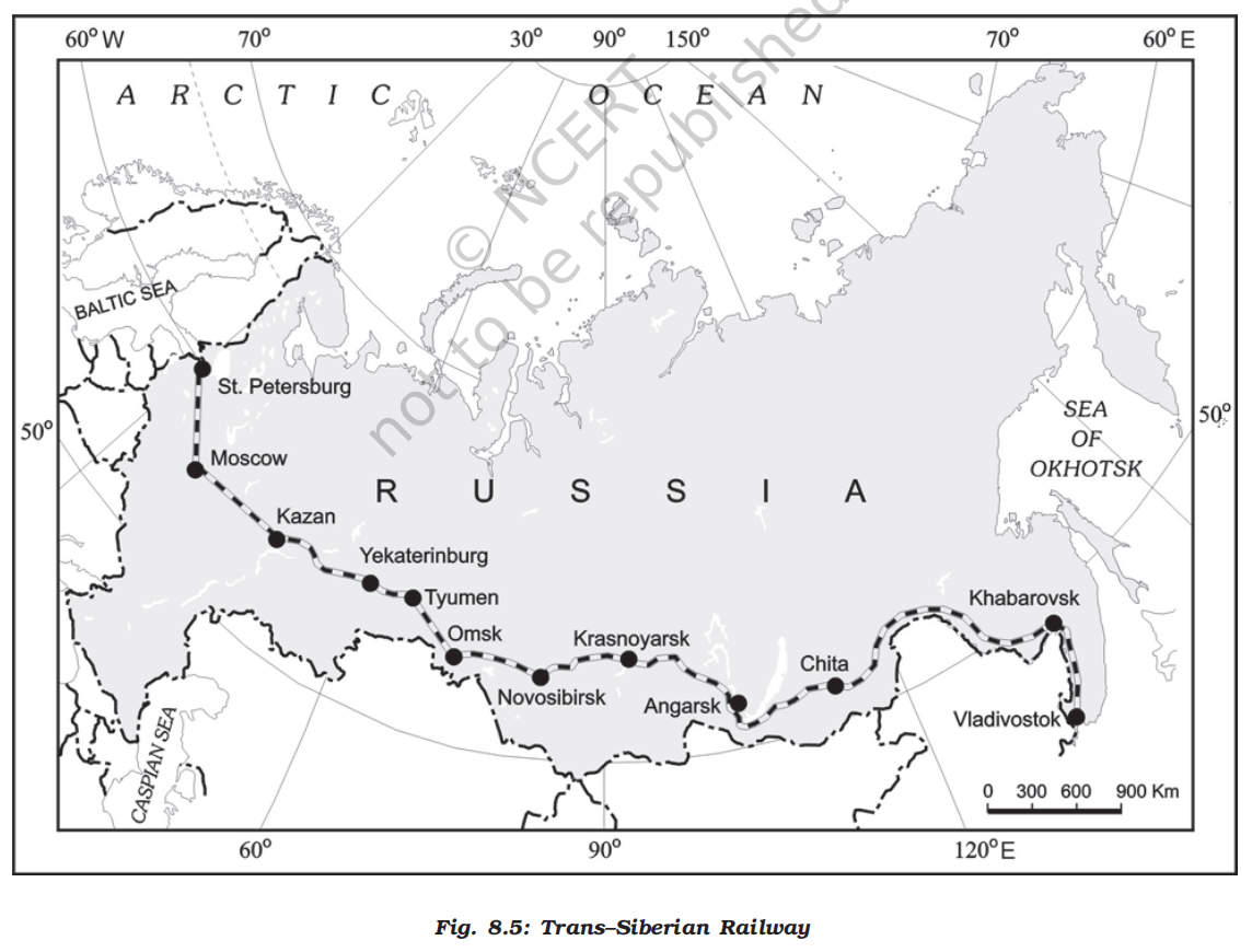
- This is a trans–Siberian Railways major rail route of Russia runs from St. Petersburg in the west to Vladivostok on the Pacific Coast in the east passing through Moscow, Ufa, Novosibirsk, Irkutsk, Chita and Khabarovsk
- It is the most important route in Asia and the longest (9,332 km) double-tracked and electrified trans–continental railway in the world
- It has helped in opening up its Asian region to West European markets
- It runs across the Ural Mountains Ob and Yenisei rivers Chita is an important agrocentre and Irkutsk, a fur centre
- There are connecting links to the south, namely, to Odessa (Ukraine), Baku on the Caspian Coast, Tashkent (Uzbekistan), Ulan Bator (Mongolia), and Shenyang (Mukden) and Beijing in China
- Trans–Canadian Railways
-
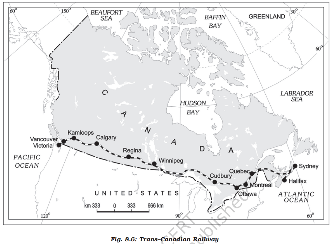
- This 7,050 km long rail-line in Canada runs from Halifax in the east to Vancouver on the Pacific Coast passing through Montreal, Ottawa, Winnipeg and Calgary (Fig. 8.6)
- It was constructed in 1886, initially as part of an agreement to make British Columbia on the west coast join the Federation of States
- Later on, it gained economic significance because it connected the Quebec-Montreal Industrial Region with the wheat belt of the Prairie Region and the Coniferous Forest region in the north
- Thus each of these regions became complementary to the other
- A loop line from Winnipeg to Thunder Bay (Lake Superior) connects this rail-line with one of the important waterways of the world
- This line is the economic artery of Canada
- Wheat and meat are the important exports on this route
- The Union and Pacific Railway
- This rail-line connects New York on the Atlantic Coast to San Francisco on the Pacific Coast passing through Cleveland, Chicago, Omaha, Evans, Ogden and Sacramento
- The most valuable exports on this route are ores, grain, paper, chemicals and machinery
- The Australian Trans–Continental Railway
-

- This rail-line runs west-east across the southern part of the continent from Perth on the west coast, to Sydney on the east coast passing through Kalgoorlie, Broken Hill and Port Augusta (Fig. 8.7)
- Another major north-south line connects Adelaide and Alice Spring and to be joined further to the Darwin–Birdum line
- The Orient Express
- This line runs from Paris to Istanbul passing through Strasbourg, Munich, Vienna, Budapest and Belgrade
- The journey time from London to Istanbul by this Express is now reduced to 96 hours as against 10 days by the sea-route
- The chief exports on this rail-route are cheese, bacon, oats, wine, fruits, and machinery
- There is a proposal to build a Trans–Asiatic Railway linking Istanbul with Bangkok via Iran, Pakistan, India, Bangladesh and Myanmar
- Water transport
- Overview
- One of the great advantages of water transportation is that it does not require route construction
- The oceans are linked with each other and are negotiable with ships of various sizes
- All that is needed is to provide port facilities at the two ends
- It is much cheaper because the friction of water is far less than that of land
- The energy cost of water transportation is lower
- Water transport is divided into sea routes and inland waterways
- Sea routes
- Overview
- The oceans offer a smooth highway traversable in all directions with no maintenance costs
- Its transformation into a routeway by sea-going vessels is an important development in human adaptation to the physical environment
- Compared to land and air, ocean transport is a cheaper means of haulage [the commercial transport of goods] of bulky material over long distances from one continent to another
- Modern passenger liners (ships) and cargo ships are equipped with radar, wireless and other navigation aids
- The development of refrigerated chambers for perishable goods, tankers and specialised ships has also improved cargo transport
- The use of containers has made cargo handling at the world’s major ports easier
- Important sea routes
-
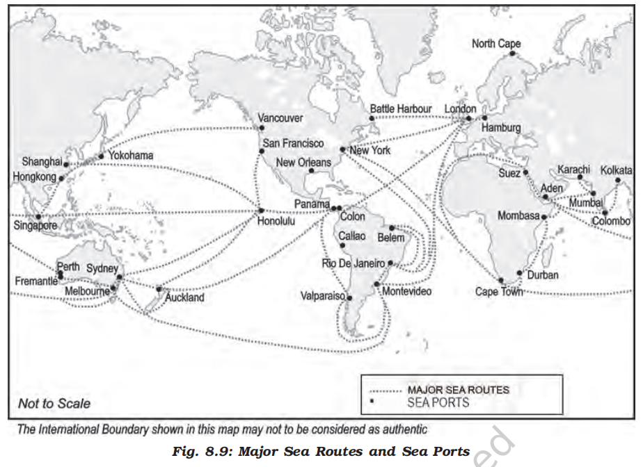
- Some important routes have been discussed in the following pages
- The Northern Atlantic Sea Route
- This links North-eastern U.S.A. and North-western Europe, the two industrially developed regions of the world
- The foreign trade over this route is greater than that of the rest of the world combined
- One fourth of the world’s foreign trade moves on this route
- It is, therefore, the busiest in the world and otherwise, called the Big Trunk Route
- Both the coasts have highly advanced ports and harbour facilities
- The Mediterranean–Indian Ocean Sea Route
- This sea route passes through the heart of the Old World and serves more countries and people than any other route
- Port Said, Aden, Mumbai, Colombo and Singapore are some of the important ports on this route
- The construction of Suez Canal has greatly reduced the distance and time as compared to the earlier route through the Cape of Good Hope, which was longer than the route through Suez Canal
- The Cape of Good Hope Sea Route
- This trade route connects the highly industrialised Western European region with West Africa, South Africa, South-east Asia and the commercial agriculture and livestock economies of Australia and New Zealand
- The volume of trade and traffic between both East and West Africa is on the increase due to the development of the rich natural resources such as gold, diamond, copper, tin, groundnut, oil palm, coffee and fruits
- The Southern Atlantic Sea Route
- This sea route is another important one across the Atlantic Ocean which connects West European and West African countries with Brazil, Argentina and Uruguay in South America
- The traffic is far less on this route because of the limited development and population in South America and Africa
- Only southeastern Brazil and Plata estuary and parts of South Africa have large-scale industries
- There is also little traffic on the route between Rio de Janeiro and Cape Town because both South America and Africa have similar products and resources
- The North Pacific Sea Route
- Trade across the vast North Pacific Ocean moves by several routes which converge at Honolulu
- The direct route on the Great Circle links Vancouver and Yokohama and reduces the travelling distance (2,480 km) by half
- This sea route links the ports on the west-coast of North America with those of Asia
- These are Vancouver, Seattle, Portland, San Francisco and Los Angeles on the American side and Yokohama, Kobe, Shanghai, Hong Kong, Manila and Singapore on the Asian side
- The South Pacific Sea Route
- This sea route connects Western Europe and North America with Australia, New Zealand and the scattered Pacific islands via the Panama Canal
- This route is also used for reaching Hong Kong, Philippines and Indonesia
- The distance covered between Panama and Sydney is 12,000 km
- Honolulu is an important port on this route
- Coastal shipping
- It is obvious that water transport is a cheaper mode
- While oceanic routes connect different countries, coastal shipping is a convenient mode of transportation with long coastlines, e.g. U.S.A, China and India
- Shenzhen States in Europe are most suitably placed for coastal shipping connecting one member’s coast with the other
- If properly developed, coastal shipping can reduce the congestion on the land routes
- Shipping canals
- The Suez and the Panama Canals are two vital man-made navigation canals or waterways which serve as gateways of commerce for both the eastern and western worlds
- The Suez Canal
-
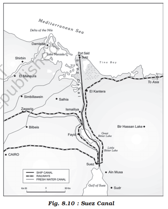
- This canal had been constructed in 1869 in Egypt between Port Said in the north and Port Suez in the south linking the Mediterranean Sea and the Red Sea
- It gives Europe a new gateway to the Indian Ocean and reduces direct sea-route distance between Liverpool and Colombo compared to the Cape of Good Hope route
- It is a sea-level canal without locks which is about 160 km and 11 to 15 m deep
- About 100 ships travel daily and each ship takes 10-12 hours to cross this canal
- The tolls are so heavy that some find it cheaper to go by the longer Cape Route whenever the consequent delay is not important
- A railway follows the canal to Suez, and from Ismailia there is a branch line to Cairo
- A navigable fresh-water canal from the Nile also joins the Suez Canal in Ismailia to supply fresh-water to Port Said and Suez
- The Panama Canal
-

- This canal connects the Atlantic Ocean in the east to the Pacific Ocean in the west
- It has been constructed across the Panama Isthmus between Panama City and Colon by the U.S. government which purchased 8 km of area on either side and named it the Canal Zone
- Latest update
- Earlier it was owned by USA, but later transferred to the Panama by signing Torrijos–Carter treaties. USA now owns nothing
- The Canal is about 72 km long and involves a very deep cutting for a length of 12 km
- It has a six-lock system and ships cross the different levels (26 m up and down) through these locks before entering the Gulf of Panama
- It shortens the distance between New York and San Francisco by 13,000 km by sea
- Likewise the distance between Western Europe and the West-coast of U.S.A.; and North-eastern and Central U.S.A. and East and South-east Asia is shortened
- The economic significance of this Canal is relatively less than that of the Suez
- However, it is vital to the economies of Latin America
- Inland waterways
-

- Overview
- Rivers, canals, lakes and coastal areas have been important waterways since time immemorial
- Boats and steamers are used as means of transport for cargo and passengers
- The development of inland waterways is dependent on the navigability width and depth of the channel, continuity in the water flow, and transport technology in use
- Rivers are the only means of transport in dense forests
- Very heavy cargo like coal, cement, timber and metallic ores can be transported through inland waterways
- In ancient times, riverways were the main highways of transportation as in the case of India
- But they lost importance because of competition from railways, lack of water due to diversion for irrigation, and their poor maintenance
- The significance of rivers as inland waterways for domestic and international transport and trade has been recognised throughout the developed world
- Despite inherent limitations, many rivers have been modified to enhance their navigability by dredging, stabilising river banks, and building dams and barrages for regulating the flow of water
- The following river waterways are some of the world’s important highways of commerce
-
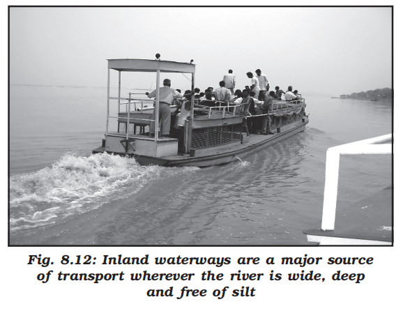
- The Rhine Waterways
-

-
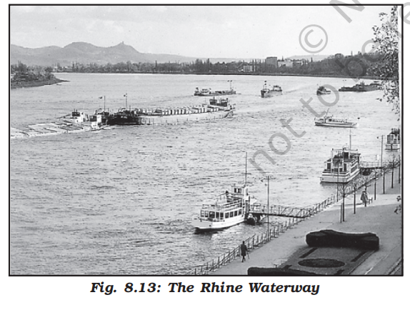
- The Rhine flows through Germany and the Netherlands
- It is navigable for 700 km from Rotterdam, at its mouth in the Netherlands to Basel in Switzerland
- Ocean-going vessels can reach up to Cologne
- The Ruhr river joins the Rhine from the east
- It flows through a rich coalfield and the whole basin has become a prosperous manufacturing area
- Dusseldorf is the Rhine port for this region
- Huge tonnage moves along the stretch south of the Ruhr
- This waterway is the world’s most heavily used
- Each year more than 20,000 ocean-going ships and 2,00,000 inland vessels exchange their cargoes
- It connects the industrial areas of Switzerland, Germany, France, Belgium and the Netherlands with the North Atlantic Sea Route
- The Danube Waterway
- This important inland waterway serves Eastern Europe
- The Danube river rises in the Black Forest and flows eastwards through many countries
- It is navigable up to Taurna Severin
- The chief export items are wheat, maize, timber, and machinery
- The Volga Waterway
- Russia has a large number of developed waterways, of which the Volga is one of the most important
- It provides a navigable waterway of 11,200 km and drains into the Caspian Sea
- The Volga-Moscow Canal connects it with the Moscow region and the Volga-Don Canal with the Black Sea
- The Great Lakes – St. Lawrence Seaway
- The Great Lakes of North America Superior, Huron Erie and Ontario are connected by Soo Canal and Welland Canal to form an inland waterway
- The estuary of St. Lawrence River, along with the Great Lakes, forms a unique commercial waterway in the northern part of North America
- The ports on this route like Duluth and Buffalo are equipped with all facilities of ocean ports
- As such large ocean-going vessels are able to navigate up the river deep inside the continent to Montreal
- But here goods have to be trans-shipped to smaller vessels due to the presence of rapids
- Canals have been constructed up to 3.5 m deep to avoid these
- The Mississippi Waterways
- The Mississippi-Ohio waterway connects the interior part of U.S.A. with the Gulf of Mexico in the south
- Large steamers can go through this route up to Minneapolis
- Air transport
-
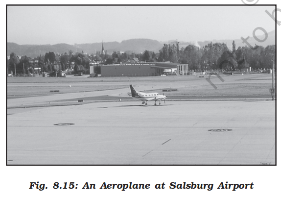
-
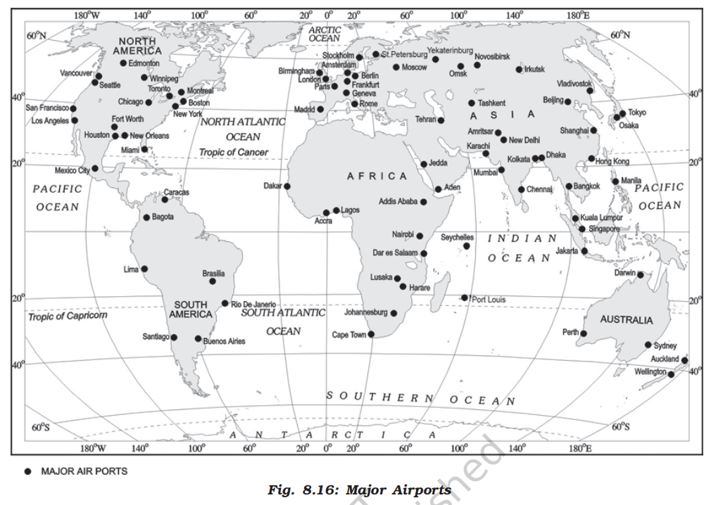
- Overview
- Air transport is the fastest means of transportation, but it is very costly
- Being fast, it is preferred by passengers for long-distance travel
- Valuable cargo can be moved rapidly on a world-wide scale
- It is often the only means to reach inaccessible areas
- Air transport has brought about a connectivity revolution in the world
- The frictions created by mountainous snow fields or inhospitable desert terrains have been overcome
- The accessibility has increased
- The airplane brings varied articles to the Eskimos in Northern Canada unhindered by the frozen ground
- In the Himalayan region, the routes are often obstructed due to landslides, avalanches or heavy snow fall
- At such times, air travel is the only alternative to reach a place
- Airways also have great strategic importance
- The air strikes by U.S. and British forces in Iraq bears testimony to this fact
- The airways network is expanding very fast
- The manufacturing of aircrafts and their operations require elaborate infrastructure like hangars, landing, fuelling, and maintenance facilities for the aircrafts
- The construction of airports is also very expensive and has developed more in highly industrialised countries where there is a large volume of traffic
- At present no place in the world is more than 35 hours away
- This startling fact has been made possible due to people who build and fly airplanes
- Travel by air can now be measured by hours and minutes instead of years and months
- Frequent air services are available to many parts of the world
- Although, U.K. pioneered the use of commercial jet transport, U.S.A. developed largely post-War international civil aviation
- Today, more than 250 commercial airlines offer regular services to different parts of the world
- Recent developments can change the future course of air transport
- Supersonic aircraft, cover the distance between London and New York within three and a half hours
- Inter-continental air routes
- In the Northern Hemisphere, there is a distinct east-west belt of inter-continental air routes
- Dense network exists in Eastern U.S.A., Western Europe and Southeast Asia
- U.S.A. alone accounts for 60 per cent of the airways of the world
- New York, London, Paris, Amsterdam, Frankfurt Rome, Moscow, Karachi, New Delhi, Mumbai, Bangkok, Singapore, Tokyo, San Francisco, Los Angeles and Chicago are the nodal points where air routes converge or radiate to all continents
- Africa, Asiatic part of Russia and South America lack air services
- There are limited air services between 10-35 latitudes in the Southern hemisphere due to sparser population, limited landmass and economic development
- Pipelines
-
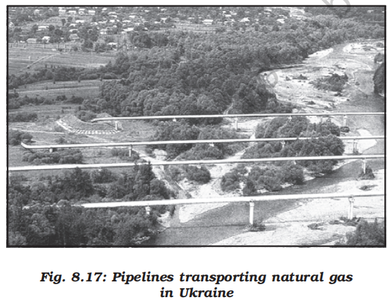
- Pipelines are used extensively to transport liquids and gases such as water, petroleum and natural gas for an uninterrupted flow
- Water supplied through pipelines is familiar to all
- Cooking gas or LPG is supplied through pipelines in many parts of the world
- Pipelines can also be used to transport liquidified coal
- In New Zealand, milk is being supplied through pipelines from farms to factories
- In U.S.A. there is a dense network of oil pipelines from the producing areas to the consuming areas
- Big Inch is one such famous pipeline, which carries petroleum from the oil wells of the Gulf of Mexico to the North-eastern States
- About 17 per cent of all freight per tonne-km is carried through pipelines in U.S.A.
- In Europe, Russia, West Asia and India pipelines are used to connect oil wells to refineries, and to ports or domestic markets
- Turkmenistan is central Asia has extended pipelines to Iran and also to parts of China
- The proposed Iran-India via Pakistan international oil and natural gas pipeline will be the longest in the world
- Update as of Jan 2026
- India withdrew from the Iran-Pakistan-India (IPI) pipeline project around 2009 due to geopolitical and sanction pressures (especially related to the U.S. stance on Iran).
- After India’s exit, the trilateral pipeline plan was effectively cancelled.
- Pakistan and Iran have continued a bilateral pipeline plan (Iran–Pakistan pipeline). It is about 2,775 km from Iran into Pakistan
- Communications
- Overview
- Human beings have used different methods long-distance communications of which the telegraph and the telephone were important
- The telegraph was instrumental in the colonisation of the American West
- During the early and mid-twentieth century, the American Telegraph and Telephone Company (AT&T) enjoyed a monopoly over U.S.A.’s telephone industry
- In fact, the telephone became a critical factor in the urbanisation of America
- Firms centralised their functioning at city-headquarters and located their branch offices in smaller towns
- Even today, the telephone is the most commonly used mode
- In developing countries, the use of cell phones, made possible by satellites, is important for rural connectivity
- Today there is a phenomenal pace of development
- The first major breakthrough is the use of optic fiber cables (OFC)
- Faced with mounting competition, telephone companies all over the world soon upgraded their copper cable systems to include optic fiber cables
- These allow large quantities of data to be transmitted rapidly, securely, and are virtually error-free
- With the digitisation of information in the 1990s, telecommunication slowly merged with computers to form integrated networks termed as Internet
- Satellite communication
- Today Internet is the largest electronic network on the planet connecting about 1,000 million people in more than 100 countries
- Satellites touch human lives in many ways
- Every time you use a cell phone to call a friend, send an SMS or watch a popular programme on cable television
- You are using satellite communication
- Communication through satellites emerged as a new area in communication technology since the 1970s after U.S.A. and former U.S.S.R. pioneered space research
- Artificial satellites, now, are successfully deployed in the earth’s orbit to connect even the remote corners of the globe with limited on-site verification
- These have rendered the unit cost and time of communication invariant in terms of distance
- This means it costs the same to communicate over 500 km as it does over 5,000 km via satellite
- India has also made great strides in satellite development
- Aryabhatt was launched on 19 April 1979, Bhaskar-I in 1979 and Rohini in 1980
- On 18 June 1981, APPLE (Arian Passenger Payload Experiment) was launched through Arian rocket
- Bhaskar, Challenger and INSAT I-B have made long-distance communication, television and radio very effective
- Today weather forecasting through television is a boon
- Cyber space – Internet
- Cyberspace is the world of electronic computerised space
- It is encompassed by the Internet such as the World Wide Web (www)
- In simple words, it is the electronic digital world for communicating or accessing information over computer networks without physical movement of the sender and the receiver
- It is also referred to as the Internet
- Cyberspace exists everywhere
- It may be in an office, sailing boat, flying plane and virtually anywhere
- The speed at which this electronic network has spread is unprecedented in human history
- There were less than 50 million Internet users in 1995, about 400 million in 2000 A.D. and over two billion in 2010
- In the last few years there has been a shift among global users from U.S.A. to the developing countries
- The percentage share of U.S.A. has dropped from 66 in 1995 to only 25 in 2005
- Now the majority of the world’s users are in U.S.A., U.K., Germany, Japan, China and India
- As billions use the Internet each year, cyberspace will expand the contemporary economic and social space of humans through e-mail, e-commerce, e-learning and e-governance
- Internet together with fax, television and radio will be accessible to more and more people cutting across place and time
- It is these modern communication systems, more than transportation, that has made the concept of global village a reality
- International trade
- Introduction
- Overview
- You are already familiar with the term “trade” as a tertiary activity which you have studied in Chapter 7 of this book
- You know that trade means the voluntary exchange of goods and services
- Two parties are required to trade
- One person sells and the other purchases
- In certain places, people barter their goods
- For both the parties trade is mutually beneficial
- Levels of trade
- Trade may be conducted at two levels:
- International
- International trade is the exchange of goods and services among countries across national boundaries
- Countries need to trade to obtain commodities, they cannot produce themselves or they can purchase elsewhere at a lower price
- National
- Within a country
- Evolution of trade
-
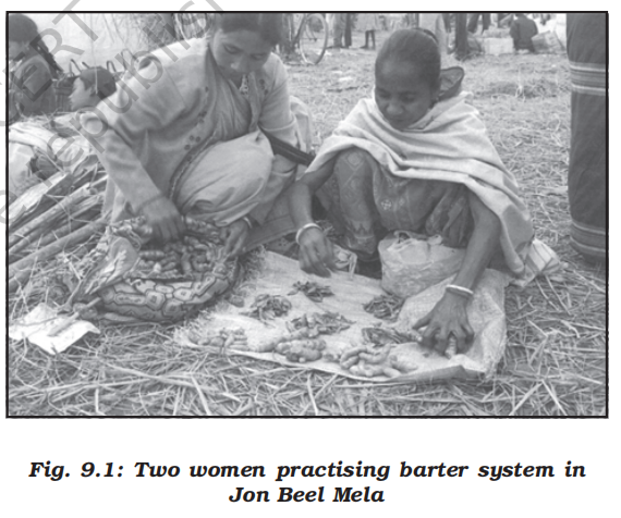
- The initial form of trade in primitive societies was the barter system, where direct exchange of goods took place
- In this system if you were a potter and were in need of a plumber, you would have to look for a plumber who would be in need of pots and you could exchange your pots for his plumbing service
- The difficulties of barter system were overcome by the introduction of money
- In the olden times, before paper and coin currency came into being, rare objects with very high intrinsic value served as money, like, flintstones, obsidian, cowrie shells, tiger’s paws, whale’s teeth, dogs teeth, skins, furs, cattle, rice, peppercorns, salt, small tools, copper, silver and gold
- The word salary comes from the Latin word Salarium which means payment by salt
- As in those times producing salt from sea water was unknown and could only be made from rock salt which was rare and expensive
- That is why it became a mode of payment
- History of international trade
- In ancient times, transporting goods over long distances was risky, hence trade was restricted to local markets
- People then spent most of their resources on basic necessities – food and clothes
- Only the rich people bought jewellery, costly dresses and this resulted in trade of luxury items
- The Silk Route is an early example of long distance trade connecting Rome to China – along the 6,000 km route
- The traders transported Chinese silk, Roman wool and precious metals and many other high value commodities from intermediate points in India, Persia and Central Asia
- After the disintegration of the Roman Empire, European commerce grew during twelfth and thirteenth century with the development of ocean going warships trade between Europe and Asia grew and the Americas were discovered
- Fifteenth century onwards, the European colonialism began and along with trade of exotic commodities, a new form of trade emerged which was called slave trade
- The Portuguese, Dutch, Spaniards, and British captured African natives and forcefully transported them to the newly discovered Americas for their labour in the plantations
- Slave trade was a lucrative business for more than two hundred years till it was abolished in Denmark in 1792, Great Britain in 1807 and United States in 1808
- After the Industrial Revolution the demand for raw materials like grains, meat, wool also expanded, but their monetary value declined in relation to the manufactured goods
- The industrialised nations imported primary products as raw materials and exported the value added finished products back to the non-industrialised nations
- In the later half of the nineteenth century, regions producing primary goods were no more important, and industrial nations became each other’s principle customers
- During the World Wars I and II, countries imposed trade taxes and quantitative restrictions for the first time
- During the postwar period, organisations like General Agreement for Tariffs and Trade (which later became the World Trade Organisation), helped in reducing tariff
- Why does international trade exist?
- International trade is the result of specialisation in production
- It benefits the world economy if different countries practise specialisation and division of labour in the production of commodities or provision of services
- Each kind of specialisation can give rise to trade
- Thus, international trade is based on the principle of comparative advantage, complimentarity and transferability of goods and services and in principle, should be mutually beneficial to the trading partners
- In modern times, trade is the basis of the world’s economic organisation and is related to the foreign policy of nations
- With well-developed transportation and communication systems, no country is willing to forego the benefits derived from participation in international trade
- Basis of international trade
- Difference in national resources
- The world’s national resources are unevenly distributed because of differences in their physical make up i.e. geology, relief soil and climate
- (a) Geological structure
- It determines the mineral resource base and topographical differences ensure diversity of crops and animals raised
- Lowlands have greater agricultural potential
- Mountains attract tourists and promote tourism
- (b) Mineral resources
- They are unevenly distributed the world over
- The availability of mineral resources provides the basis for industrial development
- (c) Climate
- It influences the type of flora and fauna that can survive in a given region
- It also ensures diversity in the range of various products, e.g. wool production can take place in cold regions, bananas, rubber and cocoa can grow in tropical regions
- Population factors
- The size, distribution and diversity of people between countries affect the type and volume of goods traded
- (a) Cultural factors
- Distinctive forms of art and craft develop in certain cultures which are valued the world over, e.g. China produces the finest porcelains and brocades
- Carpets of Iran are famous while North African leather work and Indonesian batik cloth are prized handicrafts
- (b) Size of population
- Densely populated countries have large volume of internal trade but little external trade because most of the agricultural and industrial production is consumed in the local markets
- Standard of living of the population determines the demand for better quality imported products because with low standard of living only a few people can afford to buy costly imported goods
- Stage of economic development
- At different stages of economic development of countries, the nature of items traded undergo changes
- In agriculturally important countries, agro products are exchanged for manufactured goods whereas industrialised nations export machinery and finished products and import food grains and other raw materials
- Extent of foreign investment
- Foreign investment can boost trade in developing countries which lack in capital required for the development of mining, oil drilling, heavy engineering, lumbering and plantation agriculture
- By developing such capital intensive industries in developing countries, the industrial nations ensure import of food stuffs, minerals and create markets for their finished products
- This entire cycle steps up the volume of trade between nations
- Transport
- In olden times, lack of adequate and efficient means of transport restricted trade to local areas
- Only high value items, e.g. gems, silk and spices were traded over long distances
- With expansions of rail, ocean and air transport, better means of refrigeration and preservation, trade has experienced spatial expansion
- Important aspects of international trade
- Volume of trade
- The actual tonnage of goods traded makes up the volume
- However, services traded cannot be measured in tonnage
- Therefore, the total value of goods and services traded is considered to be the volume of trade
- Table 9.1 shows that the total volume of world trade has been steadily rising over the past decades
- Composition of trade
- The nature of goods and services imported and exported by countries have undergone changes during the last century
- Trade of primary products was dominant in the beginning of the last century
- Later manufactured goods gained prominence and currently, though the manufacturing sector commands the bulk of the global trade, service sector which includes travel, transportation and other commercial services have been showing an upward trend
- Table 9.1 shows that the volume of imports and exports of the world merchandise has been growing consistently over the years
- Looking at Figure 9.1 it becomes evident that manufactured goods contributed to the bulk of world merchandise exports from 2005 to 2015
- Fuels and mining goods and agricultural goods are also important contributors of merchandise exports
- There is change in the share of continents in the world merchandise trade as Europe’s contribution is declining while the contribution of Asian countries is growing
-
| Year |
1955 |
1965 |
1975 |
1985 |
1995 |
2005 |
2015 |
| Total Merchandise Exports |
95,000 |
190,000 |
877,000 |
1,954,000 |
5,162,000 |
10,393,000 |
15,583,232 |
| Total Merchandise Imports |
99,000 |
199,000 |
912,000 |
2,015,000 |
5,292,000 |
10,753,000 |
15,628,204 |
- Direction of trade
- Historically, the developing countries of the present used to export valuable goods and artefacts, etc., which were exported to European countries
- During the nineteenth century there was a reversal in the direction of trade
- European countries started exporting manufactured goods for exchange of foodstuffs and raw materials from their colonies
- Europe and U.S.A. emerged as major trade partners in the world and were leaders in the trade of manufactured goods
- Japan at that time was also the third important trading country
- The world trade pattern underwent a drastic change during the second half of the twentieth century
- Europe lost its colonies while India, China and other developing countries started competing with developed countries
- The nature of the goods traded has also changed
-
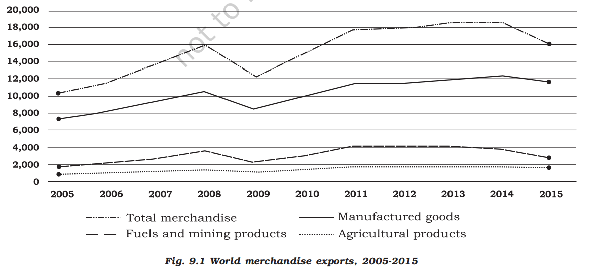
- Balance of trade
- Balance of trade records the volume of goods and services imported as well as exported by a country to other countries
- If the value of imports is more than the value of a country’s exports, the country has negative or unfavourable balance of trade
- If the value of exports is more than the value of imports, then the country has a positive or favourable balance of trade
- Balance of trade and balance of payments have serious implications for a country’s economy
- A negative balance would mean that the country spends more on buying goods than it can earn by selling its goods
- This would ultimately lead to exhaustion of its financial reserves
- Types of international trade
- Bilateral trade
- Bilateral trade is done by two countries with each other
- They enter into agreement to trade specified commodities amongst them
- For example, country A may agree to trade some raw material with agreement to purchase some other specified item to country B or vice versa
- Multi-lateral trade
- As the term suggests multi-lateral trade is conducted with many trading countries
- The same country can trade with a number of other countries
- The country may also grant the status of the “Most Favoured Nation” (MFN) on some of the trading partners
- Case for free trade
- The act of opening up economies for trading is known as free trade or trade liberalisation
- This is done by bringing down trade barriers like tariffs
- Trade liberalisation allows goods and services from everywhere to compete with domestic products and services
- Globalisation along with free trade can adversely affect the economies of developing countries by not giving equal playing field by imposing conditions which are unfavourable
- With the development of transport and communication systems goods and services can travel faster and farther than ever before
- But free trade should not only let rich countries enter the markets, but allow the developed countries to keep their own markets protected from foreign products
- Countries also need to be cautious about dumped goods; as along with free trade dumped goods of cheaper prices can harm the domestic producers
- Dumping
- The practice of selling a commodity in two countries at a price that differs for reasons not related to costs is called dumping
- World Trade Organisation
- In 1948, to liberalise the world from high customs tariffs and various other types of restrictions, General Agreement for Tariffs and Trade (GATT) was formed by some countries
- In 1994, it was decided by the member countries to set up a permanent institution for looking after the promotion of free and fair trade amongst nation and the GATT was transformed into the World Trade Organisation from 1st January 1995
- WTO is the only international organisation dealing with the global rules of trade between nations
- It sets the rules for the global trading system and resolves disputes between its member nations
- WTO also covers trade in services, such as telecommunication and banking, and others issues such as intellectual rights
- The WTO has however been criticised and opposed by those who are worried about the effects of free trade and economic globalisation
- It is argued that free trade does not make ordinary people’s lives more prosperous
- It is actually widening the gulf between rich and poor by making rich countries more rich
- This is because the influential nations in the WTO focus on their own commercial interests
- Moreover, many developed countries have not fully opened their markets to products from developing countries
- It is also argued that issues of health, worker’s rights, child labour and environment are ignored
- WTO Headquarters are located in Geneva, Switzerland
- 164 countries were members of WTO as on December 2016
- India has been one of the founder member of WTO
- Regional trade blocs
- Regional Trade Blocs have come up in order to encourage trade between countries with geographical proximity, similarity and complementarities in trading items and to curb restrictions on trade of the developing world
- Today, 120 regional trade blocs generate 52 per cent of the world trade
- These trading blocs developed as a response to the failure of the global organisations to speed up intra-regional trade
- Though, these regional blocs remove trade tariffs within the member nations and encourage free trade, in the future it could get increasingly difficult for free trade to take place between different trading blocs
- Some major regional trade blocs have been listed in Table 9.3
-
| Regional Blocs |
Headquarters |
Member Nations |
Origin |
Commodities |
Other Areas of Cooperation |
| ASEAN (Association of South East Asian Nations) |
Jakarta, Indonesia |
Brunei Darussalam, Cambodia, Indonesia, Laos, Malaysia, Myanmar, Philippines, Singapore, Thailand, Vietnam |
Aug, 1967 |
Agro products, rubber, palm oil, rice, copra, coffee, minerals – copper, coal, nickel, tungsten, petroleum, natural gas, software products |
Accelerate economic growth, cultural development, peace, and regional stability |
| CIS (Commonwealth of Independent States) |
Minsk, Belarus |
Armenia, Azerbaijan, Belarus, Georgia, Kazakhstan, Kyrgyzstan, Moldova, Russia, Tajikistan, Turkmenistan, Ukraine, Uzbekistan |
— |
Crude oil, natural gas, gold, cotton, fibre, aluminium |
Integration and cooperation on matters of economics, defence, and foreign policy |
| EU (European Union) |
Brussels, Belgium |
Austria, Belgium, Bulgaria, Croatia, Cyprus, Czech Republic, Denmark, Estonia, Finland, France, Germany, Greece, Hungary, Ireland, Italy, Latvia, Lithuania, Luxembourg, Malta, Poland, Portugal, Romania, Slovakia, Slovenia, Spain, Sweden, Netherlands, United Kingdom |
EEC - March 1957, EU - Feb. 1992 |
Agro products, minerals, chemicals, wood, paper, transport vehicles, optical instruments, clocks, works of art, antiques |
Single market with single currency |
| LAIA (Latin American Integration Association) |
Montevideo, Uruguay |
Argentina, Bolivia, Brazil, Colombia, Ecuador, Mexico, Paraguay, Peru, Uruguay, Venezuela |
— |
— |
— |
| NAFTA (North American Free Trade Agreement) |
— |
U.S.A., Canada, Mexico |
1994 |
Agro products, motor vehicles, automotive parts, computers, textiles |
— |
| OPEC (Organisation of Petroleum Exporting Countries) |
Vienna, Austria |
Algeria, Indonesia, Iran, Iraq, Kuwait, Libya, Nigeria, Qatar, Saudi Arabia, U.A.E., Venezuela |
1960 |
Crude petroleum |
Coordinate and unify petroleum policies |
| SAFTA (South Asian Free Trade Agreement) |
— |
Bangladesh, Maldives, Bhutan, Nepal, India, Pakistan, Sri Lanka |
Jan-2006 |
— |
Reduce tariffs on interregional trade |
- Concerns related to international trade
- Trade Imbalances
- Some countries run persistent trade deficits, relying heavily on imports while exporting less.
- Weakens domestic industries, increases dependence on foreign goods, and leads to currency instability.
- Unfair Trade Practices
- Developed countries often subsidize their agricultural and industrial sectors, making it hard for developing nations to compete.
- Distorts market competition and harms local producers in poorer countries.
- Overdependence on a Few Commodities
- Many developing nations rely on a limited number of exports (e.g., oil, coffee).
- Makes them vulnerable to price shocks and global demand fluctuations.
- Loss of Domestic Industries
- Opening markets without adequate safeguards can lead to the collapse of local industries due to cheap imports.
- Job losses and deindustrialization in sensitive sectors.
- Environmental Degradation
- International trade encourages overexploitation of natural resources to meet export demands.
- Leads to deforestation, pollution, and biodiversity loss.
- Labor Exploitation and Poor Working Conditions
- To remain competitive in global markets, companies in some countries compromise on labor rights and wages.
- Increased inequality and human rights violations.
- Intellectual Property Rights (IPR) Issues
- Strict global IPR regimes can limit access to essential medicines and technology in developing nations.
- Affects public health and technological progress.
- Dominance of Multinational Corporations (MNCs)
- MNCs often dominate trade, influencing prices, regulations, and even politics.
- Can undermine local businesses and reduce national economic sovereignty.
- Inequitable Trade Agreements
- Trade agreements (like FTAs or WTO rules) may favor developed nations.
- Creates structural disadvantages for developing countries.
- Geopolitical Tensions and Protectionism
- Trade is increasingly weaponized for political gains (e.g., sanctions, tariffs).
- Disrupts global supply chains and increases global uncertainty.
- Gateways of international trade
- Ports
-
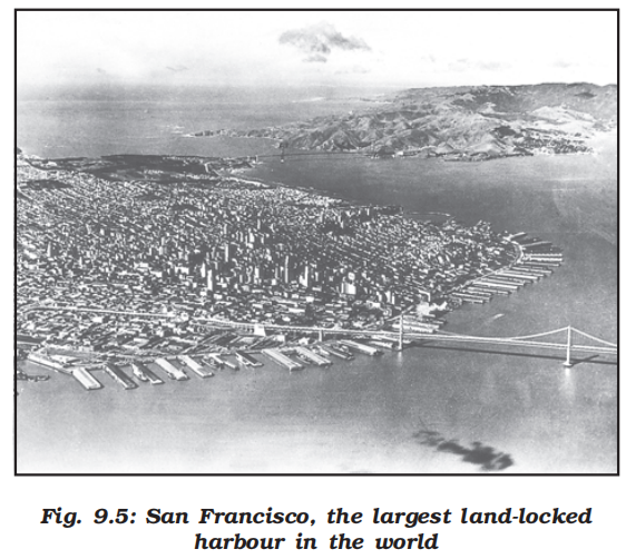
-
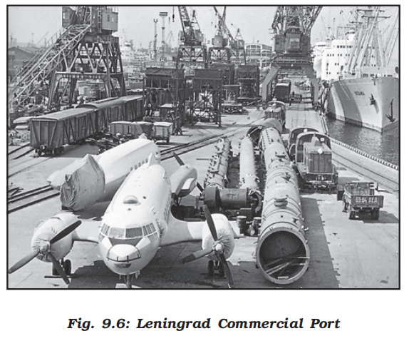
- Overview
- The chief gateways of the world of international trade are the harbours and ports
- Cargoes and travellers pass from one part of the world to another through these ports
- The ports provide facilities of docking, loading, unloading and the storage facilities for cargo
- In order to provide these facilities, the port authorities make arrangements for maintaining navigable channels, arranging tugs and barges, and providing labour and managerial services
- The importance of a port is judged by the size of cargo and the number of ships handled
- The quantity of cargo handled by a port is an indicator of the level of development of its hinterland
- Types of port
- Types of port according to cargo handled
- Industrial Ports
- These ports specialise in bulk cargo-like grain, sugar, ore, oil, chemicals and similar materials
- Commercial Ports
- These ports handle general cargo-packaged products and manufactured good
- These ports also handle passenger traffic
- Comprehensive Ports
- Such ports handle bulk and general cargo in large volumes
- Most of the world’s great ports are classified as comprehensive ports
- Types of port on the basis of location
- Inland Ports
- These ports are located away from the sea coast
- They are linked to the sea through a river or a canal
- Such ports are accessible to flat bottom ships or barges
- For example, Manchester is linked with a canal; Memphis is located on the river Mississippi; Rhine has several ports like Mannheim and Duisburg; and Kolkata is located on the river Hoogli, a branch of the river Ganga
- Out Ports
- These are deep water ports built away from the actual ports
- These serve the parent ports by receiving those ships which are unable to approach them due to their large size
- Classic combination, for example, is Athens and its out port Piraeus in Greece
- Types of port on the basis of specialised functions
- Oil Ports
- These ports deal in the processing and shipping of oil
- Some of these are tanker ports and some are refinery ports
- Maracaibo in Venezuela, Esskhira in Tunisia, Tripoli in Lebanon are tanker ports
- Abadan on the Gulf of Persia is a refinery port
- Ports of Call
- These are the ports which originally developed as calling points on main sea routes where ships used to anchor for refuelling, watering and taking food items
- Later on, they developed into commercial ports
- Aden, Honolulu and Singapore are good examples
- Packet Station
- These are also known as ferry ports
- These packet stations are exclusively concerned with the transportation of passengers and mail across water bodies covering short distances
- These stations occur in pairs located in such a way that they face each other across the water body, e.g. Dover in England and Calais in France across the English Channel
- Entrepot Ports
- These are collection centres where the goods are brought from different countries for export
- Singapore is an entrepot for Asia
- Rotterdam for Europe, and Copenhagen for the Baltic region
- Naval Ports
- These are ports which have only strategic importance
- These ports serve warships and have repair workshops for them
- Kochi and Karwar are examples of such ports in India
- Human settlements
- Introduction
- Definition
- Human Settlement means cluster of dwellings of any type or size where human beings live
- For this purpose, people may erect houses and other structures and command some area or territory as their economic support-base
- Thus, the process of settlement inherently involves grouping of people and apportioning of territory as their resource base
- A human settlement is defined as a place inhabited more or less permanently
- The houses may be designed or redesigned, buildings may be altered, functions may change but settlement continues in time and space
- There may be some settlements which are temporary and are occupied for short periods, may be a season
- Characteristics
- Settlements vary in size and type
- They range from a hamlet to metropolitan cities
- With size, the economic character and social structure of settlements changes and so do its ecology and technology
- Settlements could be small and sparsely spaced; they may also be large and closely spaced
- The sparsely located small settlements are called villages, specialising in agriculture or other primary activities
- On the other hand, there are fewer but larger settlements which are termed as urban settlements specialising in secondary and tertiary activities
- Classification of settlements
- Rural-urban dichotomy
- It is widely accepted that settlements can be differentiated in terms of rural and urban, but there is no consensus on what exactly defines a village or a town
- Although population size is an important criterion, it is not a universal criterion since many villages in densely populated countries of India and China have population exceeding that of some towns of Western Europe and United States
- At one time, people living in villages pursued agriculture or other primary activities, but presently in developed countries, large sections of urban populations prefer to live in villages even though they work in the city
- The basic difference between towns and villages is that in towns the main occupation of the people is related to secondary and tertiary sectors, while in the villages most of the people are engaged in primary occupations such as agriculture, fishing, lumbering, mining, animal husbandry, etc
- Rural vs. urban settlements
- The rural settlements derive their life support or basic economic needs from land based primary economic activities, whereas, urban settlements, depend on processing of raw materials and manufacturing of finished goods on the one hand and a variety of services on the other
- Cities act as nodes of economic growth, provide goods and services not only to urban dwellers but also to the people of the rural settlements in their hinterlands in return for food and raw materials
- This functional relationship between the urban and rural settlements takes place through transport and communication network
- Rural and urban settlements differ in terms of social relationship, attitude and outlook
- Rural people are less mobile and therefore, social relations among them are intimate
- In urban areas, on the other hand, way of life is complex and fast, and social relations are formal
- Sub urbanisation
- It is a new trend of people moving away from congested urban areas to cleaner areas outside the city in search of a better quality of living
- Important suburbs develop around major cities and everyday thousands of people commute from their homes in the sub urbs to their work places in the city
- Functional differentiation
- Differentiations between rural and urban on the basis of functions are more meaningful even though there is no uniformity in the hierarchy of the functions provided by rural and urban settlements
- Petrol pumps are considered as a lower order function in the United States while it is an urban function in India
- Even within a country, rating of functions may vary according to the regional economy
- Facilities available in the villages of developed countries may be considered rare in villages of developing and less developed countries
- Census definition (India)
- The census of India, 1991 defines urban settlements as “All places which have municipality, corporation, cantonment board or notified town area committee and have a minimum population of 5000 persons, at least 75 per cent of male workers are engaged in non-agricultural pursuits and a density of population of at least 400 persons per square kilometers" are urban
- Types and patterns of settlements
- Settlements may also be classified by their shape, patterns types
- The major types classified by shape are:
- Compact or Nucleated settlements
-

- These settlements are those in which large number of houses are built very close to each other
- Such settlements develop along river valleys and in fertile plains
- Communities are closely knit and share common occupations
- Dispersed Settlements
-
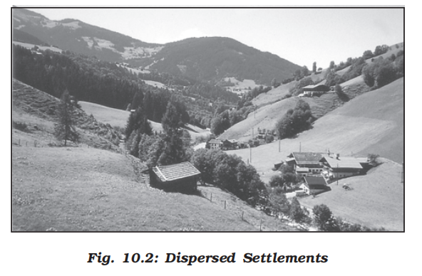
- In these settlements, houses are spaced far apart and often interspersed with fields
- A cultural feature such as a place of worship or a market, binds the settlement together
- Rural settlements
- Overview
- Rural settlements are most closely and directly related to land
- They are dominated by primary activities such as agriculture, animal husbandary, fishing etc
- The settlements size is relatively small
- Factors affecting location
- Water Supply
-
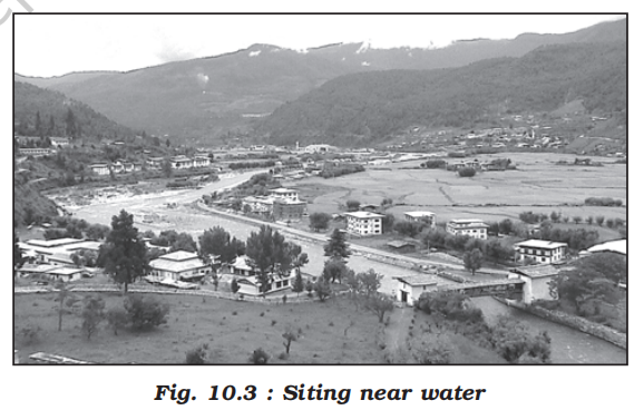
- Usually rural settlements are located near water bodies such as rivers, lakes, and springs where water can be easily obtained
- Sometimes the need for water drives people to settle in otherwise disadvantaged sites such as islands surrounded by swamps or low lying river banks
- Most water based ‘wet point’ settlements have many advantages such as water for drinking, cooking and washing
- Rivers and lakes can be used to irrigate farm land
- Water bodies also have fish which can be caught for diet and navigable rivers and lakes can be used for transportation
- Land
- People choose to settle near fertile lands suitable for agriculture
- In Europe villages grew up near rolling country avoiding swampy, low lying land while people in south east Asia chose to live near low lying river valleys and coastal plains suited for wet rice cultivation
- Early settlers chose plain areas with fertile soils
- Upland
- Upland which is not prone to flooding was chosen to prevent damage to houses and loss of life
- Thus, in low lying river basins people chose to settle on terraces and levees which are “dry points”
- In tropical countries people build their houses on stilts near marshy lands to protect themselves from flood, insects and animal pests
- Building Material
-

- The availability of building materials- wood, stone near settlements is another advantage
- Early villages were built in forest clearings where wood was plentiful
- In loess areas of China, cave dwellings were important and African Savanna’s building materials were mud bricks and the Eskimos, in polar regions, use ice blocks to construct igloos
- Defence
- During the times of political instability, war, hostility of neighbouring groups villages were built on defensive hills and islands
- In Nigeria, upstanding inselbergs formed good defensive sites
- In India most of the forts are located on higher grounds or hills
- Planned Settlements
- Sites that are not spontaneously chosen by villagers themselves, planned settlements are constructed by governments by providing shelter, water and other infrastructures on acquired lands
- The scheme of villagisation in Ethiopia and the canal colonies in Indira Gandhi canal command area in India are some good examples
- Types of rural settlement
- Overview
- Types of the settlement are determined by the extent of the built-up area and inter-house distance
- In India compact or clustered village of a few hundred houses is a rather universal feature, particularly in the northern plains
- However, there are several areas, which have other forms of rural settlements
- There are various factors and conditions responsible for having different types of rural settlements in India
- Physical features – nature of terrain, altitude, climate and availability of water
- Cultural and ethnic factors – social structure, caste and religion
- Security factors – defence against thefts and robberies
- Rural settlements in India can broadly be put into four types:
- Clustered settlements
-
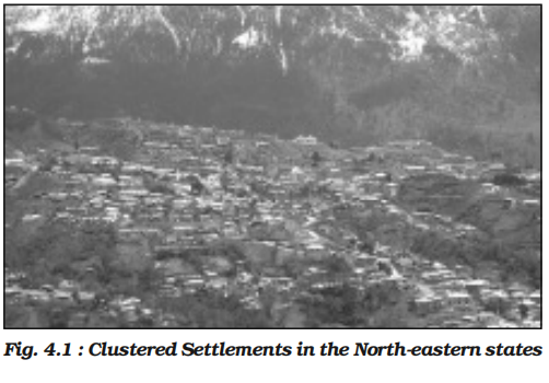
- The clustered rural settlement is a compact or closely built up area of houses
- In this type of village the general living area is distinct and separated from the surrounding farms, barns and pastures
- The closely built-up area and its intervening streets present some recognisable pattern or geometric shape, such as rectangular, radial, linear, etc
- Such settlements are generally found in fertile alluvial plains and in the northeastern states
- Sometimes, people live in compact village for security or defence reasons, such as in the Bundelkhand region of central India and in Nagaland
- In Rajasthan, scarcity of water has necessitated compact settlement for maximum utilisation of available water resources
- Semi-clustered settlements
-
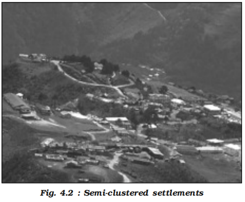
- Semi-clustered or fragmented settlements may result from tendency of clustering in a restricted area of dispersed settlement
- More often such a pattern may also result from segregation or fragmentation of a large compact village
- In this case, one or more sections of the village society choose or is forced to live a little away from the main cluster or village
- In such cases, generally, the land-owning and dominant community occupies the central part of the main village, whereas people of lower strata of society and menial workers settle on the outer flanks of the village
- Such settlements are widespread in the Gujarat plain and some parts of Rajasthan
- Hamleted settlements
- Sometimes settlement is fragmented into several units physically separated from each other bearing a common name
- These units are locally called panna, para, palli, nagla, dhani, etc. in various parts of the country
- This segmentation of a large village is often motivated by social and ethnic factors
- Such villages are more frequently found in the middle and lower Ganga plain, Chhattisgarh and lower valleys of the Himalayas
- Dispersed settlements
-
- Dispersed or isolated settlement pattern in India appears in the form of isolated huts or hamlets of few huts in remote jungles, or on small hills with farms or pasture on the slopes
- Extreme dispersion of settlement is often caused by extremely fragmented nature of the terrain and land resource base of habitable areas
- Many areas of Meghalaya, Uttaranchal, Himachal Pradesh and Kerala have this type of settlement
- Rural settlement patterns
- Overview
- Patterns of rural settlements reflect the way the houses are sited in relation to each other
- The site of the village, the surrounding topography and terrain influence the shape and size of a village
- Rural settlements may be classified on the basis of a number of criteria:
- On the basis of setting:
- Plain villages
- Plateau villages
- Coastal villages
- Forest villages
- Desert villages
- On the basis of functions:
- Farming villages
- Fishermen’s villages
- Lumberjack villages
- Pastoral villages etc
- On the basis of forms or shapes of the settlements
-
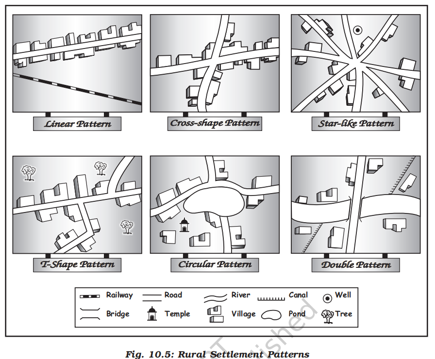
- Linear pattern
-

- In such settlements houses are located along a road, railway line, river, canal edge of a valley or along a levee
- Rectangular pattern
- Such patterns of rural settlements are found in plain areas or wide inter montane valleys
- The roads are rectangular and cut each other at right angles
- Circular pattern
- Circular villages develop around lakes, tanks and sometimes the village is planned in such a way that the central part remains open and is used for keeping the animals to protect them from wild animals
- Star like pattern
- Where several roads converge, star shaped settlements develop by the houses built along the roads
- T-shaped, Y-shaped, Cross-shaped or cruciform settlements
-
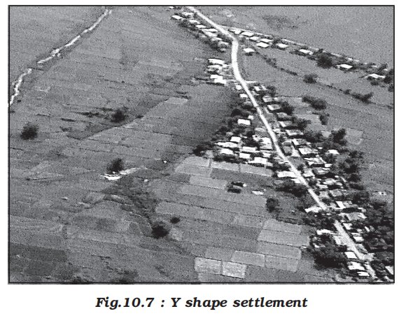
- T-shaped settlements develop at tri-junctions of the roads (T) while (Y) shaped settlements emerge as the places where two roads converge on the third one and houses are built along these roads
- Cruciform settlements develop on the cross-roads and houses extend in all the four direction
- Double village
- These settlements extend on both sides of a river where there is a bridge or a ferry
- Problems of rural settlements
- Inadequate infrastructure
- Most rural areas lack all-weather roads, electricity, transport, and digital connectivity
- This isolation hinders access to markets, healthcare, and education
- Water supply
- Rural settlements often suffer from unreliable or contaminated water sources
- In arid and hilly areas, residents walk long distances to fetch water
- Waterborne diseases like cholera and diarrhea are common
- Poor housing
- Houses are often built from mud, thatch, and bamboo with poor ventilation and durability
- They are vulnerable to natural disasters such as floods and cyclones
- In many cases, animal sheds are attached to homes, impacting hygiene
- Sanitation and health
- Lack of proper toilets and waste disposal systems lead to open defecation
- Unhygienic living conditions contribute to high disease burden and child mortality
- Educational constraints
- Schools are either absent or poorly equipped
- Long distances, lack of teachers, and poor infrastructure lead to high dropout rates
- Vulnerability to natural disasters
- Many villages face recurring floods, droughts, and soil erosion
- Agricultural patterns suffer due to erratic rainfall and lack of irrigation
- Social issues
- Deep-rooted caste, class, and gender inequalities hinder inclusive development
- Women often bear disproportionate responsibility for water, firewood, and household chores
- Employment and economic problems
- Agricultural dependency and seasonal unemployment lead to poverty and out-migration
- Informal credit markets often exploit rural populations
- Dispersed settlements
- Scattered housing patterns make infrastructure delivery difficult
- Lack of compact settlement planning leads to inefficiency
- Governance and planning deficit
- Poor implementation of rural development schemes and corruption dilute policy impact
- Local governance bodies often lack funds, manpower, and autonomy
- Urban settlements
- Unlike rural settlements, urban settlements are generally compact and larger in size
- They are engaged in a variety of nonagricultural, economic and administrative functions
- As mentioned earlier, cities are functionally linked to rural areas around them
- Thus, exchange of goods and services is performed sometimes directly and sometimes through a series of market towns and cities
- Thus, cities are connected directly as well as indirectly with the villages and also with each other
- You can see the definition of towns in Chapter 10 of the book, “Fundamentals of Human Geography.”
- Rapid urban growth is a recent phenomenon
- Until recent times, few settlements reached the population size of more than a few thousand inhabitants
- The first urban settlement to reach a population of one million was the city of London by around A.D. 1810
- By 1982 approximately 175 cities in the world had crossed the one million population mark
- Presently 54 per cent of the world’s population lives in urban settlements compared to only 3 per cent in the year 1800 (Table 10.1)
-
| Year |
Percentage of Population Living in Urban Areas |
| 1800 |
3% |
| 1850 |
6% |
| 1900 |
14% |
| 1950 |
30% |
| 1982 |
37% |
| 2001 |
48% |
| 2017 |
54% |
- Classification of urban settlements (varies from one country to another)
- Population Size
- It is an important criteria used by most countries to define urban areas
- The lower limit of the population size for a settlement to be designated as urban is 1,500 in Colombia, 2,000 in Argentina and Portugal, 2,500 in U.S.A. and Thailand, 5,000 in India and 30,000 in Japan
- Besides the size of population, density of 400 persons per sq km and share of non-agricultural workers are taken into consideration in India
- Countries with low density of population may choose a lower number as the cut-off figure compared to densely populated countries
- In Denmark, Sweden and Finland, all places with a population size of 250 persons are called urban
- The minimum population for a city is 300 in Iceland, whereas in Canada and Venezuela, it is 1,000 persons
- Occupational Structure
- In some countries, such as India, the major economic activities in addition to the size of the population in designating a settlement as urban are also taken as a criterion
- Similarly, in Italy, a settlement is called urban, if more than 50 per cent of its economically productive population is engaged in non-agricultural pursuits
- India has set this criterion at 75 per cent
- Administration
- The administrative setup is a criterion for classifying a settlement as urban in some countries
- For example, in India, a settlement of any size is classified as urban, if it has a municipality, Cantonment Board or Notified Area Council
- Similarly, in Latin American countries, such as Brazil and Bolivia, any administrative centre is considered urban irrespective of its population size
- Location
- Location of urban centres is examined with reference to their function
- For example, the sitting requirements of a holiday resort are quite different from that of an industrial town, a military centre or a seaport
- Strategic towns require sites offering natural defence
- Mining towns require the presence of economically valuable minerals
- Industrial towns generally need local energy supplies or raw materials
- Tourist centres require attractive scenery, or a marine beach, a spring with medicinal water or historical relics, ports require a harbour etc
- Locations of the earliest urban settlements were based on the availability of water, building materials and fertile land
- Today, while these considerations still remain valid, modern technology plays a significant role in locating urban settlements far away from the source of these materials
- Piped water can be supplied to a distant settlement, building material can be transported from long distances
- Apart from site, the situation plays an important role in the expansion of towns
- The urban centres which are located close to an important trade route have experienced rapid development
- Functions of urban centres
- Overview
- The earliest towns were centres of administration, trade, industry, defence and religious importance
- The significance of defence and religion as differentiating functions has declined in general, but other functions have entered the list
- Today, several new functions, such as, recreational, residential, transport, mining, manufacturing and most recently activities related to information technology are carried on in specialised towns
- Some of these functions do not necessarily require the urban centre to have any fundamental relationship with their neighbouring rural areas
- In spite of towns performing multiple functions we refer to their dominant function
- For example, we think of Sheffield as an industrial city, London as a port city, Chandigarh as an administrative city and so on
- Large cities have a rather greater diversity of functions
- Besides, all cities are dynamic and over a period of time may develop new functions
- Most of the early nineteenth-century fishing ports in England have now developed tourism
- Many of the old market towns are now known for manufacturing activities
- Towns and cities are classified into the following categories
- Developing counties experienced rapid urbanisation during the second half of the twentieth century
- Administrative Towns
- National capitals, which house the administrative offices of central governments, such as New Delhi, Canberra, Beijing, Addis Ababa, Washington D.C., and London etc are called administrative towns
- Provincial (sub-national) towns can also have administrative functions, for example, Victoria (British Columbia), Albany (New York), Chennai (Tamil Nadu)
- Trading and Commercial Towns
- Agricultural market towns, such as, Winnipeg and Kansas city; banking and financial centres like Frankfurt and Amsterdam; large inland centres like Manchester and St Louis; and transport nodes such as, Lahore, Baghdad and Agra have been important trading centres
- Cultural Towns
- Places of pilgrimage, such as Jerusalem, Mecca, Jagannath Puri and Varanasi etc are considered cultural towns
- These urban centres are of great religious importance
- Additional Functions
- Additional functions which the cities perform are health and recreation (Miami and Panaji), industrial (Pittsburgh and Jamshedpur), mining and quarrying (Broken Hill and Dhanbad) and transport (Singapore and Mughal Sarai)
- Urbanisation
- Urbanisation means the increase in the proportion population of a country who live in urban areas
- The most important cause of urbanisation is rural-urban migration
- During the late 1990s some 20 to 30 million people were leaving the countryside every year and moving into towns and cities
- Developed countries experienced rapid urbanisation during the nineteenth century
- Classification of towns on the basis of forms
- An urban settlement may be linear, square, star or crescent shaped
- In fact, the form of the settlement, architecture and style of buildings and other structures are an outcome of its historical and cultural traditions
- Towns and cities of developed and developing countries reflect marked differences in planning and development
- While most cities in developed countries are planned, most urban settlements of developing countries have evolved historically with irregular shapes
- For example, Chandigarh and Canberra are planned cities, while smaller town in India have evolved historically from walled cities to large urban sprawls
- Case studies
- Addis Ababa (The New Flower)
-

- The name of Ethiopian capital Addis Ababa, as the name indicates (Addis-New, Ababa-Flower) is a ‘new’ city which was established in 1878
- The whole city is located on a hill-valley topography
- The road pattern bears the influence of the local topography
- The roads radiate from the govt headquarters Piazza, Arat and Amist Kilo roundabouts
- Mercato has markets which grew with time and is supposed to be the largest market between Cairo and Johannesburg
- A multi-faculty university, a medical college, a number of good schools make Addis Ababa an educational centre
- It is also the terminal station for the Djibouti-Addis Ababa rail route
- Bole airport is a relatively new airport
- The city has witnessed rapid growth because of its multifunctional nature and being a large nodal centre located in the centre of Ethiopia
- Canberra
-

- Canberra was planned as the capital of Australia in 1912 by American landscape architect, Walter Burley Griffin
- He had envisaged a garden city for about 25,000 people taking into account the natural features of the landscape
- There were to be five main centres, each with separate city functions
- During the last few decades, the city has expanded to accommodate several satellite towns, which have their own centres
- The city has wide-open spaces and many parks and gardens
- Types of urban settlements
- Overview
- Depending on the size and the services available and functions rendered, urban centres are designated as town, city, million city, conurbation, megalopolis
- Town
- The concept of ‘town’ can best be understood with reference to ‘village’
- Population size is not the only criterion
- Functional contrasts between towns and villages may not always be clear-cut, but specific functions such as, manufacturing, retail and wholesale trade, and professional services exist in towns
- City
- A city may be regarded as a leading town, which has outstripped its local or regional rivals
- In the words of Lewis Mumford, “ the city is in fact the physical form of the highest and most complex type of associative life”
- Cities are much larger than towns and have a greater number of economic functions
- They tend to have transport terminals, major financial institutions and regional administrative offices
- When the population crosses the one million mark it is designated as a million city
- Conurbation
- The term conurbation was coined by Patrick Geddes in 1915 and applied to a large area of urban development that resulted from the merging of originally separate towns or cities
- Greater London, Manchester, Chicago and Tokyo are examples
- Million City
- The number of million cities in the world has been increasing as never before
- London reached the million mark in 1800, followed by Paris in 1850, New York in 1860, and by 1950 there were around 80 such cities
- There were 162 million cities in mid 70’s and there was threefold increase in 2005 and the number reached to 438
- In 2016, there were 512 cities with at least 1 million inhabitants globally
- By 2030, a projected 662 cities will have at least 1 million residents
- Megalopolis
- This Greek word meaning “great city”, was popularised by Jean Gottman (1957) and signifies ‘super- metropolitan’ region extending, as union of conurbations
- The urban landscape stretching from Boston in the north to south of Washington in U.S.A. is the best known example of a megalopolis
- Distribution of mega cities
- Overview
- A mega city or megalopolis is a general term for cities together with their suburbs with a population of more than 10 million people
- New York was the first to attain the status of a mega city by 1950 with a total population of about 12.5 million
- The number of mega cities is now 31
- The number of mega cities has increased in the developing countries during the last 50 years vis-à-vis the developed countries
- Mega Cities of the World in 2016.
-
| Rank |
City, Country |
Population in 2016 (thousands) |
| 1 |
Tokyo, Japan |
38,140 |
| 2 |
Delhi, India |
26,454 |
| 3 |
Shanghai, China |
24,484 |
| 4 |
Mumbai (Bombay), India |
21,357 |
| 5 |
São Paulo, Brazil |
21,297 |
| 6 |
Beijing, China |
21,240 |
| 7 |
Ciudad de México (Mexico City), Mexico |
21,157 |
| 8 |
Kinki M.M.A. (Osaka), Japan |
20,337 |
| 9 |
Al-Qahirah (Cairo), Egypt |
19,128 |
| 10 |
New York-Newark, USA |
18,604 |
| 11 |
Dhaka, Bangladesh |
18,237 |
| 12 |
Karachi, Pakistan |
17,121 |
| 13 |
Buenos Aires, Argentina |
15,334 |
| 14 |
Kolkata (Calcutta), India |
14,980 |
| 15 |
Istanbul, Turkey |
14,365 |
| 16 |
Chongqing, China |
13,744 |
| 17 |
Lagos, Nigeria |
13,661 |
| 18 |
Manila, Philippines |
13,131 |
| 19 |
Guangzhou, Guangdong, China |
13,070 |
| 20 |
Rio de Janeiro, Brazil |
12,981 |
| 21 |
Los Angeles-Long Beach-Santa Ana, USA |
12,317 |
| 22 |
Moskva (Moscow), Russian Federation |
12,260 |
| 23 |
Kinshasa, Democratic Republic of the Congo |
12,071 |
| 24 |
Tianjin, China |
11,558 |
| 25 |
Paris, France |
10,925 |
| 26 |
Shenzhen, China |
10,828 |
| 27 |
Jakarta, Indonesia |
10,483 |
| 28 |
Bangalore, India |
10,456 |
| 29 |
London, United Kingdom |
10,434 |
| 30 |
Chennai (Madras), India |
10,163 |
| 31 |
Lima, Peru |
10,072 |
- Problems of Urban Settlements in Developing Countries
- Overview
- Urban settlements in developing countries face a multitude of challenges due to rapid urbanisation, unplanned growth, and rural-urban migration.
- These cities are often unable to provide adequate infrastructure, services, or economic opportunities to their rapidly increasing populations.
- The issues span across economic, social, environmental, and infrastructural domains.
- Core Problems
- Demographic and Infrastructure Challenges
- Uncontrolled rural-to-urban migration leads to population explosion in cities.
- Most cities are unplanned or poorly planned, resulting in:
- Congested housing and narrow streets.
- Growth of informal settlements (slums and squatter colonies).
- Inadequate housing stock, leading to overcrowded homes.
- Overburdened infrastructure (electricity, water, sanitation).
- Economic Problems
- Lack of employment opportunities in rural areas pushes people into urban centres.
- Urban job markets are saturated, especially in the unorganised sector.
- High rates of underemployment and informal labour.
- Economic disparity fuels poverty and restricts upward mobility.
- Social and Cultural Issues
- Insufficient financial resources limit investment in social infrastructure.
- Poor access to quality education and healthcare for urban poor.
- High crime rates due to unemployment and lack of recreational spaces.
- Distortion of sex ratios in cities due to male-selective migration.
- Rising socio-economic inequality and exclusion of vulnerable populations.
- Environmental Problems
- Inadequate solid waste management and sewage disposal lead to health hazards.
- Domestic and industrial wastes are often dumped untreated.
- Air and water pollution due to heavy use of traditional fuels and traffic congestion.
- Urban Heat Island effect caused by dense concrete infrastructure.
- Deforestation and loss of green cover in expanding urban peripheries.
- Public Health Concerns
-
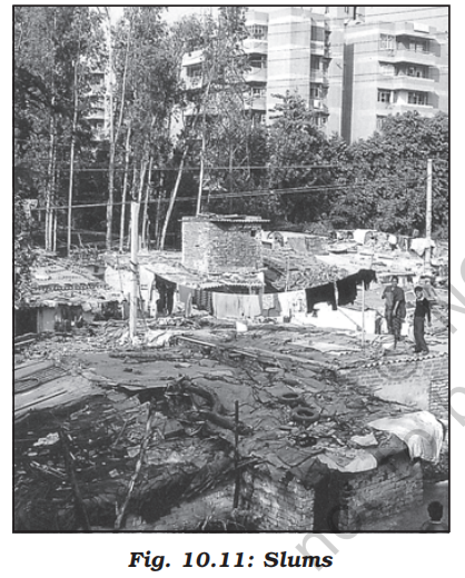
- Lack of access to clean drinking water and proper sanitation.
- High prevalence of communicable diseases in slums.
- Overcrowded hospitals and clinics unable to meet growing demand.
- Malnutrition and poor maternal-child health indicators.
- Governance and Urban Planning Issues
- Weak urban governance and lack of coordination among agencies.
- Limited community participation in planning.
- Corruption and delays in service delivery.
- Poor urban land management and outdated master plans.
- What is a Healthy City? (According to WHO)
- A city that:
- Has a clean and safe environment.
- Meets the basic needs of all its inhabitants.
- Provides accessible health services.
- Encourages community participation in governance.
- Global and National Strategies to Tackle Urban Problems
- United Nations Development Programme (UNDP) Urban Strategy
- Increase shelter for the urban poor.
- Provide basic urban services: clean water, sanitation, education, and primary healthcare.
- Improve women’s access to essential services.
- Promote sustainable energy use and public transport.
- Reduce air pollution and improve waste management.
- Urban-Rural Linkages
- Cities and villages are interconnected through the flow of goods, services, labour, and capital.
- Overdependence on urban centres causes stress on city infrastructure.
- Strengthening rural development can ease pressure on cities by:
- Creating jobs in rural areas.
- Improving rural education and healthcare.
- Enhancing connectivity between rural and urban areas.
- Promoting local economic development and decentralised planning.
- Policy Recommendations and Way Forward
- Promote planned urbanisation and enforce master plans.
- Develop affordable housing and regularise informal settlements.
- Strengthen urban local bodies and ensure participatory governance.
- Invest in sustainable public transport systems.
- Improve solid waste, water, and sewage management infrastructure.
- Ensure inclusive development that addresses needs of the marginalised.
- Integrate climate resilience and environmental sustainability in urban policy.
- Foster rural development to minimise distress migration.
- Evolution of towns in India
- Overview
- Towns flourished since prehistoric times in India
- Even at the time of Indus valley civilisation, towns like Harappa and Mohanjodaro were in existence
- The following period has witnessed evolution of towns
- It continued with periodic ups and downs until the arrival of Europeans in India in the eighteenth century
- On the basis of their evolution in different periods, Indian towns may be classified as:
- Ancient towns
- Medieval towns
- Modern towns
- Ancient towns
- There are number of towns in India having historical background spanning over 2000 years
- Most of them developed as religious and cultural centres
- Varanasi is one of the important towns among these
- Prayag (Allahabad), Pataliputra (Patna), Madurai are some other examples of ancient towns in the country
- Medieval towns
- About 100 of the existing towns have their roots in the medieval period
- Most of them developed as headquarters of principalities and kingdoms
- These are fort towns which came up on the ruins of ancient towns
- Important among them are Delhi, Hyderabad, Jaipur, Lucknow, Agra and Nagpur
- Modern towns
-
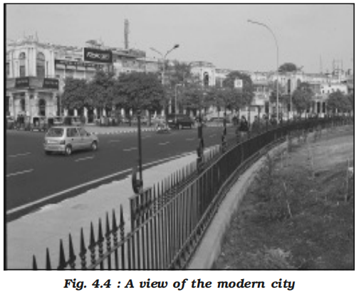
- The British and other Europeans have developed a number of towns in India
- Starting their foothold on coastal locations, they first developed some trading ports such as Surat, Daman, Goa, Pondicherry, etc
- The British later consolidated their hold around three principal nodes – Mumbai (Bombay), Chennai (Madras), and Kolkata (Calcutta) – and built them in the British style
- Rapidly extending their domination either directly or through control over the princely states, they established their administrative centres, hill-towns as summer resorts, and added new civil, administrative and military areas to them
- Towns based on modern industries also evolved after 1850
- Jamshedpur can be cited as an example
- After independence, a large number of towns have been developed as administrative headquarters, e.g. Chandigarh, Bhubaneswar, Gandhinagar, Dispur, etc. and industrial centres such as Durgapur, Bhilai, Sindri, Barauni
- Some old towns also developed as satellite towns around metropolitan cities such as Ghaziabad, Rohtak, Gurgaon around Delhi
- With increasing investment in rural areas, a large number of medium and small towns have developed all over the country
-
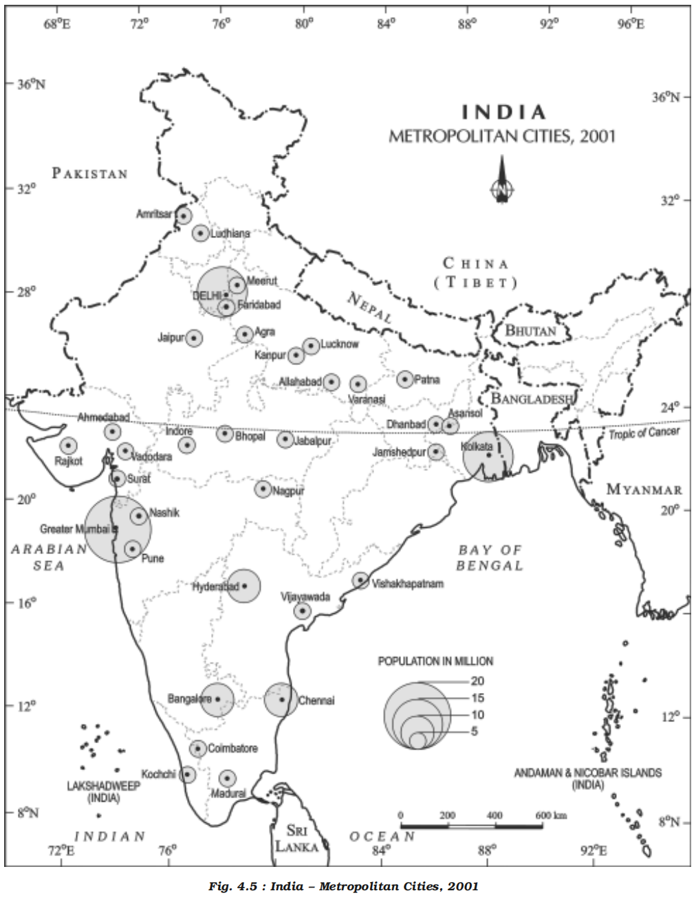
- Urbanisation in India
- Overview
- The level of urbanisation is measured in terms of percentage of urban population to total population
- The level of urbanisation in India in 2001 was 28 per cent, which is quite low in comparison to developed countries
- Total urban population has increased eleven fold during twentieth century
- Enlargement of urban centres and emergence of new towns have played a significant role in the growth of urban population and urbanisation in the country
-
| Year |
Number of Towns/UAs |
Urban Population (in Millions) |
% of Total Population |
Decennial Growth (%) |
| 1901 |
1,827 |
25.85 |
10.84 |
— |
| 1911 |
1,815 |
25.94 |
10.29 |
0.35 |
| 1921 |
1,949 |
28.09 |
11.18 |
8.27 |
| 1931 |
2,072 |
33.46 |
11.99 |
19.12 |
| 1941 |
2,250 |
44.15 |
13.86 |
31.97 |
| 1951 |
2,843 |
62.44 |
17.29 |
41.42 |
| 1961 |
2,365 |
78.94 |
17.97 |
26.41 |
| 1971 |
2,590 |
109.11 |
19.91 |
38.23 |
| 1981 |
3,378 |
159.46 |
23.34 |
46.14 |
| 1991 |
4,689 |
217.61 |
25.71 |
36.47 |
| 2001 |
5,161 |
285.35 |
27.78 |
31.13 |
| 2011 |
7,935 |
377.10 |
31.16 |
32.17 |
| 2021 (Est.) |
~8,000+ |
483.00 |
35.4 |
28.1 (est.) |
- But the growth rate of urbanisation has slowed down during last two decades
- Declining Rural-to-Urban Migration Rate
- One of the key drivers of urbanisation is rural-to-urban migration.
- In recent years, migration rates have plateaued or declined slightly due to limited job creation in urban areas, high cost of living, and saturation of urban job markets, especially in informal sectors.
- Emergence of Census Towns
- The 2011 Census recorded a large number of 'Census Towns' (non-statutory [not mandated by law] towns that are urban in characteristics but not governed by urban local bodies).
- These towns do not contribute to official urbanisation as they remain classified under rural administration.
- Underestimation and Classification Issues
- Many urbanising areas are not reclassified as urban due to administrative delays, political considerations, or lack of infrastructure benchmarks.
- This leads to underreporting of urbanisation in official statistics.
- Economic Slowdown and Jobless Growth
- The slowdown in manufacturing and formal service sectors has limited the absorptive capacity of cities.
- Urban job opportunities have not kept pace with the increase in urban population, discouraging rural migration.
- Rising Costs of Living in Cities
- High costs of housing, healthcare, and education in urban areas have acted as deterrents for rural migrants.
- Informal settlements are overcrowded, and quality of life in many urban areas is poor, reducing the perceived benefit of migration.
- In-Situ Urbanisation
- In regions like Tamil Nadu and parts of Gujarat, rural areas are becoming urbanised in place through infrastructure and industrialisation without a change in administrative status.
- This process reduces migration-driven urbanisation.
- Policy Focus on Rural Development
- Government initiatives like MGNREGA, PMGSY, rural electrification and sanitation have improved rural living standards.
- This has reduced the push factors compelling people to move to urban areas.
- Environmental and Infrastructure Constraints
- Carrying capacity of large Indian cities is being tested due to congestion, pollution, water shortages, and inadequate public services.
- These limitations act as a brake on further migration and urban growth.
- Classification of towns on the basis of population size
- Overview
- Census of India classifies urban centres into six classes as presented in Table 4.2
- Urban centre with population of more than one lakh is called a city or class I town
- Cities accommodating population size between one to five million are called metropolitan cities and more than five million are mega cities
- Majority of metropolitan and mega cities are urban agglomerations
- An urban agglomeration may consist of any one of the following three combinations:
- 1. A town and its adjoining urban outgrowths
- 2. Two or more contiguous towns with or without their outgrowths
- 3. A city and one or more adjoining towns with their outgrowths together forming a contiguous spread
-

- Examples of urban outgrowth are railway colonies, university campus, port area, military cantonment, etc. located within the revenue limits of a village or villages contiguous to the town or city
- India – Class-wise Number of Towns and Cities and Their Population (2001)
-
| Class |
Population Size |
Number |
Population (Million) |
% of Total Urban Population |
% Growth 1991-2001 |
| All Classes |
Total |
5161 |
285.35 |
100 |
31.13 |
| I |
1,00,000 and more |
423 |
172.04 |
61.48 |
23.12 |
| II |
50,000 – 99,999 |
498 |
34.43 |
12.3 |
43.45 |
| III |
20,000 – 49,999 |
1386 |
41.97 |
15.0 |
46.19 |
| IV |
10,000 – 19,999 |
1560 |
22.6 |
8.08 |
32.94 |
| V |
5,000 – 9,999 |
1057 |
7.98 |
2.85 |
41.49 |
| VI |
Less than 5,000 |
227 |
0.8 |
0.29 |
21.21 |
- Population distribution
- It is evident from Table 4.2 that more than 60 per cent of urban population in India lives in Class I towns
- Out of 423 cities, 35 cities/ urban agglomerations [a mass or collection of thing] are metropolitan cities (Fig.4.6)
- Six of them are mega cities with population over five million each
- More than one-fifth (21.0%) of urban population lives in these mega cities
- Among them, Greater Mumbai is the largest agglomeration with 16.4 million people
- Kolkata, Delhi, Chennai, Bangalore and Hyderabad are other mega cities in the country
- Functional classification of towns
- Overview
- Apart from their role as central or nodal places, many towns and cities perform specialised services
- Some towns and cities specialise in certain functions and they are known for some specific activities, products or services
- However, each town performs a number of functions
- On the basis of dominant or specialised functions, Indian cities and towns can be broadly classified as follows:
- Administrative towns and cities
- Towns supporting administrative headquarters of higher order are administrative towns, such as Chandigarh, New Delhi, Bhopal, Shillong, Guwahati, Imphal, Srinagar, Gandhinagar, Jaipur, Chennai, etc
- Industrial towns
- Industries constitute prime motive force of these cities such as Mumbai, Salem, Coimbatore, Modinagar, Jamshedpur, Hugli, Bhilai, etc
- Transport cities
- They may be ports primarily engaged in export and import activities such as Kandla, Kochchi, Kozhikode, Vishakhapatnam, etc. or hubs of inland transport such as Agra, Dhulia, Mughal Sarai, Itarsi, Katni, etc
- Commercial towns
- Towns and cities specialising in trade and commerce are kept in this class
- Kolkata, Saharanpur, Satna, etc. are some examples
- Mining towns
- These towns have developed in mineral rich areas such as Raniganj, Jharia, Digboi, Ankaleshwar, Singrauli, etc
- Garrison cantonment towns
- These towns emerged as garrison towns such as Ambala, Jalandhar, Mhow, Babina, Udhampur, etc
- Educational towns
- Starting as centres of education, some of the towns have grown into major campus towns such as Roorki, Varanasi, Aligarh, Pilani, Allahabad etc
- Religious and cultural towns
- Varanasi, Mathura, Amritsar, Madurai, Puri, Ajmer, Pushkar, Tirupati, Kurukshetra, Haridwar, Ujjain came to prominence due to their religious/cultural significance
- Tourist towns
- Nainital, Mussoorie, Shimla, Pachmarhi, Jodhpur, Jaisalmer, Udagamandalam (Ooty), Mount Abu are some of the tourist destinations
- Dynamic nature
- The cities are not static in their function
- The functions change due to their dynamic nature
- Even specialised cities, as they grow into metropolises become multifunctional wherein industry, business, administration, transport, etc. become important
- The functions get so intertwined that the city can not be categorised in a particular functional class
- Population of million-plus cities
-
| Rank |
Urban Agglomeration |
Population (2001) |
Population (2011) |
| 1 | Greater Mumbai | 11.98 million | 18.41 million |
| 2 | Delhi | 12.79 million | 16.31 million |
| 3 | Kolkata | 13.22 million | 14.11 million |
| 4 | Chennai | 6.56 million | 8.65 million |
| 5 | Bangalore | 5.70 million | 8.52 million |
| 6 | Hyderabad | 5.74 million | 7.68 million |
| 7 | Ahmedabad | 4.53 million | 6.36 million |
| 8 | Pune | 3.76 million | 5.05 million |
| 9 | Surat | 2.81 million | 4.59 million |
| 10 | Jaipur | 2.32 million | 3.07 million |
| 11 | Kanpur | 2.69 million | 2.92 million |
| 12 | Lucknow | 2.25 million | 2.90 million |
| 13 | Nagpur | 2.13 million | 2.50 million |
| 14 | Patna | 1.70 million | 2.05 million |
| 15 | Indore | 1.51 million | 2.17 million |
| 16 | Vadodara | 1.69 million | 3.55 million |
| 17 | Bhopal | 1.46 million | 1.89 million |
| 18 | Coimbatore | 1.46 million | 2.14 million |
| 19 | Ludhiana | 1.40 million | 1.62 million |
| 20 | Kochi | 1.36 million | 2.12 million |
| 21 | Visakhapatnam | 1.35 million | 1.73 million |
| 22 | Agra | 1.33 million | 1.76 million |
| 23 | Varanasi | 1.20 million | 1.43 million |
| 24 | Madurai | 1.20 million | 1.47 million |
| 25 | Meerut | 1.16 million | 1.42 million |
| 26 | Nashik | 1.15 million | 1.56 million |
| 27 | Jabalpur | 1.10 million | 1.27 million |
| 28 | Jamshedpur | 1.10 million | 1.34 million |
| 29 | Asansol | 1.07 million | 1.24 million |
| 30 | Dhanbad | 1.06 million | 1.20 million |
| 31 | Faridabad | 1.06 million | 1.41 million |
| 32 | Allahabad | 1.05 million | 1.21 million |
| 33 | Amritsar | 1.00 million | 1.18 million |
| 34 | Vijayawada | 1.04 million | 1.48 million |
| 35 | Rajkot | 1.00 million | 1.39 million |
- Add the marks for each main's PYQ in the bracket alongside before practicing
- Remove this line after adding
- Human geography mains PYQs
- 2025
- What are non-farm primary activities? How are these activities related to physiographic features in India? Discuss with suitable examples.
- Discuss the distribution and density of population in the Ganga River Basin with special reference to land, soil and water resources.
- 2024
- What is the concept of a ‘demographic winter’? Is the world moving towards such a situation? Elaborate.
- 2023
- Why did human development fail to keep pace with economic development in India?
- 2022
- Mention the significance of straits and isthmus in international trade.
- 2021
- What are the main socio-economic implications arising out of the development of IT industries in major cities of India?
- 2020
- Account for the huge flooding of million cities in India including the smart ones like Hyderabad and Pune. Suggest lasting remedial measures.
- 2019
- Add the left out questions
- 2018
- Mention core strategies for the transformation of aspirational districts in India & explain the nature of convergence, collaboration & competition for its success.
- 2017
- “The growth of cities as I.T. hubs has opened up new avenues of employment, but has also created new problems”. Substantiate with examples.
- 2016
- With a brief background of quality of urban life in India, introduce the objectives and strategy of the ‘Smart City Programme.’
- The effective management of land and water resources will drastically reduce the human miseries. Explain.
- 2015
- Mumbai, Delhi and Kolkata are the three mega cities of the country but the air pollution is much more serious problem in Delhi as compared to the other two. Why is this so?
- Smart cities in India cannot sustain without smart villages. Discuss this statement in the backdrop of rural urban integration.
- 2014
- Why did the Green Revolution in India virtually by-pass the eastern region despite fertile soil and good availability of water?
- How does India see its place in the economic space of rising natural resource rich Africa?
- 2013
- (a) Bring out the causes for the formation of heat islands in the urban habitat of the world.
- (b) What do you understand by the phenomenon of ‘temperature inversion’? How does it affect the habitants of the place?
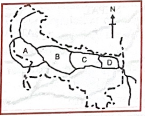 - Options:
(a) Brajbhasha, Bhojpuri, Maithili, and Awadhi
(b) Awadhi, Maithili, Bhojpuri, and Brajbhasha
(c) Brajbhasha, Awadhi, Bhojpuri, and Maithili
(d) Maithili, Bhojpuri, Brajbhasha, and Awadhi
- Answer:
- (c) Brajbhasha, Awadhi, Bhojpuri, and Maithili
- Q28: According to the latest census figures, the sex ratio in India is: (Correct affair based question, answer may vary)
- Options:
(a) Declining
(b) Stable
(c) Increasing
(d) Fluctuating
- Answer:
- (a) Declining
- Analysis:
- Geographical Context:
- The “latest census” in 1997 refers to the 1991 Census, which reported India’s sex ratio (females per 1000 males). The sex ratio was 927 in 1991, down from 934 in 1981, indicating a decline due to factors like female infanticide and gender bias.
- Explanation:
- Option (a) is correct because the 1991 Census showed a declining sex ratio (927) compared to 1981 (934), reflecting a worsening gender imbalance.
- Why Not Others?:
- (b) Stable:
- Incorrect. The drop from 934 to 927 indicates change, not stability.
- (c) Increasing:
- Incorrect. The sex ratio decreased, not increased.
- (d) Fluctuating:
- Incorrect. The consistent decline (930 in 1971, 934 in 1981, 927 in 1991) doesn’t suggest fluctuation.
- Related Concepts:
- Demographic Trends: Sex ratio reflects social issues like gender discrimination.
- Census Data: 1991 Census is a key source for UPSC demographic questions.
- Broader Connection:
- Links to Q13 [1996] on population density or Q42 [1998] on tribal populations. Tests social geography.
- Key Takeaway:
- India’s sex ratio declined to 927 in 1991, highlighting gender imbalance issues, as per the latest census in 1997.
- Q29: The tribal population in Andaman and Nicobar Islands belongs to the:
- Options:
(a) Australoid race
(b) Caucasoid race
(c) Mongoloid race
(d) Negroid race
- Answer:
- (d) Negroid race
- Analysis:
- Geographical Context:
- The Andaman and Nicobar Islands host indigenous tribes like the Great Andamanese, Onge, Jarawa, and Sentinelese, whose anthropological classification has been debated. In 1997 UPSC context, these tribes were often classified as Negroid due to physical traits like dark skin and curly hair, though modern studies suggest Negrito ancestry with distinct genetic origins.
- Explanation:
- Option (d) is correct in the 1997 context, as UPSC and contemporary sources classified Andaman tribes as Negroid, reflecting their unique anthropological traits.
- Why Not Others?:
- (a) Australoid race:
- Incorrect. Australoid refers to mainland Indian tribes (e.g., Bhils), not Andamanese.
- (b) Caucasoid race:
- Incorrect. Caucasoid applies to populations in northern India, not Andaman tribes.
- (c) Mongoloid race:
- Incorrect. Mongoloid is associated with northeastern tribes (e.g., Nagas), not Andamanese.
- Related Concepts:
- Anthropological Classification: Uses physical traits, now supplemented by genetics.
- Andaman Tribes: Among the most isolated, facing conservation challenges.
- Broader Connection:
- Links to Q15 [1996] on de-notified tribes or Q4 [1995] on Andaman ecology. Tests tribal geography.
- Key Takeaway:
- In 1997, Andaman and Nicobar tribes were classified as Negroid, reflecting their distinct anthropological identity.
- [1998]
- Q42: Among the Indian states shown labelled 1, 2, 3, and 4 in the rough outline map, the correct sequence in descending order of percent of scheduled tribe population to their total population is:
-
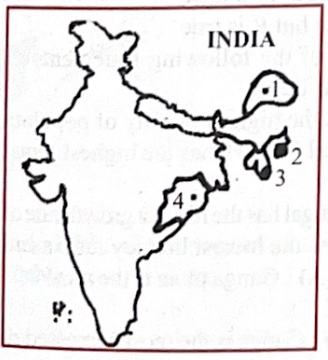 - Options:
(a) 1, 3, 2, 4
(b) 3, 1, 2, 4
(c) 3, 1, 4, 2
(d) 1, 3, 4, 2
- Answer:
- (b) 3, 1, 2, 4
- [1999]
- Q23: A person of mixed European and Indian blood in Latin America is called a:
- Options:
(a) Mulatto
(b) Mestizo
(c) Meiji
(d) Mau Mau
- Answer:
(b) Mestizo
- Analysis:
- Anthropological Context:
- Mestizo refers to a person of mixed European (e.g., Spanish) and indigenous American (Indian) ancestry in Latin America, common in colonial history.
- Why Not Others?:
- (a) Mulatto: Incorrect—Mixed European and African ancestry.
- (c) Meiji: Incorrect—Refers to Japan’s Meiji era, not ethnicity.
- (d) Mau Mau: Incorrect—Kenyan anti-colonial movement.
- Related Concepts:
- Colonial Legacy:
- Racial mixing in Latin America (see Q12 [1997]).
- Cultural Identity:
- Mestizo’s role in regional demographics.
- Broader Connection:
- Links to human geography or anthropology, key for UPSC geography.
- Relevant to Latin American history.
- Key Takeaway:
- Mestizo denotes mixed European-Indian ancestry in Latin America.
- Q45: “India has the largest population of the Asian X. Today, there are just about 20,000 to 25,000 X in their natural habitat spreading across the evergreen forests, dry thorn forest, swamps, and grasslands. Their prime habitats are, however, the moist deciduous forests. The X population in India ranges from north-west India where they are found in the forest divisions of Dehradun, Bijnor, and National districts of UP to the Western Ghats in the states of Karnataka and Kerala and Tamil Nadu. In Central India, their population is distributed over Southern Bihar and Orissa. In the East, they are seen in North Bengal, Assam, and a few other states.” The animal “X” referred to in this quotation is:
- Options:
(a) Lion
(b) Elephant
(c) Tiger
(d) One-horned rhinoceros
- Answer:
- (b) Elephant
- Analysis:
- Geographical Context:
- India hosts the largest Asian elephant population (Elephas maximus), with ~25,000–30,000 in 1999 across diverse habitats, preferring evergreen and moist deciduous forests. Their range spans northwest (Uttarakhand), Western Ghats (Karnataka, Kerala, Tamil Nadu), Central India (Jharkhand, Odisha), and East (Assam, North Bengal).
- Explanation:
- Option (b) is correct: Elephants match the quotation’s distribution and habitat:
- Population: ~25,000–30,000, close to the quoted 20,000–25,000.
- Habitats: Evergreen, moist deciduous (prime), swamps, grasslands.
- Range: Dehradun, Western Ghats, Jharkhand, Odisha, Assam, North Bengal.
- Project Elephant (1988) and 1990s wildlife data confirm this.
- Why Not Others?:
- (a) Lion: Incorrect. Asiatic lions are confined to Gir Forest (Gujarat).
- (c) Tiger: Incorrect: The analysis’ choice. Tigers (~3,000 in 1999) don’t match the population estimate and prefer moist deciduous over evergreen forests.
- (d) One-horned rhinoceros: Incorrect. Limited to Assam and West Bengal.
- Related Concepts:
- Wildlife Conservation: Project Elephant protects habitats.
- Biodiversity Hotspots: Western Ghats and Eastern Himalayas host elephants.
- Broader Connection:
- Links to Q51 [1999] on sanctuaries, Q4 [1995] on ecology.
- Key Takeaway:
- Elephants, with their wide distribution and population, match the quotation, unlike tigers.
- Q46: Assertion (A): According to statistics, more female children are born each year than male children in India.
Reason (R): In India, the death rate of a male child is higher than that of the female child.
- Options:
(a) Both A and R are true, and R is the correct explanation of A
(b) Both A and R are true, but R is not a correct explanation of A
(c) A is true, but R is false
(d) A is false, but R is true
- Answer:
- (c) A is true, but R is false
- Analysis:
- Geographical Context:
- The 1991 Census shows India’s sex ratio at birth slightly favors females in some years (~950 females per 1000 males, varying regionally). However, male child mortality is not consistently higher; social factors (e.g., female neglect) often skew ratios.
- Explanation:
- Option (c) is correct:
- A is true: Some 1990s data show marginally more female births in specific years.
- R is false: Male child mortality is not consistently higher; female mortality is often higher due to neglect.
- Census 1991 and health surveys support this.
- Why Not Others?:
- (a) Incorrect: R is false and doesn’t explain A.
- (b) Incorrect: R is false.
- (d) Incorrect: The analysis’ choice. A is true; R is false.
- Related Concepts:
- Sex Ratio: Influenced by birth and social factors.
- Child Mortality: Varies by gender and region.
- Broader Connection:
- Links to Q28 [1997] on sex ratio, Q13 [1996] on population.
- Key Takeaway:
- More female births occurred in some years, but higher male mortality is not supported.
- Q52: Which one of the following pairs of states and tribes is not correctly matched?
- Options:
(a) Assam: Miri
(b) Nagaland: Konyak
(c) Arunachal: Apatani
(d) Madhya Pradesh: Lambada
- Answer:
- (d) Madhya Pradesh: Lambada
- Analysis:
- Geographical Context:
- India’s tribal populations are region-specific, with Assam, Nagaland, and Arunachal hosting northeastern tribes, while Madhya Pradesh has central Indian tribes. Lambada (Banjara) is more associated with western India.
- Explanation:
- Option (d) is incorrect because Lambada (Banjara) tribes are primarily in Rajasthan, Gujarat, and Andhra Pradesh, not Madhya Pradesh, which has tribes like Gond and Bhil.
- Why Not Others?:
- (a) Assam: Miri:
- Correct. Miri (Mising) are a major tribe in Assam.
- (b) Nagaland: Konyak:
- Correct. Konyak are a prominent Naga tribe in Nagaland.
- (c) Arunachal: Apatani:
- Correct. Apatani are an indigenous tribe in Arunachal Pradesh.
- Related Concepts:
- Tribal Geography: Northeastern tribes differ from central Indian tribes in culture and history.
- Scheduled Tribes: Recognized for affirmative action and cultural preservation.
- Broader Connection:
- Links to Q29 [1997] on Andaman tribes or Q15 [1996] on de-notified tribes. Tests tribal geography.
- Key Takeaway:
- Lambada’s mismatch with Madhya Pradesh highlights the need to know regional tribal distributions.
- [2000]
- Q58: Which one of the following pairs of primitive tribes and places of their inhabitation is NOT correctly matched?
- Options:
(a) Buksa: Pauri-Garhwal
(b) Kol: Jabalpur
(c) Munda: Chhota Nagpur
(d) Korba: Kodagu
- Answer:
- (d) Korba: Kodagu
- Analysis:
- Geographical Context:
- India’s tribal populations are region-specific, with Buksa, Kol, and Munda associated with northern and central India, while Kodagu (Coorg) in Karnataka hosts different tribes.
- Explanation:
- Option (d) is incorrect because the Korba tribe is primarily found in Jharkhand and Chhattisgarh (e.g., Korba district), not Kodagu, which is home to tribes like Kodava.
- Why Not Others?:
- (a) Buksa: Pauri-Garhwal:
- Correct. Buksa tribe inhabits Pauri-Garhwal, Uttarakhand.
- (b) Kol: Jabalpur:
- Correct. Kol tribe is found in Jabalpur, Madhya Pradesh.
- (c) Munda: Chhota Nagpur:
- Correct. Munda tribe is prominent in Chhota Nagpur, Jharkhand.
- Related Concepts:
- Tribal Geography: Distinct tribal groups are tied to specific regions.
- Scheduled Tribes: Recognized for cultural preservation and welfare.
- Broader Connection:
- Links to Q52 [1999] on tribes or Q29 [1997] on Andaman tribes. Tests tribal geography.
- Key Takeaway:
- The Korba tribe’s mismatch with Kodagu highlights the importance of accurate tribal-regional associations.
- Q60: Which one of the following statements is true according to 1991 Census data?
- Options:
(a) U.P. has the highest density of population in India
(b) Himachal Pradesh has the highest female to male sex ratio in India
(c) West Bengal has the highest growth rate of population in India
(d) Bihar has the lowest literacy rate in India
- Answer:
- (d) Bihar has the lowest literacy rate in India
- Analysis:
- Geographical Context:
- The 1991 Census provides demographic data: population density, sex ratio, growth rate, and literacy. Bihar’s low literacy reflects socio-economic challenges, while other states lead in density, sex ratio, and growth.
- Explanation:
- Option (d) is true: Bihar’s literacy rate in 1991 was 37.49%, the lowest among major states.
- Why Not Others?:
- (a) U.P. has the highest density:
- False. West Bengal had the highest density (767 persons/km² vs. U.P.’s 473).
- (b) Himachal Pradesh has the highest sex ratio:
- False. Kerala had the highest (1036 females/1000 males vs. Himachal’s 976).
- (c) West Bengal has the highest growth rate:
- False. Nagaland had the highest (56.08% vs. West Bengal’s 24.73%).
- Related Concepts:
- Census Data: 1991 Census is a key source for demographic trends.
- Socio-Economic Indicators: Literacy reflects education access.
- Broader Connection:
- Links to Q28 [1997] on sex ratio or Q13 [1996] on density. Tests demographic geography.
- Key Takeaway:
- Bihar’s lowest literacy rate in 1991 highlights its educational challenges, distinguishing it from other demographic metrics.
- Q61: Assertion (A): Ganga plain is the most densely populated part of India.
Reason (R): Ganga is the most harnessed river of India.
- Options:
(a) Both A and R are true and R is the correct explanation of A
(b) Both A and R are true but R is not a correct explanation of A
(c) A is true but R is false
(d) A is false but R is true
- Answer:
- (b) Both A and R are true but R is not a correct explanation of A (book is saying option a but all other sources are saying option b)
- Analysis:
- Geographical Context:
- The Ganga plain, spanning Uttar Pradesh, Bihar, and West Bengal, is densely populated due to fertile alluvial soils and agriculture. The Ganga is heavily harnessed for irrigation and hydropower (e.g., Farakka, Tehri).
- Explanation:
- Option (b) is correct:
- A is true: Ganga plain has high density (e.g., West Bengal 767 persons/km² in 1991).
- R is true: Ganga is harnessed via dams, barrages, and canals.
- R does not explain A: Density is driven by soil fertility and historical settlement, not river harnessing.
- Why Not Others?:
- (a) R explains A:
- Incorrect. Harnessing supports agriculture but isn’t the primary density driver.
- (c) A is true, R is false:
- Incorrect. Ganga is indeed harnessed.
- (d) A is false, R is true:
- Incorrect. Ganga plain is densely populated.
- Related Concepts:
- Population Density: Linked to agricultural productivity.
- River Utilization: Ganga supports irrigation and power.
- Broader Connection:
- Links to Q59 [2000] on floods or Q13 [1996] on density. Tests human geography.
- Key Takeaway:
- The Ganga plain’s high density and Ganga’s harnessing are true, but density stems from fertility, not river projects.
- [2001]
- Q16: The high density of population in Nile Valley and Islands of Java is primarily due to:
- Options:
(a) Intensive agriculture
(b) Industrialization
(c) Urbanization
(d) Topographic limitations
- Answer:
- (a) Intensive agriculture
- Analysis:
- Geographical Context:
- The Nile Valley (Egypt) and Java (Indonesia) have high population densities due to fertile soils supporting intensive agriculture, enabling food security (NCERT Class 12, Fundamentals of Human Geography).
- Explanation:
- Option (a) is correct: Intensive agriculture in the Nile Valley (irrigation-based cropping) and Java (rice paddies) supports dense populations (FAO, 2001).
- (b) Industrialization: Incorrect; both regions were agrarian in 2001.
- (c) Urbanization: Incorrect; rural agriculture drives density.
- (d) Topographic limitations: Incorrect; fertile plains, not constraints, enable density.
- Why Not Others?:
- (b) Industrialization is minimal in these regions.
- (c) Urban areas exist but aren’t the primary cause.
- (d) Fertile land, not topography, is key.
- Q70: India's population growth during the 20th century can be classified into four distinct phases. Match List-I (Period) with List-II (Phase) and select the correct answer using the codes given below the lists:
- List-I (Period):
- A. 1901-1921
- B. 1921-1951
- C. 1951-1981
- D. 1981-2001
- List-II (Phase):
- 1. Steady growth
- 2. Rapid high growth
- 3. Stagnant growth
- 4. High growth with definite signs of slowdown
- Options:
(a) A-3, B-1, C-4, D-2
(b) A-1, B-3, C-2, D-4
(c) A-3, B-1, C-2, D-4
(d) A-1, B-3, C-4, D-2
- Answer:
- (c) A-3, B-1, C-2, D-4
- Analysis:
- Geographical Context:
- India’s population growth in the 20th century, per Census data, had distinct phases: stagnant (1901–1921), steady (1921–1951), rapid (1951–1981), and slowing (1981–2001).
- Explanation:
- Option (c) is correct:
- A. 1901–1921: Stagnant growth (3), ~0.5% annual growth due to famines, epidemics.
- B. 1921–1951: Steady growth (1), ~1–1.3% due to better health measures.
- C. 1951–1981: Rapid high growth (2), ~2.2% due to post-independence development.
- D. 1981–2001: High growth with slowdown (4), ~1.9% due to family planning.
- Why Not Others?:
- (a) A-3, B-1, C-4, D-2:
- Incorrect. 1951–1981 was rapid growth (C-2), not slowdown (C-4).
- (b) A-1, B-3, C-2, D-4:
- Incorrect. 1901–1921 was stagnant (A-3), not steady (A-1).
- (d) A-1, B-3, C-4, D-2:
- Incorrect. Multiple mismatches in periods and phases.
- Related Concepts:
- Demographic Transition: India moved from high birth/death rates to lower rates.
- Population Policy: Family planning reduced growth post-1981.
- Broader Connection:
- Links to Q60 [2000] on 1991 Census or Q78 [2002] on population density. Tests demographic geography.
- Key Takeaway:
- India’s population phases (stagnant, steady, rapid, slowing) match 1901–1921, 1921–1951, 1951–1981, and 1981–2001, reflecting demographic trends.
- [2002]
- Q33: Consider the following countries of South Asia:
- Countries:
1. Bangladesh
2. India
3. Pakistan
4. Sri Lanka
- The descending order of literacy status of these countries is:
- Options:
(a) 4, 2, 1, 3
(b) 2, 4, 3, 1
(c) 4, 2, 3, 1
(d) 2, 4, 1, 3
- Answer:
(c) 4, 2, 3, 1
- Analysis:
- Socioeconomic Context:
- Early 2000s literacy rates:
- Sri Lanka (4): ~90% (high education focus).
- India (2): ~65% (improving but uneven).
- Pakistan (3): ~45% (lower female literacy).
- Bangladesh (1): ~40% (education challenges).
- Descending order: Sri Lanka, India, Pakistan, Bangladesh.
- Why Not Others?:
- (a) Incorrect—India not third.
- (b) Incorrect—Sri Lanka not second.
- (d) Incorrect—Bangladesh not third.
- Related Concepts:
- Human Development:
- Literacy as HDI indicator.
- South Asian Education:
- Regional disparities.
- Broader Connection:
- Links to human geography or development studies, key for UPSC geography.
- Relevant to education policy.
- Key Takeaway:
- Sri Lanka, India, Pakistan, Bangladesh is the literacy order.
- Q32: Consider the following countries:
- Countries:
1. Brazil
2. Indonesia
3. Japan
4. Russia
- What is the descending order of the size of the following countries population-wise?
- Options:
(a) 1, 2, 4, 3
(b) 2, 3, 1, 4
(c) 2, 1, 4, 3
(d) 1, 2, 3, 4
- Answer:
(c) 2, 1, 4, 3
- Analysis:
- Demographic Context:
- Early 2000s population estimates:
- Indonesia (2): ~210 million.
- Brazil (1): ~170 million.
- Russia (4): ~145 million.
- Japan (3): ~127 million.
- Descending order: Indonesia, Brazil, Russia, Japan.
- Why Not Others?:
- (a) Incorrect—Russia not before Japan.
- (b) Incorrect—Japan not second.
- (d) Incorrect—Brazil not largest.
- Related Concepts:
- Population Dynamics:
- Global distribution (see Q11 [1997]).
- Urbanization:
- Brazil, Indonesia’s growth.
- Broader Connection:
- Links to human geography or demography, key for UPSC geography.
- Relevant to resource planning.
- Key Takeaway:
- Indonesia, Brazil, Russia, Japan is the population size order.
- Q78: Which amongst the following States has the highest population density as per Census-2001?
- Options:
(a) Kerala
(b) Madhya Pradesh
(c) Uttar Pradesh
(d) West Bengal
- Answer:
- (d) West Bengal
- Analysis:
- Geographical Context:
- The 2001 Census shows population density (persons/km²) varies by state, with West Bengal’s fertile Ganga delta supporting high density.
- Explanation:
- Option (d) is correct: West Bengal had the highest density in 2001 (904 persons/km²), followed by Kerala (819), Uttar Pradesh (689), and Madhya Pradesh (196).
- Why Not Others?:
- (a) Kerala:
- Incorrect. Kerala’s density (819) is high but lower than West Bengal.
- (b) Madhya Pradesh:
- Incorrect. Madhya Pradesh’s density (196) is low due to large area.
- (c) Uttar Pradesh:
- Incorrect. Uttar Pradesh’s density (689) is less than West Bengal’s.
- Related Concepts:
- Population Density: Driven by agriculture and urbanization.
- Census 2001: Key source for demographic trends.
- Broader Connection:
- Links to Q60 [2000] on 1991 Census or Q61 [2000] on Ganga plains. Tests demographic geography.
- Key Takeaway:
- West Bengal’s 904 persons/km² in 2001 reflects its high population density, surpassing other states.
- [2003]
- Q37: Life expectancy is the highest in the world in:
- Options:
(a) Canada
(b) Germany
(c) Japan
(d) Norway
- Answer:
(c) Japan
- Analysis:
- Demographic Context:
- In 2003, Japan had the highest life expectancy (~82 years), due to advanced healthcare, diet, and lifestyle.
- Why Not Others?:
- (a) Canada: Incorrect—High (~80), but below Japan.
- (b) Germany: Incorrect—~78, lower than Japan.
- (d) Norway: Incorrect—~79, close but not highest.
- Related Concepts:
- Human Development:
- Life expectancy as HDI indicator (see Q33 [2002]).
- Aging Populations:
- Japan’s demographic challenge.
- Broader Connection:
- Links to human geography or health studies, key for UPSC geography.
- Relevant to healthcare policy.
- Key Takeaway:
- Japan led in life expectancy in 2003.
- Q38: Consider the following statements:
- Statements:
1. In Macedonia, ethnic Albanians are in a minority
2. In Kosovo, Serbians are in a majority
- Which of these statements is/are correct?
- Options:
(a) Only 1
(b) Only 2
(c) Both 1 and 2
(d) Neither 1 nor 2
- Answer:
(a) Only 1
- Analysis:
- Demographic Context:
- 1. True—In Macedonia (now North Macedonia), ethnic Albanians are a minority (~25% vs. Macedonian majority).
- 2. False—In Kosovo, ethnic Albanians are the majority (~90%), Serbians a minority (~5-10%).
- Why Not Others?:
- (b) Incorrect—Statement 2 false.
- (c) Incorrect—Statement 2 false.
- (d) Incorrect—Statement 1 true.
- Related Concepts:
- Balkan Demographics:
- Ethnic tensions (see Q34 [2002]).
- Kosovo Conflict:
- Albanian dominance.
- Broader Connection:
- Links to human geography or conflict studies, key for UPSC geography.
- Relevant to Balkan stability.
- Key Takeaway:
- Ethnic Albanians are a minority in Macedonia; Serbians are not a majority in Kosovo.
- Q40: Which one of the following countries has the largest population?
- Options:
(a) Indonesia
(b) Japan
(c) Pakistan
(d) Sudan
- Answer:
(a) Indonesia
- Analysis:
- Demographic Context:
- Early 2000s populations:
- Indonesia: ~210 million.
- Japan: ~127 million.
- Pakistan: ~140 million.
- Sudan: ~35 million.
- Indonesia is largest.
- Why Not Others?:
- (b) Japan: Incorrect—Smaller than Indonesia.
- (c) Pakistan: Incorrect—Smaller than Indonesia.
- (d) Sudan: Incorrect—Much smaller.
- Related Concepts:
- Population Dynamics:
- Developing nations’ growth (see Q32 [2002]).
- Southeast Asia:
- Indonesia’s demographic weight.
- Broader Connection:
- Links to human geography or demography, key for UPSC geography.
- Relevant to resource planning.
- Key Takeaway:
- Indonesia had the largest population among listed countries.
- Q84: In which one of the following Union Territories, do people of the Onge tribe live?
- Options:
(a) Andaman and Nicobar Islands
(b) Dadra and Nagar Haveli
(c) Daman and Diu
(d) Lakshadweep
- Answer:
- (a) Andaman and Nicobar Islands
- Analysis:
- Geographical Context:
- The Onge are an indigenous tribe of the Andaman and Nicobar Islands, primarily residing on Little Andaman Island. They are a Scheduled Tribe, known for their semi-nomadic lifestyle.
- Explanation:
- Option (a) is correct because the Onge tribe is native to the Andaman and Nicobar Islands, specifically Little Andaman, with a small population (~100 in 2003).
- Why Not Others?:
- (b) Dadra and Nagar Haveli:
- Incorrect. This UT has tribes like Warli, not Onge.
- (c) Daman and Diu:
- Incorrect. No significant tribal population, and Onge are not present.
- (d) Lakshadweep:
- Incorrect. Lakshadweep has a Malayali population, not Onge.
- Related Concepts:
- Scheduled Tribes: Onge are protected under India’s tribal policies.
- Andaman Tribes: Include Jarawa, Sentinelese, and Great Andamanese.
- Broader Connection:
- Links to Q52 [1999] on tribes or Q29 [1997] on Andaman tribes. Tests tribal geography.
- Key Takeaway:
- The Onge tribe’s residence in the Andaman and Nicobar Islands highlights the region’s unique tribal diversity.
- [2005]
- Q103: Which one of the following statements is not correct?
- Options:
(a) There is no definition of the Scheduled Tribe in the constitutions of India
(b) North-East India accounts for a little over half of the country's tribal population
(c) The people known as Todas live in the Nilgiri area
(d) Lotha is a language spoken in Nagaland
- Answer:
- (b) North-East India accounts for a little over half of the country's tribal population
- Analysis:
- Geographical Context:
- Scheduled Tribes are recognized under India’s Constitution, with significant populations in Northeast and Central India. Todas and Lotha are specific to their regions.
- Explanation:
- Option (b) is not correct:
- Northeast India accounts for ~10–12% of India’s tribal population (~8% of total population), not over half.
- (a) True: Constitution lists tribes but doesn’t define “Scheduled Tribe.”
- (c) True: Todas are indigenous to Nilgiris, Tamil Nadu.
- (d) True: Lotha is a Naga language in Nagaland.
- Why Not Others?:
- (a) No constitutional definition:
- Correct. Article 342 lists tribes without definition.
- (c) Todas in Nilgiri:
- Correct. Known for pastoral lifestyle.
- (d) Lotha in Nagaland:
- Correct. Spoken by Lotha Naga tribe.
- Related Concepts:
- Tribal Demography: Northeast has diverse but not majority tribal population.
- Constitutional Provisions: Tribes protected under Schedule V/VI.
- Broader Connection:
- Links to Q58 [2000] on tribes or Q84 [2003] on Onge. Tests tribal geography.
- Key Takeaway:
- Northeast India’s tribal population is significant but not over half, making (b) incorrect.
- Q104: Consider the following statements:
- Statements:
- 1. India is the second country in the world to adopt a National Family Planning Programme
- 2. The National Population Policy of India 2000 seeks to achieve replacement level of fertility by 2010 with a population of 111 crores
- 3. Kerala is the first state in India to achieve replacement level of fertility
- Options:
(a) 1 only
(b) 1 and 2
(c) 2 and 3
(d) 1, 2 and 3
- Answer:
- (c) 2 and 3
- Analysis:
- Geographical Context:
- India’s 1952 Family Planning Programme was among the earliest, but not second globally. The 2000 Population Policy targeted replacement fertility (TFR 2.1) by 2010, projecting 1,110 million. Kerala achieved TFR ~1.8 by the 1990s.
- Explanation:
- Option (c) is correct:
- 1. False: India was among the first but not confirmed as second.
- 2. True: Policy targeted TFR 2.1 by 2010, ~1,110 million.
- 3. True: Kerala achieved replacement fertility in the 1990s.
- Census 2001 and policy documents confirm this.
- Why Not Others?:
- (a) Incorrect: 1 is false.
- (b) Incorrect: 3 is true.
- (d) Incorrect: The analysis’ choice. 1 is false.
- Related Concepts:
- Demographic Transition: Kerala’s low TFR reflects development.
- Population Policy: Aims for stabilization.
- Broader Connection:
- Links to Q70 [2001] on population, Q105 [2005] on Census.
- Key Takeaway:
- Policy goals and Kerala’s fertility success are true; India’s ranking is not.
- Q105: Which one of the following statements is true on the basis of Census - 2001?
- Options:
(a) Bihar has the highest percentage of the scheduled castes of its population
(b) The decadal growth of population of India (1991-2001) has been below 20%
(c) Mizoram is the Indian state with the least population
(d) Pondicherry has the highest sex ratio among the Union Territories
- Answer:
- (d) Pondicherry has the highest sex ratio among the Union Territories
- Analysis:
- Geographical Context:
- Census 2001: Uttar Pradesh has the highest SC percentage (~21%). Decadal growth was 21.54%. Sikkim has the least population (~0.54 million). Pondicherry’s sex ratio (~1001) is highest among UTs.
- Explanation:
- Option (d) is correct: Pondicherry’s sex ratio (~1001) leads UTs.
- Census 2001 data confirm this.
- Why Not Others?:
- (a) Incorrect: Uttar Pradesh, not Bihar, leads in SC percentage.
- (b) Incorrect: Growth was 21.54%, above 20%.
- (c) Incorrect: The analysis’ choice. Sikkim, not Mizoram, has the least population.
- Related Concepts:
- Census Data: Tracks demographic trends.
- Regional Disparities: UTs vary in sex ratios.
- Broader Connection:
- Links to Q60 [2000] on 1991 Census, Q106 [2005] on population.
- Key Takeaway:
- Pondicherry’s high sex ratio is true per Census 2001.
- Q106: According to the census 2001, which one of the following Indian States has the maximum population in India after Uttar Pradesh?
- Options:
(a) West Bengal
(b) Maharashtra
(c) Bihar
(d) Tamil Nadu
- Answer:
- (b) Maharashtra
- Analysis:
- Geographical Context:
- The 2001 Census ranks states by population: Uttar Pradesh (166 million), Maharashtra (96.9 million), Bihar (83 million), West Bengal (80.2 million), Tamil Nadu (62.4 million).
- Explanation:
- Option (b) is correct: Maharashtra (96.9 million) is second after Uttar Pradesh.
- Why Not Others?:
- (a) West Bengal:
- Incorrect. 80.2 million, fourth rank.
- (c) Bihar:
- Incorrect. 83 million, third rank.
- (d) Tamil Nadu:
- Incorrect. 62.4 million, lower rank.
- Related Concepts:
- Population Distribution: Urban and industrial states like Maharashtra rank high.
- Census 2001: Key demographic source.
- Broader Connection:
- Links to Q78 [2002] on population or Q105 [2005] on Census. Tests demographic geography.
- Key Takeaway:
- Maharashtra’s 96.9 million population in 2001 places it second after Uttar Pradesh.
- [2007]
- Q142: Which one among the following States of India has the lowest density of population?
- Options:
(a) Himachal Pradesh
(b) Meghalaya
(c) Arunachal Pradesh
(d) Sikkim
- Answer:
- (c) Arunachal Pradesh
- Analysis:
- Geographical Context:
- Population density (Census 2001): Arunachal Pradesh (~13/km²), Sikkim (~76/km²), Himachal Pradesh (~109/km²), Meghalaya (~103/km²).
- Explanation:
- Option (c) is correct: Arunachal Pradesh has the lowest density (~13/km²) due to its large area and sparse population.
- Why Not Others?:
- (a) Himachal Pradesh:
- Incorrect. ~109/km², higher than Arunachal.
- (b) Meghalaya:
- Incorrect. ~103/km², higher than Arunachal.
- (d) Sikkim:
- Incorrect. ~76/km², higher than Arunachal.
- Related Concepts:
- Population Density: Reflects terrain and settlement patterns.
- Northeast Geography: Sparse populations in hilly areas.
- Broader Connection:
- Links to Q118 [2006] on population or Q101 [2005] on demographics. Tests demographic geography.
- Key Takeaway:
- Arunachal Pradesh’s low population density (~13/km²) distinguishes it among the listed states.
- [2008]
- Q72: Which two countries follow China and India in the decreasing order of their population?
- Options:
(a) Brazil and USA
(b) USA and Indonesia
(c) Canada and Malaysia
(d) Russia and Nigeria
- Answer:
(b) USA and Indonesia
- Analysis:
- Demographic Context:
- 2008 population rankings:
- China: ~1.33 billion.
- India: ~1.15 billion.
- USA: ~304 million.
- Indonesia: ~237 million.
- Next two: USA, Indonesia.
- Why Not Others?:
- (a) Incorrect—Brazil (~190 million) after Indonesia.
- (c) Incorrect—Canada (~33 million), Malaysia (~27 million) much smaller.
- (d) Incorrect—Russia (~142 million), Nigeria (~150 million) lower.
- Related Concepts:
- Population Dynamics:
- Global rankings (see Q32 [2002]).
- Urbanization:
- USA, Indonesia’s growth.
- Broader Connection:
- Links to human geography or demography, key for UPSC geography.
- Relevant to global economics.
- Key Takeaway:
- USA and Indonesia follow China and India in population.
- Q73: For India, China, UK and USA, which one of the following is the correct sequence of the median age of their population?
- Options:
(a) China < India < UK < USA
(b) India < China < USA < UK
(c) China < India < USA < UK
(d) India < China < UK < USA
- Answer:
(b) India < China < USA < UK
- Analysis:
- Scientific Context:
- Median age reflects population age structure (2008 data):
- India: ~25 years (young, high birth rate).
- China: ~34 years (aging due to one-child policy).
- USA: ~36 years (developed, moderate aging).
- UK: ~40 years (older, low birth rate, high life expectancy).
- Sequence: India < China < USA < UK.
- Why Not Others?:
- (a) China < India < UK < USA:
- Incorrect—China older than India.
- (c) China < India < USA < UK:
- Incorrect—China older than India.
- (d) India < China < UK < USA:
- Incorrect—UK older than USA.
- Related Concepts:
- Demographic Transition:
- Developing (India) vs. developed (UK) nations.
- Aging Population:
- Impacts economy, healthcare.
- Broader Connection:
- Links to human geography or population studies, key for UPSC geography.
- Relevant to policy planning and development.
- Key Takeaway:
- India’s young population contrasts with aging China, USA, UK, in that order.
- Q143: As per India’s National Population Policy, 2000, by which one of the following years is it our long-term objective to achieve population stabilization?
- Options:
(a) 2025
(b) 2035
(c) 2045
(d) 2055
- Answer:
- (c) 2045
- Analysis:
- Geographical Context:
- India’s National Population Policy, 2000, addresses demographic challenges, aiming for stabilization through fertility and mortality control.
- Explanation:
- Option (c) is correct: The policy targets population stabilization by 2045, achieved when the Total Fertility Rate (TFR) reaches replacement level (~2.1).
- Why Not Others?:
- (a) 2025:
- Incorrect. Too early for stabilization per the policy.
- (b) 2035:
- Incorrect. Policy sets a later timeline.
- (d) 2055:
- Incorrect. Beyond the policy’s target.
- Related Concepts:
- Demographic Transition: India aims for stable population growth.
- TFR: Key indicator for stabilization.
- Broader Connection:
- Links to Q144 [2008] on aging or Q168 [2009] on mortality. Tests demographic geography.
- Key Takeaway:
- The 2045 target reflects India’s long-term demographic strategy.
- Q144: What is the approximate percentage of persons above 65 years of age in India’s current population?
- Options:
(a) 14-15%
(b) 11-12%
(c) 8-9%
(d) 5-6%
- Answer:
- (d) 5-6% (It's a dyanamic question, book is saying option c, but the answer changes over time)
- Analysis:
- Geographical Context:
- Based on Census 2001 (closest to 2008), India’s elderly population (65+) was ~5.1% of the total population (~1.02 billion).
- Explanation:
- Option (d) is correct: Approximately 5–6% of India’s population was above 65 years, reflecting a young demographic profile.
- Why Not Others?:
- (a) 14-15%:
- Incorrect. Typical of developed nations, not India.
- (b) 11-12%:
- Incorrect. Overestimates India’s elderly share.
- (c) 8-9%:
- Incorrect. Still too high for 2001 data.
- Related Concepts:
- Age Structure: India has a youthful population.
- Demographic Dividend: Large working-age group.
- Broader Connection:
- Links to Q145 [2008] on rural population or Q169 [2009] on density. Tests demographic geography.
- Key Takeaway:
- India’s elderly population (~5–6%) in 2001 highlights its youthful demographic.
- Q145: Amongst the following States, which one has the highest percentage of rural population to its total population (on the basis of the Census, 2001)?
- Options:
(a) Himachal Pradesh
(b) Bihar
(c) Orissa
(d) Uttar Pradesh
- Answer:
- (a) Himachal Pradesh
- Analysis:
- Geographical Context:
- Census 2001 rural population percentages: Himachal Pradesh (~90.2%), Bihar (~89.5%), Orissa (~85%), Uttar Pradesh (~79%).
- Explanation:
- Option (a) is correct: Himachal Pradesh has the highest rural population percentage (~90.2%) due to its hilly terrain limiting urban growth.
- Why Not Others?:
- (b) Bihar:
- Incorrect. ~89.5%, slightly lower than Himachal.
- (c) Orissa:
- Incorrect. ~85%, lower than Himachal and Bihar.
- (d) Uttar Pradesh:
- Incorrect. ~79%, lowest among options.
- Related Concepts:
- Rural-Urban Divide: Hilly states have higher rural shares.
- Census Data: Key for demographic analysis.
- Broader Connection:
- Links to Q146 [2008] on population or Q142 [2007] on density. Tests demographic geography.
- Key Takeaway:
- Himachal Pradesh’s high rural population (~90.2%) reflects its topography.
- Q146: Among the following, which one has the minimum population on the basis of data of Census of India, 2001?
- Options:
(a) Chandigarh
(b) Mizoram
(c) Pondicherry
(d) Sikkim
- Answer:
- (d) Sikkim
- Analysis:
- Geographical Context:
- Census 2001 populations: Chandigarh (~0.9 million), Mizoram (~0.89 million), Pondicherry (~0.97 million), Sikkim (~0.54 million).
- Explanation:
- Option (d) is correct: Sikkim has the smallest population (~0.54 million) among the options.
- Why Not Others?:
- (a) Chandigarh:
- Incorrect. ~0.9 million, higher than Sikkim.
- (b) Mizoram:
- Incorrect. ~0.89 million, higher than Sikkim.
- (c) Pondicherry:
- Incorrect. ~0.97 million, highest among options.
- Related Concepts:
- Population Size: Smaller states/UTs have lower populations.
- Northeast Demography: Sparse populations in hilly areas.
- Broader Connection:
- Links to Q145 [2008] on rural population or Q142 [2007] on density. Tests demographic geography.
- Key Takeaway:
- Sikkim’s small population (~0.54 million) makes it the least populous.
- Q160: Which of the following are among the million-plus cities in India on the basis of data of the Census, 2001?
- Cities:
- 1. Ludhiana
- 2. Kochi
- 3. Surat
- 4. Nagpur
- Options:
(a) 1, 2 and 3 only
(b) 2, 3 and 4 only
(c) 1 and 4 only
(d) 1, 2, 3 and 4
- Answer:
- (d) 1, 2, 3 and 4
- Analysis:
- Geographical Context:
- Census 2001 million-plus cities include Ludhiana (~1.4 million), Kochi (~1.35 million), Surat (~2.4 million), Nagpur (~2.05 million).
- Explanation:
- Option (d) is correct: All four cities had populations exceeding 1 million in 2001.
- Why Not Others?:
- (a) 1, 2 and 3:
- Incorrect. Nagpur (4) is also million-plus.
- (b) 2, 3 and 4:
- Incorrect. Ludhiana (1) is also million-plus.
- (c) 1 and 4:
- Incorrect. Kochi and Surat are also million-plus.
- Related Concepts:
- Urbanization: Million-plus cities drive economic growth.
- Census Data: Tracks urban expansion.
- Broader Connection:
- Links to Q135 [2007] on cities or Q146 [2008] on population. Tests urban geography.
- Key Takeaway:
- Ludhiana, Kochi, Surat, and Nagpur were all million-plus cities in 2001.
- [2009]
- Q75: Which one among the following South Asian countries has the highest population density?
(Current affair based question, it's answer will change over time)
- Options:
(a) India
(b) Nepal
(c) Pakistan
(d) Sri Lanka
- Answer:
(c) Bangladesh
- Analysis:
- Demographic Context:
- 2009 population densities (people/km²):
- Bangladesh: ~1,100.
- India: ~350.
- Nepal: ~200.
- Pakistan: ~190.
- Sri Lanka: ~300.
- Bangladesh has the highest density.
- Why Not Others?:
- (a) India: Incorrect—Lower than Bangladesh.
- (b) Nepal: Incorrect—Lower density.
- (d) Sri Lanka: Incorrect—Lower density.
- Related Concepts:
- Population Density:
- South Asian trends (see Q32 [2002]).
- Urbanization:
- Bangladesh’s challenges.
- Broader Connection:
- Links to human geography or demography, key for UPSC geography.
- Relevant to resource management.
- Key Takeaway:
- Bangladesh has South Asia’s highest population density.
- Q165: In which one of the following places is the Shompen tribe found?
- Options:
(a) Nilgiri Hills
(b) Nicobar Islands
(c) Spiti Valley
(d) Lakshadweep Islands
- Answer:
- (b) Nicobar Islands
- Analysis:
- Geographical Context:
- Shompen, a Particularly Vulnerable Tribal Group (PVTG), are indigenous to Great Nicobar Island in the Nicobar Islands.
- Explanation:
- Option (b) is correct: Shompen tribe is found in the Nicobar Islands.
- Why Not Others?:
- (a) Nilgiri Hills:
- Incorrect. Home to tribes like Todas, not Shompen.
- (c) Spiti Valley:
- Incorrect. Has Tibetan-influenced populations.
- (d) Lakshadweep Islands:
- Incorrect. Different ethnic groups, not Shompen.
- Related Concepts:
- Tribal Geography: Shompen are isolated and vulnerable.
- Andaman and Nicobar: Hosts unique indigenous groups.
- Broader Connection:
- Links to Q153 [2008] on Andaman fauna or Q161 [2008] on parks. Tests cultural geography.
- Key Takeaway:
- Shompen’s presence in Nicobar Islands highlights their unique cultural identity.
- Q168: Consider the following statements:
- Statements:
- 1. Infant mortality rate takes into account the death of infants within a month after birth
- 2. Infant mortality rate is the number of infant deaths in a particular year per 100 live births during that year
- Options:
(a) 1 only
(b) 2 only
(c) Both 1 and 2
(d) Neither 1 nor 2
- Answer:
- (d) Neither 1 nor 2
- Analysis:
- Geographical Context:
- Infant Mortality Rate (IMR) is defined as deaths of infants under 1 year per 1,000 live births in a year. Neonatal mortality covers deaths within the first month.
- Explanation:
- Option (d) is correct:
- 1. False: IMR includes deaths within 1 year, not just 1 month (neonatal mortality).
- 2. False: IMR is per 1,000 live births, not per 100.
- Why Not Others?:
- (a) 1 only:
- Incorrect. Statement 1 is false.
- (b) 2 only:
- Incorrect. Statement 2 is false.
- (c) Both 1 and 2:
- Incorrect. Both are false.
- Related Concepts:
- Demographic Indicators: IMR reflects health systems.
- Neonatal vs. Infant Mortality: Distinct timeframes.
- Broader Connection:
- Links to Q143 [2008] on population policy or Q169 [2009] on density. Tests demographic geography.
- Key Takeaway:
- IMR’s correct definition (under 1 year, per 1,000) makes both statements false.
- Q169: Consider the following statements:
- Statements:
- 1. Between Census 1951 and Census 2001, the density of the population of India has increased more than three times
- 2. Between Census 1951 and Census 2001, the annual growth rate (exponential) of the population of India has doubled
- Options:
(a) 1 only
(b) 2 only
(c) Both 1 and 2
(d) Neither 1 nor 2
- Answer:
- (d) Neither 1 nor 2
- Analysis:
- Geographical Context:
- Census 1951: Density ~117/km²; 2001: ~324/km² (~2.77 times increase). Annual growth rate peaked in 1971–81 (~2.22%) but declined to ~1.93% by 2001.
- Explanation:
- Option (d) is correct:
- 1. False: Density increased ~2.77 times, not over three.
- 2. False: Growth rate declined, not doubled.
- Census 2001 data confirm this.
- Why Not Others?:
- (a) Incorrect: The analysis’ choice. 1 is false.
- (b) Incorrect: 2 is false.
- (c) Incorrect: Both are false.
- Related Concepts:
- Population Density: Reflects resource pressure.
- Growth Rate: Indicates demographic transition.
- Broader Connection:
- Links to Q144 [2008] on aging, Q142 [2007] on density.
- Key Takeaway:
- Neither density nor growth rate claims are true.
- [2004]
- Q208: With reference to ‘Changpa’ community of India, consider the following statements:
- Statements:
- 1. They live mainly in the State of Uttarakhand
- 2. They rear the Pashmina goats that yield a fine wool
- 3. They are kept in the category of Scheduled Tribes
- Options:
(a) 1 only
(b) 2 and 3 only
(c) 3 only
(d) 1, 2 and 3
- Answer:
- (b) 2 and 3 only
- Analysis:
- Geographical Context:
- Changpa are nomadic herders in Ladakh (Jammu and Kashmir), not Uttarakhand. They rear Pashmina goats and are a Scheduled Tribe.
- Explanation:
- Option (b) is correct:
- 1. False: Changpa live in Ladakh, not Uttarakhand.
- 2. True: They rear Pashmina goats for fine wool.
- 3. True: Changpa are a Scheduled Tribe.
- Why Not Others?:
- (a) 1 only:
- Incorrect. 1 is false.
- (c) 3 only:
- Incorrect. 2 is also true.
- (d) 1, 2 and 3:
- Incorrect. 1 is false.
- Related Concepts:
- Pastoral Nomadism: Changpa’s lifestyle is unique.
- Pashmina Wool: High-value product from Ladakh.
- Broader Connection:
- Links to Q165 [2009] on Shompen tribe or Q153 [2008] on fauna. Tests cultural geography.
- Key Takeaway:
- Changpa’s Pashmina herding and ST status are correct, but they are in Ladakh.
- [2022]
- Q91: Consider the following statements:
- Statements:
1. Bidibidi is a large refugee settlement in north-western Kenya
2. Some people who fled from South Sudan civil war live in Bidibidi
3. Some people who fled from civil war in Somalia live in Dadaab refugee complex in Kenya
- Which of the statements given above is/are correct?
- Options:
(a) 1 and 2
(b) 2 only
(c) 2 and 3
(d) 3 only
- Answer:
(c) 2 and 3
- Analysis:
- Humanitarian Context:
- 1. False—Bidibidi is in northwestern Uganda, not Kenya.
- 2. True—Bidibidi hosts South Sudanese refugees from the civil war (2013-2020).
- 3. True—Dadaab refugee complex in Kenya hosts Somali refugees from the civil war.
- Why Not Others?:
- (a) Incorrect—Statement 1 false.
- (b) Incorrect—Statement 3 also true.
- (d) Incorrect—Statement 2 also true.
- Related Concepts:
- Refugee Crises:
- East African displacement.
- Humanitarian Geography:
- Refugee camp locations.
- Broader Connection:
- Links to human geography or migration studies, key for UPSC geography.
- Relevant to global refugee policies.
- Key Takeaway:
- Bidibidi (South Sudan refugees) and Dadaab (Somali refugees) are correct, but Bidibidi is in Uganda.